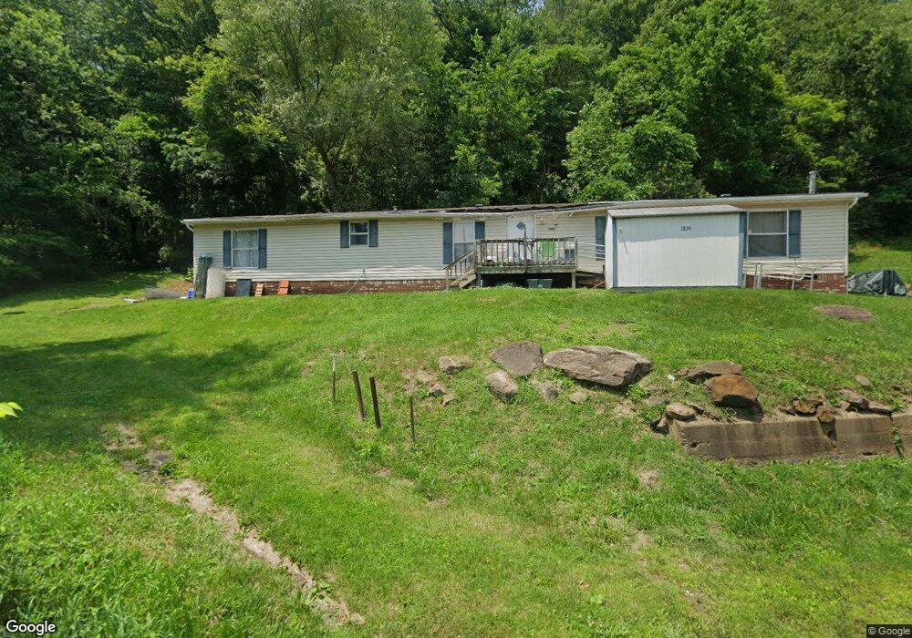
1826 Roxford St New Philadelphia, OH 44663
Estimated Value: $149,000 - $236,000
4
Beds
3
Baths
2,128
Sq Ft
$89/Sq Ft
Est. Value
About This Home
This home is located at 1826 Roxford St, New Philadelphia, OH 44663 and is currently estimated at $188,811, approximately $88 per square foot. 1826 Roxford St is a home located in Tuscarawas County with nearby schools including Midvale Elementary School, Tuscarawas Middle School, and Indian Valley High School.
Ownership History
Date
Name
Owned For
Owner Type
Purchase Details
Closed on
Aug 4, 2022
Sold by
Stout James B and Stout Cynthia J
Bought by
Stout James B and Stout Cynthia J
Current Estimated Value
Purchase Details
Closed on
Oct 12, 2005
Sold by
Young Kathy S
Bought by
Stout Cynthia J
Home Financials for this Owner
Home Financials are based on the most recent Mortgage that was taken out on this home.
Original Mortgage
$69,900
Interest Rate
5.82%
Mortgage Type
Fannie Mae Freddie Mac
Purchase Details
Closed on
Oct 30, 2003
Sold by
Young Kathy S
Bought by
Stout Cynthia J
Home Financials for this Owner
Home Financials are based on the most recent Mortgage that was taken out on this home.
Original Mortgage
$2,000
Interest Rate
9%
Mortgage Type
Seller Take Back
Create a Home Valuation Report for This Property
The Home Valuation Report is an in-depth analysis detailing your home's value as well as a comparison with similar homes in the area
Home Values in the Area
Average Home Value in this Area
Purchase History
| Date | Buyer | Sale Price | Title Company |
|---|---|---|---|
| Stout James B | $250 | Connolly Hillyer & Ong Inc | |
| Stout Cynthia J | $4,000 | -- | |
| Stout Cynthia J | $2,000 | -- |
Source: Public Records
Mortgage History
| Date | Status | Borrower | Loan Amount |
|---|---|---|---|
| Previous Owner | Stout Cynthia J | $69,900 | |
| Previous Owner | Stout Cynthia J | $2,000 |
Source: Public Records
Tax History Compared to Growth
Tax History
| Year | Tax Paid | Tax Assessment Tax Assessment Total Assessment is a certain percentage of the fair market value that is determined by local assessors to be the total taxable value of land and additions on the property. | Land | Improvement |
|---|---|---|---|---|
| 2024 | $990 | $30,190 | $2,870 | $27,320 |
| 2023 | $763 | $86,260 | $8,210 | $78,050 |
| 2022 | $1,183 | $30,191 | $2,874 | $27,318 |
| 2021 | $943 | $26,786 | $2,450 | $24,336 |
| 2020 | $1,050 | $26,786 | $2,450 | $24,336 |
| 2019 | $1,031 | $26,786 | $2,450 | $24,336 |
| 2018 | $1,119 | $22,600 | $2,070 | $20,530 |
| 2017 | $928 | $22,600 | $2,070 | $20,530 |
| 2016 | $937 | $22,600 | $2,070 | $20,530 |
| 2014 | $1,096 | $21,050 | $1,730 | $19,320 |
| 2013 | $1,069 | $21,050 | $1,730 | $19,320 |
Source: Public Records
Map
Nearby Homes
- 4711 Broadway
- 0 Royal St
- 0 Vernon St Unit 5009296
- 973 Baltzley Valley Rd SE
- 2923 Brightwood Rd SE
- 2993 Brightwood Rd SE
- 3264 Simpson Rd SE
- 5920 Main St SE
- 5876 Main St SE
- 5785 Main St SE
- 2025 N Water Street Extension
- 4161 Indian Hill Rd SE
- 2163 E High Ave
- 1508 Roanoke Ave
- 377 Schoenbrunn Dr NE
- 247 Kent Cir NE
- 0 Irish Run Rd SE
- 1221 Eastport Ave
- 1000 N 2nd St
- 934 Parrish St
- 1808 Roxford St
- 1843 Roxford St
- 1892 Roxford St
- 1866 Barnhill Rd
- 4123 Main St
- 1912 Roxford St
- 2226 Main St
- 2215 Main St
- 2146 Main St
- 2082 Main St
- 2185 Main St
- 4106 Main St
- 1735 Roxford St
- 1928 Roxford St
- 0 Main St Unit 4389452
- 1976 Barnhill Rd
- 1942 Roxford St
- 1948 Roxford St
- 1840 Barnhill Rd
- 1974 Reynolds Ln