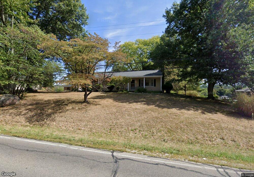
1826 Sheridan Dr Lancaster, OH 43130
Estimated Value: $266,707 - $286,000
3
Beds
2
Baths
1,300
Sq Ft
$213/Sq Ft
Est. Value
About This Home
This home is located at 1826 Sheridan Dr, Lancaster, OH 43130 and is currently estimated at $276,677, approximately $212 per square foot. 1826 Sheridan Dr is a home located in Fairfield County with nearby schools including Medill Elementary School, Thomas Ewing Junior High School, and Lancaster High School.
Ownership History
Date
Name
Owned For
Owner Type
Purchase Details
Closed on
Jun 20, 2016
Sold by
Shull Gregory S and Shull Sandra K
Bought by
Sheridan Rentals Llc
Current Estimated Value
Purchase Details
Closed on
Jun 11, 2014
Sold by
Shull Gregory S
Bought by
Shull Family Trust
Purchase Details
Closed on
Sep 14, 1993
Sold by
Shull Gergory S
Bought by
Shull Gregory S
Purchase Details
Closed on
Mar 1, 1988
Create a Home Valuation Report for This Property
The Home Valuation Report is an in-depth analysis detailing your home's value as well as a comparison with similar homes in the area
Home Values in the Area
Average Home Value in this Area
Purchase History
| Date | Buyer | Sale Price | Title Company |
|---|---|---|---|
| Sheridan Rentals Llc | -- | None Available | |
| Shull Family Trust | -- | Attorney | |
| Shull Gregory S | -- | -- | |
| -- | $55,000 | -- |
Source: Public Records
Tax History Compared to Growth
Tax History
| Year | Tax Paid | Tax Assessment Tax Assessment Total Assessment is a certain percentage of the fair market value that is determined by local assessors to be the total taxable value of land and additions on the property. | Land | Improvement |
|---|---|---|---|---|
| 2024 | $5,296 | $54,540 | $15,760 | $38,780 |
| 2023 | $2,241 | $54,540 | $15,760 | $38,780 |
| 2022 | $2,268 | $54,540 | $15,760 | $38,780 |
| 2021 | $1,874 | $43,820 | $14,330 | $29,490 |
| 2020 | $1,804 | $43,820 | $14,330 | $29,490 |
| 2019 | $1,723 | $43,820 | $14,330 | $29,490 |
| 2018 | $1,559 | $37,460 | $14,330 | $23,130 |
| 2017 | $1,560 | $37,460 | $14,330 | $23,130 |
| 2016 | $1,449 | $37,460 | $14,330 | $23,130 |
| 2015 | $1,457 | $36,510 | $14,330 | $22,180 |
| 2014 | $1,391 | $36,510 | $14,330 | $22,180 |
| 2013 | $1,391 | $36,510 | $14,330 | $22,180 |
Source: Public Records
Map
Nearby Homes
- 0 Declaration Dr W Unit 219044159
- 1523 Fuller Ct
- 1700 Rosewood Dr NE
- 1189 Ridge Rd NE
- 1976 Breed Hill Ct
- 1760 Rainbow Dr NE
- 1801 Pleasantview Dr NE
- 1669 Lexington Dr
- 1916 Country Place
- 1804 Pleasantville Rd
- 0 Old Millersport Rd NE Unit Lot 10 225033491
- 0 Old Millersport Rd NE Unit 225010386
- 0 Old Millersport Rd NE Unit Tract 8 224028101
- 2444 Sheridan Dr
- 706 Sherman Bluff Way Unit 1706
- 715 Sherman Bluff Way Unit 14715
- 1415 Epworth Forest Dr
- 2149 Pleasantview Dr NE
- 2010 Ridgebrook Rd
- 1876 Bent Creek Dr
- 1814 Sheridan Dr
- 1838 Sheridan Dr
- 1850 Sheridan Dr
- 1767 Sheridan Dr
- 1770 Sheridan Dr
- 1747 Sheridan Dr
- 1913 Sheridan Dr
- 1406 Beechwood Dr NE
- 1430 Beechwood Dr NE
- 1368 Beechwood Dr NE
- 1662 Sheridan Dr
- 1702 Sheridan Dr
- 1765 Longwood Dr NE
- 1942 Sheridan Dr
- 1350 Beechwood Dr NE
- 1330 Beechwood Dr NE
- 1451 Beechwood Dr NE
- 1653 Sheridan Dr
- 1658 Sheridan Dr
- 1762 Longwood Dr NE