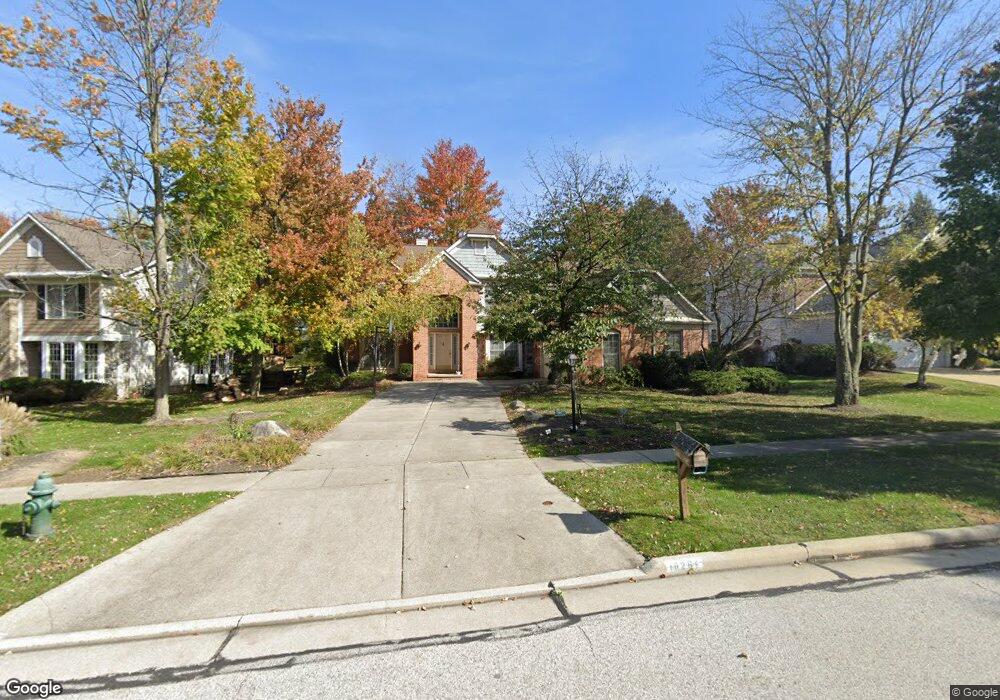
18267 Martins Ln Strongsville, OH 44149
Estimated Value: $503,804 - $570,000
4
Beds
3
Baths
3,018
Sq Ft
$177/Sq Ft
Est. Value
About This Home
This home is located at 18267 Martins Ln, Strongsville, OH 44149 and is currently estimated at $535,201, approximately $177 per square foot. 18267 Martins Ln is a home located in Cuyahoga County with nearby schools including Strongsville High School, Strongsville Academy, and Strongsville Montessori School.
Ownership History
Date
Name
Owned For
Owner Type
Purchase Details
Closed on
Sep 29, 1997
Sold by
Bauer Richard V
Bought by
Parikh Satish N and Parikh Pragna S
Current Estimated Value
Home Financials for this Owner
Home Financials are based on the most recent Mortgage that was taken out on this home.
Original Mortgage
$125,000
Outstanding Balance
$20,400
Interest Rate
7.63%
Mortgage Type
New Conventional
Estimated Equity
$514,801
Purchase Details
Closed on
Oct 23, 1993
Bought by
Bauer Richard
Purchase Details
Closed on
Jan 1, 1993
Bought by
Puite Hms Of Michigan Corp
Create a Home Valuation Report for This Property
The Home Valuation Report is an in-depth analysis detailing your home's value as well as a comparison with similar homes in the area
Home Values in the Area
Average Home Value in this Area
Purchase History
| Date | Buyer | Sale Price | Title Company |
|---|---|---|---|
| Parikh Satish N | $242,000 | -- | |
| Bauer Richard | $220,600 | -- | |
| Puite Hms Of Michigan Corp | -- | -- |
Source: Public Records
Mortgage History
| Date | Status | Borrower | Loan Amount |
|---|---|---|---|
| Open | Parikh Satish N | $125,000 |
Source: Public Records
Tax History Compared to Growth
Tax History
| Year | Tax Paid | Tax Assessment Tax Assessment Total Assessment is a certain percentage of the fair market value that is determined by local assessors to be the total taxable value of land and additions on the property. | Land | Improvement |
|---|---|---|---|---|
| 2024 | $7,278 | $155,015 | $28,560 | $126,455 |
| 2023 | $7,439 | $118,800 | $25,730 | $93,070 |
| 2022 | $7,385 | $118,790 | $25,725 | $93,065 |
| 2021 | $7,326 | $118,790 | $25,730 | $93,070 |
| 2020 | $7,527 | $107,980 | $23,380 | $84,600 |
| 2019 | $7,306 | $308,500 | $66,800 | $241,700 |
| 2018 | $6,631 | $107,980 | $23,380 | $84,600 |
| 2017 | $6,657 | $100,350 | $20,620 | $79,730 |
| 2016 | $6,603 | $100,350 | $20,620 | $79,730 |
| 2015 | $6,257 | $100,350 | $20,620 | $79,730 |
| 2014 | $6,257 | $93,770 | $19,250 | $74,520 |
Source: Public Records
Map
Nearby Homes
- 19414 Blue Spruce Dr
- 18848 Pearl Rd
- 18411 Yorktown Oval
- 20086 Bradgate Ln
- 19292 Charter Ln
- 17934 Cambridge Oval
- 20393 Wildwood Ln
- 18294 Drake Rd
- 20121 Driftwood Ct
- 19297 Lauren Way
- 20556 Drake Rd
- 20592 Drake Rd
- 19311 Bradford Ct
- 17834 Princeton Cir
- 17469 Sun Meadow Trail
- 17682 Drake Rd
- 19908 Stoughton Dr
- 17745 Brick Mill Run
- 17024 Bear Creek Ln
- 20745 Sun Meadow Trail
- 18231 Martins Ln
- 18303 Martins Ln
- 19362 Ellsworth Dr
- 18195 Martins Ln
- 18284 Martins Ln
- 18157 Martins Ln
- 18375 Martins Ln
- 18320 Martins Ln
- 18260 Martins Ln
- 18236 Martins Ln
- 18212 Martins Ln
- 19383 Ellsworth Dr
- 19511 Elm Dr
- 18123 Martins Ln
- 19477 Ellsworth Dr
- 19556 Ellsworth Dr
- 19543 Elm Dr
- 19515 Ellsworth Dr
- 19462 Elm Dr
- 18301 Oliver Dr