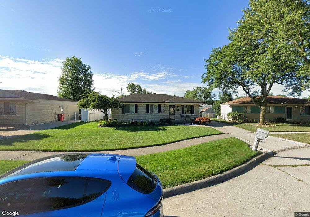
18268 Matthew Dr Clinton Township, MI 48035
Estimated Value: $253,000 - $284,000
3
Beds
2
Baths
1,260
Sq Ft
$212/Sq Ft
Est. Value
About This Home
This home is located at 18268 Matthew Dr, Clinton Township, MI 48035 and is currently estimated at $267,005, approximately $211 per square foot. 18268 Matthew Dr is a home located in Macomb County with nearby schools including Salk Elementary School, Richards Middle School, and Fraser High School.
Ownership History
Date
Name
Owned For
Owner Type
Purchase Details
Closed on
Feb 22, 2013
Sold by
Walsh Dennis J and Walsh Jacquelyn J
Bought by
Walsh Dennis J
Current Estimated Value
Purchase Details
Closed on
May 7, 2004
Sold by
Adamo Mark A and Adamo Joan M
Bought by
Walsh Dennis J and Walsh Jacquelyn J
Home Financials for this Owner
Home Financials are based on the most recent Mortgage that was taken out on this home.
Original Mortgage
$173,000
Interest Rate
6.46%
Mortgage Type
Purchase Money Mortgage
Create a Home Valuation Report for This Property
The Home Valuation Report is an in-depth analysis detailing your home's value as well as a comparison with similar homes in the area
Home Values in the Area
Average Home Value in this Area
Purchase History
| Date | Buyer | Sale Price | Title Company |
|---|---|---|---|
| Walsh Dennis J | -- | First American Title Insuran | |
| Walsh Dennis J | $173,000 | Title One Inc |
Source: Public Records
Mortgage History
| Date | Status | Borrower | Loan Amount |
|---|---|---|---|
| Previous Owner | Walsh Dennis J | $173,000 |
Source: Public Records
Tax History Compared to Growth
Tax History
| Year | Tax Paid | Tax Assessment Tax Assessment Total Assessment is a certain percentage of the fair market value that is determined by local assessors to be the total taxable value of land and additions on the property. | Land | Improvement |
|---|---|---|---|---|
| 2025 | $2,620 | $112,800 | $0 | $0 |
| 2024 | $1,518 | $105,700 | $0 | $0 |
| 2023 | $1,440 | $94,000 | $0 | $0 |
| 2022 | $2,374 | $90,800 | $0 | $0 |
| 2021 | $2,310 | $82,400 | $0 | $0 |
| 2020 | $1,322 | $74,800 | $0 | $0 |
| 2019 | $2,148 | $72,200 | $0 | $0 |
| 2018 | $2,100 | $69,900 | $0 | $0 |
| 2017 | $2,063 | $62,900 | $10,900 | $52,000 |
| 2016 | $2,050 | $62,900 | $0 | $0 |
| 2015 | -- | $56,500 | $0 | $0 |
| 2014 | -- | $51,400 | $0 | $0 |
| 2011 | -- | $55,500 | $14,000 | $41,500 |
Source: Public Records
Map
Nearby Homes
- 18015 Edgefield Dr
- 36120 Harcourt
- 35279 Bristlecone
- 18976 Dixie Dr
- 35016 Bobcean Rd
- 35375 Groesbeck Hwy
- 18711 N Nunneley Rd
- 36069 Eaton Dr
- 19128 Cheyenne St
- 16655 Savor Ln Unit 5
- 37418 Fiore Trail
- 16520 Savor Ln
- 16540 Savor Ln
- 36014 Chapel Ct Unit 27
- 35530 Morris Dr
- 0 Camellia Ln
- 37444 Alpinia Ln
- 35685 Griswald St
- 35501 Griswald St
- 34559 Chope Place
- 18290 Matthew Dr
- 18246 Matthew Dr
- 18209 Kenna Dr
- 18312 Matthew Dr
- 18157 Kenna Dr
- 18221 Kenna Dr
- 18224 Matthew Dr
- 18145 Kenna Dr
- 18235 Kenna Dr
- 18334 Matthew Dr
- 18275 Matthew Dr
- 18202 Matthew Dr
- 18251 Matthew Dr
- 18301 Matthew Dr
- 18133 Kenna Dr
- 18247 Kenna Dr
- 18233 Matthew Dr
- 18323 Matthew Dr
- 35720 Simon Dr
- 35692 Simon Dr