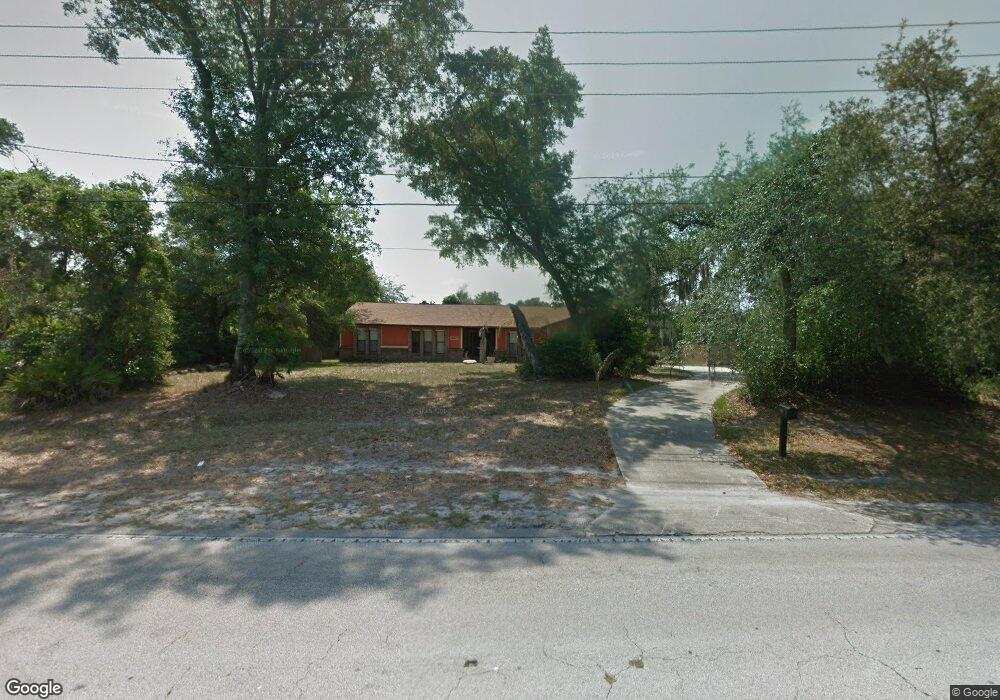
1827 E Normandy Blvd Deltona, FL 32725
Estimated Value: $403,000 - $464,148
3
Beds
2
Baths
2,826
Sq Ft
$152/Sq Ft
Est. Value
About This Home
This home is located at 1827 E Normandy Blvd, Deltona, FL 32725 and is currently estimated at $429,037, approximately $151 per square foot. 1827 E Normandy Blvd is a home located in Volusia County with nearby schools including Forest Lake Elementary School, Heritage Middle School, and Pine Ridge High School.
Ownership History
Date
Name
Owned For
Owner Type
Purchase Details
Closed on
Oct 11, 2012
Sold by
Family Realty Properties Llc
Bought by
Lang James B and Lang Mary E
Current Estimated Value
Purchase Details
Closed on
Jan 4, 2012
Sold by
Elzogby Eman F and Valle Steven
Bought by
Family Realty Properties Llc and Hill Family Realty Llc
Purchase Details
Closed on
Jun 28, 2000
Sold by
Blackwell Beverly and Key Andrew Thomas
Bought by
Eizogby Eman F
Purchase Details
Closed on
Oct 15, 1980
Bought by
Lang James B and Lang Mary E
Purchase Details
Closed on
Oct 15, 1968
Bought by
Lang James B and Lang Mary E
Create a Home Valuation Report for This Property
The Home Valuation Report is an in-depth analysis detailing your home's value as well as a comparison with similar homes in the area
Home Values in the Area
Average Home Value in this Area
Purchase History
| Date | Buyer | Sale Price | Title Company |
|---|---|---|---|
| Lang James B | $150,000 | Coast Title Volusia Cnty Inc | |
| Family Realty Properties Llc | $78,301 | None Available | |
| Eizogby Eman F | $101,700 | -- | |
| Lang James B | $16,500 | -- | |
| Lang James B | $2,300 | -- |
Source: Public Records
Tax History
| Year | Tax Paid | Tax Assessment Tax Assessment Total Assessment is a certain percentage of the fair market value that is determined by local assessors to be the total taxable value of land and additions on the property. | Land | Improvement |
|---|---|---|---|---|
| 2026 | $450 | $255,619 | -- | -- |
| 2025 | $450 | $255,619 | -- | -- |
| 2024 | $331 | $248,415 | -- | -- |
| 2023 | $331 | $241,180 | $0 | $0 |
| 2022 | $331 | $234,155 | $0 | $0 |
| 2021 | $331 | $227,335 | $0 | $0 |
| 2020 | $331 | $224,196 | $52,020 | $172,176 |
| 2019 | $331 | $223,927 | $50,490 | $173,437 |
| 2018 | $311 | $220,887 | $50,490 | $170,397 |
| 2017 | $525 | $124,457 | $0 | $0 |
| 2016 | $514 | $121,897 | $0 | $0 |
| 2015 | $519 | $121,050 | $0 | $0 |
| 2014 | $484 | $120,089 | $0 | $0 |
Source: Public Records
Map
Nearby Homes
- 1792 Paco Ct
- 1788 E Normandy Blvd
- 1778 E Normandy Blvd
- 1768 E Normandy Blvd
- 1901 Odham Dr
- 731 Brechner Terrace
- 868 Saxon Blvd
- 1680 E Normandy Blvd
- 1891 Marysville Dr
- 1906 Kingway Dr
- 1009 Fort Smith Blvd
- 1057 Fort Smith Blvd
- 1876 Coble Dr
- 1668 W Waycross Cir
- 2046 Galahad Dr
- 560 Saxon Blvd
- 968 Fort Smith Blvd
- 2050 Swanson Dr
- 937 Potomac Ave
- 1106 Swanson Dr
- 1835 E Normandy Blvd
- 1841 E Normandy Blvd
- 1820 E Normandy Blvd
- 1784 Paco Ct
- 1809 E Normandy Blvd
- Paco Paco Ct
- 1751 Paco Ct
- 1796 E Normandy Blvd
- 1850 Odham Dr
- 1849 E Normandy Blvd
- 1860 Odham Dr
- 1844 Clay Ct
- 1801 E Normandy Blvd
- 1870 Odham Dr
- 1792 E Normandy Blvd
- 1830 Odham Dr
- 1760 Paco Ct
- 1840 Odham Dr
- 1880 Odham Dr
- 1859 E Normandy Blvd
Your Personal Tour Guide
Ask me questions while you tour the home.