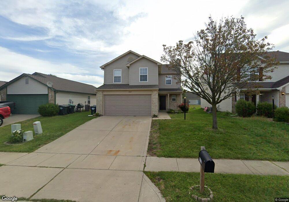
1827 Farm Meadow Dr Unit 34 Greenwood, IN 46143
Estimated Value: $264,042 - $289,000
4
Beds
3
Baths
1,968
Sq Ft
$140/Sq Ft
Est. Value
About This Home
This home is located at 1827 Farm Meadow Dr Unit 34, Greenwood, IN 46143 and is currently estimated at $276,011, approximately $140 per square foot. 1827 Farm Meadow Dr Unit 34 is a home located in Johnson County with nearby schools including Pleasant Crossing Elementary School, Clark-Pleasant Middle School, and Whiteland Community High School.
Ownership History
Date
Name
Owned For
Owner Type
Purchase Details
Closed on
Jan 28, 2022
Sold by
White Jonathan N
Bought by
Yamasa Co Ltd
Current Estimated Value
Purchase Details
Closed on
Aug 30, 2019
Sold by
Ridge Thaddeus J
Bought by
White Jonathan N
Home Financials for this Owner
Home Financials are based on the most recent Mortgage that was taken out on this home.
Original Mortgage
$160,047
Interest Rate
3.7%
Mortgage Type
FHA
Purchase Details
Closed on
Nov 4, 2010
Sold by
Ridge Traci L
Bought by
Ridge Thaddeus J
Purchase Details
Closed on
Apr 8, 2006
Sold by
Reo Management 2004 Inc
Bought by
Ridge Thad and Ridge Traci
Purchase Details
Closed on
Nov 17, 2005
Sold by
Holtsclaw Rhonda Lee
Bought by
Reo Management 2004 Inc
Create a Home Valuation Report for This Property
The Home Valuation Report is an in-depth analysis detailing your home's value as well as a comparison with similar homes in the area
Home Values in the Area
Average Home Value in this Area
Purchase History
| Date | Buyer | Sale Price | Title Company |
|---|---|---|---|
| Yamasa Co Ltd | $230,000 | O/B/O Bc Law Firm Pa | |
| White Jonathan N | -- | Fidelity National Title | |
| Ridge Thaddeus J | -- | None Available | |
| Ridge Thad | $117,900 | Rels Title | |
| Reo Management 2004 Inc | $97,750 | None Available |
Source: Public Records
Mortgage History
| Date | Status | Borrower | Loan Amount |
|---|---|---|---|
| Previous Owner | White Jonathan N | $160,047 |
Source: Public Records
Tax History Compared to Growth
Tax History
| Year | Tax Paid | Tax Assessment Tax Assessment Total Assessment is a certain percentage of the fair market value that is determined by local assessors to be the total taxable value of land and additions on the property. | Land | Improvement |
|---|---|---|---|---|
| 2025 | $5,201 | $302,600 | $45,000 | $257,600 |
| 2024 | $5,201 | $249,000 | $45,000 | $204,000 |
| 2023 | $5,214 | $250,000 | $45,000 | $205,000 |
| 2022 | $1,910 | $184,000 | $29,200 | $154,800 |
| 2021 | $1,714 | $164,700 | $29,200 | $135,500 |
| 2020 | $1,518 | $145,300 | $29,200 | $116,100 |
| 2019 | $1,388 | $133,400 | $23,600 | $109,800 |
| 2018 | $1,305 | $137,400 | $14,500 | $122,900 |
| 2017 | $1,189 | $117,900 | $14,500 | $103,400 |
| 2016 | $1,135 | $115,500 | $14,500 | $101,000 |
| 2014 | $1,047 | $103,700 | $14,800 | $88,900 |
| 2013 | $1,047 | $104,700 | $14,800 | $89,900 |
Source: Public Records
Map
Nearby Homes
- 0 W Worthsville Rd
- 3103 Grand Lake Blvd
- 898 Norfolk Ln
- 882 Norfolk Ln
- 867 Norfolk Ln
- 844 Hardin Place
- 828 Hardin Place
- 1649 Vista Ridge Dr N
- 858 Norfolk Ln
- 883 Norfolk Ln
- 876 Hardin Place
- 884 Hardin Place
- 892 Hardin Place
- 860 Hardin Place
- 868 Hardin Place
- 1832 Averitt Rd
- 2284 Blossom Dr
- 2333 Grand Fir Dr
- 660 Mountain Pine Dr
- 700 Mountain Pine Dr
- 1827 Farm Meadow Dr
- 1827 Farm Meadow Dr
- 1839 Farm Meadow Dr
- 1815 Farm Meadow Dr
- 1851 Farm Meadow Dr
- 1803 Farm Meadow Dr
- 1791 Farm Meadow Dr
- 1863 Farm Meadow Dr
- 1818 Stetson Ln Unit 1826
- 1786 Stetson Ln Unit 1794
- 1836 Farm Meadow Dr
- 1848 Farm Meadow Dr
- 1824 Farm Meadow Dr
- 1875 Farm Meadow Dr
- 1779 Farm Meadow Dr
- 1852 Farm Meadow Dr
- 1810 Farm Meadow Dr
- 1802 Stetson Ln Unit 1810
- 1834 Stetson Ln Unit 1842
- 1870 Farm Meadow Dr