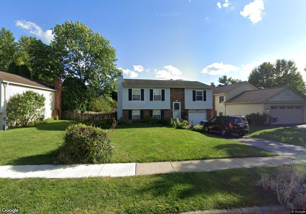
1827 Plains Blvd Powell, OH 43065
Western Hills NeighborhoodEstimated Value: $340,000 - $369,000
3
Beds
2
Baths
1,442
Sq Ft
$247/Sq Ft
Est. Value
About This Home
This home is located at 1827 Plains Blvd, Powell, OH 43065 and is currently estimated at $356,072, approximately $246 per square foot. 1827 Plains Blvd is a home located in Franklin County with nearby schools including Liberty Elementary School, McCord Middle School, and Worthington Kilbourne High School.
Ownership History
Date
Name
Owned For
Owner Type
Purchase Details
Closed on
May 28, 2010
Sold by
Rinehart Andrew K and Rinehart Erin Ann
Bought by
Deboard Keith E and Deboard Karen L
Current Estimated Value
Home Financials for this Owner
Home Financials are based on the most recent Mortgage that was taken out on this home.
Original Mortgage
$157,771
Outstanding Balance
$107,180
Interest Rate
5.25%
Mortgage Type
FHA
Estimated Equity
$248,892
Purchase Details
Closed on
Oct 13, 2003
Sold by
Dani Peter G and Dani Patricia M
Bought by
Rinehart Andrew K
Home Financials for this Owner
Home Financials are based on the most recent Mortgage that was taken out on this home.
Original Mortgage
$129,200
Interest Rate
6.04%
Mortgage Type
Purchase Money Mortgage
Purchase Details
Closed on
Feb 5, 1986
Bought by
Dani Peter G and Dani Patricia M
Create a Home Valuation Report for This Property
The Home Valuation Report is an in-depth analysis detailing your home's value as well as a comparison with similar homes in the area
Home Values in the Area
Average Home Value in this Area
Purchase History
| Date | Buyer | Sale Price | Title Company |
|---|---|---|---|
| Deboard Keith E | $159,900 | Attorney | |
| Rinehart Andrew K | $136,000 | -- | |
| Dani Peter G | $71,900 | -- |
Source: Public Records
Mortgage History
| Date | Status | Borrower | Loan Amount |
|---|---|---|---|
| Open | Deboard Keith E | $157,771 | |
| Closed | Rinehart Andrew K | $129,200 |
Source: Public Records
Tax History Compared to Growth
Tax History
| Year | Tax Paid | Tax Assessment Tax Assessment Total Assessment is a certain percentage of the fair market value that is determined by local assessors to be the total taxable value of land and additions on the property. | Land | Improvement |
|---|---|---|---|---|
| 2024 | $6,300 | $102,620 | $35,000 | $67,620 |
| 2023 | $6,025 | $102,620 | $35,000 | $67,620 |
| 2022 | $4,760 | $64,330 | $17,850 | $46,480 |
| 2021 | $4,391 | $64,330 | $17,850 | $46,480 |
| 2020 | $4,230 | $64,330 | $17,850 | $46,480 |
| 2019 | $3,887 | $53,350 | $14,880 | $38,470 |
| 2018 | $3,713 | $53,350 | $14,880 | $38,470 |
| 2017 | $3,572 | $53,350 | $14,880 | $38,470 |
| 2016 | $3,661 | $51,560 | $14,810 | $36,750 |
| 2015 | $3,661 | $51,560 | $14,810 | $36,750 |
| 2014 | $3,660 | $51,560 | $14,810 | $36,750 |
| 2013 | $1,821 | $51,555 | $14,805 | $36,750 |
Source: Public Records
Map
Nearby Homes
- 8266 Waco Ln
- 1914 Laramie Dr Unit 26
- 8345 Smoky Row Rd Unit 8345
- 8351 Smoky Row Rd Unit 48351
- 7898 Sarahurst Dr
- 1949 Hamrock Dr
- 1486 Clubview Blvd S
- 8594 Broadacre Dr
- 2053 Stancrest Rd
- 2013 Summit Row Blvd
- 8741 Jamey Ct
- 2280 Saberly Ct
- 1399 Briarmeadow Dr
- 2228 Gnarled Pine Dr
- 2074 Hard Rd
- 8292 Breckenridge Way
- 2168 Summit Row Blvd
- 8796 Yates Point Ct
- 8803 Yates Point Ct
- 2120 Sharwood Ct
- 1819 Plains Blvd
- 1811 Plains Blvd
- 1843 Plains Blvd
- 8258 Longhorn Rd
- 8264 Longhorn Rd
- 8252 Longhorn Rd
- 8315 Yuma Dr
- 1803 Plains Blvd
- 8314 Seabright Dr
- 1851 Plains Blvd
- 8270 Lone Tree Dr
- 8246 Longhorn Rd
- 8321 Yuma Dr
- 1791 Plains Blvd
- 1800 Plains Blvd
- 8322 Seabright Dr
- 1856 Plains Blvd
- 8327 Yuma Dr
- 1779 Plains Blvd
- 8253 Longhorn Rd