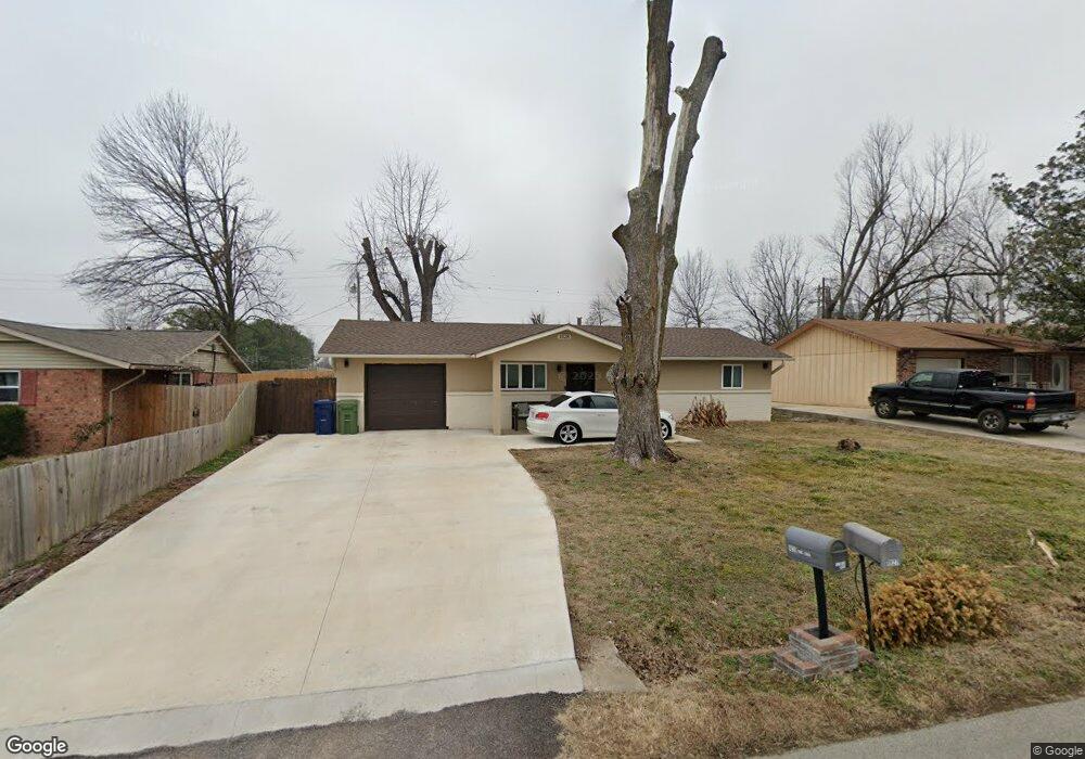
1828 S Beth Dr Rogers, AR 72758
Estimated Value: $173,000 - $198,000
3
Beds
1
Bath
1,000
Sq Ft
$184/Sq Ft
Est. Value
About This Home
This home is located at 1828 S Beth Dr, Rogers, AR 72758 and is currently estimated at $183,777, approximately $183 per square foot. 1828 S Beth Dr is a home located in Benton County with nearby schools including Westside Elementary School, Oakdale Middle School, and Rogers Heritage High School.
Ownership History
Date
Name
Owned For
Owner Type
Purchase Details
Closed on
Sep 10, 2021
Sold by
Brown Lori
Bought by
Romero Abraham
Current Estimated Value
Purchase Details
Closed on
Nov 9, 2007
Sold by
Grindstaff Deborah and Reed Heath
Bought by
Brown Lori Jayne
Home Financials for this Owner
Home Financials are based on the most recent Mortgage that was taken out on this home.
Original Mortgage
$4,980
Interest Rate
6.42%
Mortgage Type
Stand Alone Second
Purchase Details
Closed on
Apr 27, 2001
Bought by
Grindstaff
Purchase Details
Closed on
Oct 3, 1986
Bought by
Dod 10-03-1986
Purchase Details
Closed on
Jan 17, 1983
Bought by
Rittenhouse
Create a Home Valuation Report for This Property
The Home Valuation Report is an in-depth analysis detailing your home's value as well as a comparison with similar homes in the area
Home Values in the Area
Average Home Value in this Area
Purchase History
| Date | Buyer | Sale Price | Title Company |
|---|---|---|---|
| Romero Abraham | $98,000 | None Listed On Document | |
| Brown Lori Jayne | $83,000 | Waco Title Company | |
| Grindstaff | $61,000 | -- | |
| Dod 10-03-1986 | -- | -- | |
| Rittenhouse | $33,000 | -- |
Source: Public Records
Mortgage History
| Date | Status | Borrower | Loan Amount |
|---|---|---|---|
| Previous Owner | Brown Lori Jayne | $4,980 | |
| Previous Owner | Brown Lori Jayne | $82,348 | |
| Previous Owner | Brown Lori Jayne | $4,980 |
Source: Public Records
Map
Nearby Homes
- 2001 W New Hope Rd
- 2100 W New Hope Rd Unit 1704
- 1811 S 22nd St
- 1704 S Dixieland Rd
- 1607 W New Hope Rd
- 1701 Beth Dr
- Lot 1 W New Hope Rd
- 1925 S 21st St
- 1702 W Mimosa St
- 2103 W Green Acres Dr
- 2327 W Seminole Dr
- 1725 S 15th St
- 1625 S 17th Place
- 2333 W Seminole Dr
- 2331 W Seminole Dr
- 1610 S 17th Place
- 1604 S 23rd St
- 1608 S 23rd Place
- 1601 S 23rd Place
- 1600 S 23rd Place
Your Personal Tour Guide
Ask me questions while you tour the home.