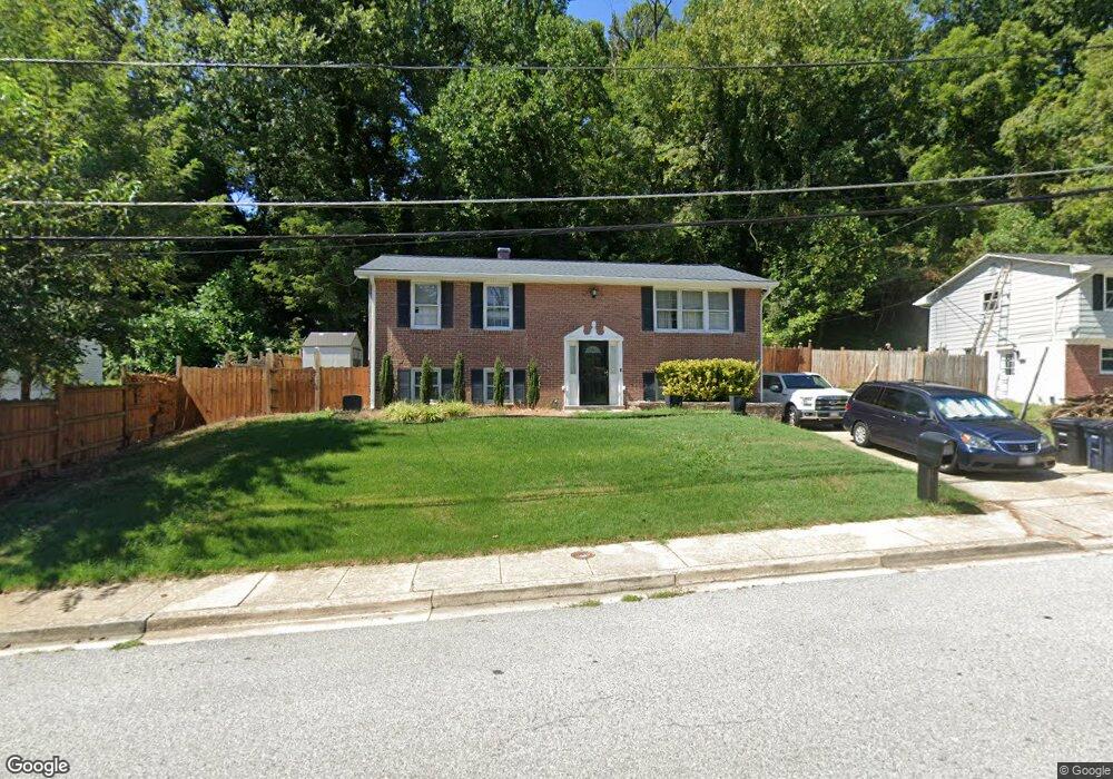
1828 Taylor Ave Fort Washington, MD 20744
Estimated Value: $410,000 - $443,000
--
Bed
3
Baths
1,107
Sq Ft
$391/Sq Ft
Est. Value
About This Home
This home is located at 1828 Taylor Ave, Fort Washington, MD 20744 and is currently estimated at $432,850, approximately $391 per square foot. 1828 Taylor Ave is a home located in Prince George's County with nearby schools including Fort Washington Forest Elementary School, Accokeek Academy, and Friendly High School.
Ownership History
Date
Name
Owned For
Owner Type
Purchase Details
Closed on
Oct 22, 2007
Sold by
Morgan Ronald L
Bought by
Bactad Frederick R
Current Estimated Value
Home Financials for this Owner
Home Financials are based on the most recent Mortgage that was taken out on this home.
Original Mortgage
$68,999
Interest Rate
6.21%
Mortgage Type
Stand Alone Second
Purchase Details
Closed on
Apr 27, 2007
Sold by
Morgan Ronald L
Bought by
Bactad Frederick R
Home Financials for this Owner
Home Financials are based on the most recent Mortgage that was taken out on this home.
Original Mortgage
$275,998
Interest Rate
6.21%
Mortgage Type
Purchase Money Mortgage
Purchase Details
Closed on
Apr 4, 1986
Sold by
Trick John J
Bought by
Morgan Ronald L and Devoe Lee R
Create a Home Valuation Report for This Property
The Home Valuation Report is an in-depth analysis detailing your home's value as well as a comparison with similar homes in the area
Home Values in the Area
Average Home Value in this Area
Purchase History
| Date | Buyer | Sale Price | Title Company |
|---|---|---|---|
| Bactad Frederick R | $344,999 | -- | |
| Bactad Frederick R | $344,999 | -- | |
| Morgan Ronald L | $50,000 | -- |
Source: Public Records
Mortgage History
| Date | Status | Borrower | Loan Amount |
|---|---|---|---|
| Closed | Bactad Frederick R | $68,999 | |
| Open | Bactad Frederick R | $275,998 | |
| Previous Owner | Bactad Frederick R | $275,998 |
Source: Public Records
Tax History Compared to Growth
Tax History
| Year | Tax Paid | Tax Assessment Tax Assessment Total Assessment is a certain percentage of the fair market value that is determined by local assessors to be the total taxable value of land and additions on the property. | Land | Improvement |
|---|---|---|---|---|
| 2025 | $4,882 | $331,600 | -- | -- |
| 2024 | $4,882 | $301,700 | $101,700 | $200,000 |
| 2023 | $4,597 | $282,600 | $0 | $0 |
| 2022 | $4,313 | $263,500 | $0 | $0 |
| 2021 | $4,030 | $244,400 | $100,800 | $143,600 |
| 2020 | $3,897 | $235,467 | $0 | $0 |
| 2019 | $3,764 | $226,533 | $0 | $0 |
| 2018 | $3,631 | $217,600 | $75,800 | $141,800 |
| 2017 | $3,437 | $204,533 | $0 | $0 |
| 2016 | -- | $191,467 | $0 | $0 |
| 2015 | $3,163 | $178,400 | $0 | $0 |
| 2014 | $3,163 | $178,400 | $0 | $0 |
Source: Public Records
Map
Nearby Homes
- 1916 Taylor Ave
- 13318 Chalfont Ave
- 1410 Fillmore Rd
- 13503 Harrison Ave
- 12904 Chalfont Ave
- 12806 Monroe Ave
- 14005 Livingston Rd
- 2421 Baileys Pond Rd
- 0 Joseph Dr
- 13102 Gerry Rd
- 2608 Saint Marys View Rd
- 2001 Medinah Ridge Rd
- 804 Cascade Dr
- 2201 Herring Creek Dr
- 802 Cornish St
- 14311 Livingston Rd
- 13303 Pendleton St
- 13403 Pendleton St
- 13803 Stroh Ct
- 2504 Brandy Ln
- 1826 Taylor Ave
- 1830 Taylor Ave
- 13402 Taylor Ct
- 1832 Taylor Ave
- 1824 Taylor Ave
- 1829 Taylor Ave
- 13400 Taylor Ct
- 1827 Taylor Ave
- 13404 Taylor Ct
- 1825 Taylor Ave
- 1833 Taylor Ave
- 1834 Taylor Ave
- 1822 Taylor Ave
- 1823 Taylor Ave
- 13401 Taylor Ct
- 13406 Taylor Ct
- 1711 Tioga Rd
- 1821 Taylor Ave
- 1820 Taylor Ave
- 1710 Tioga Rd