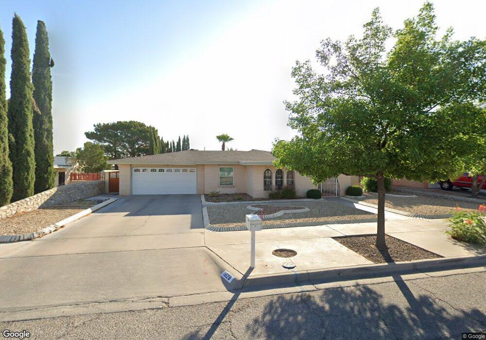
1828 Tom Bolt Dr El Paso, TX 79936
Vista Del Sol NeighborhoodEstimated Value: $277,924 - $320,000
3
Beds
3
Baths
2,143
Sq Ft
$140/Sq Ft
Est. Value
About This Home
This home is located at 1828 Tom Bolt Dr, El Paso, TX 79936 and is currently estimated at $298,981, approximately $139 per square foot. 1828 Tom Bolt Dr is a home located in El Paso County with nearby schools including Tierra Del Sol Elementary School, J M Hanks High School, and EL PASO LEADERSHIP ACADEMY - MIDDLE EAST.
Ownership History
Date
Name
Owned For
Owner Type
Purchase Details
Closed on
May 24, 2005
Sold by
Roberts Marguarette
Bought by
Stephens W Brent and Stephens Genesis C
Current Estimated Value
Home Financials for this Owner
Home Financials are based on the most recent Mortgage that was taken out on this home.
Original Mortgage
$116,700
Outstanding Balance
$60,653
Interest Rate
5.79%
Mortgage Type
Fannie Mae Freddie Mac
Estimated Equity
$238,328
Create a Home Valuation Report for This Property
The Home Valuation Report is an in-depth analysis detailing your home's value as well as a comparison with similar homes in the area
Home Values in the Area
Average Home Value in this Area
Purchase History
| Date | Buyer | Sale Price | Title Company |
|---|---|---|---|
| Stephens W Brent | -- | -- |
Source: Public Records
Mortgage History
| Date | Status | Borrower | Loan Amount |
|---|---|---|---|
| Open | Stephens W Brent | $116,700 |
Source: Public Records
Tax History Compared to Growth
Tax History
| Year | Tax Paid | Tax Assessment Tax Assessment Total Assessment is a certain percentage of the fair market value that is determined by local assessors to be the total taxable value of land and additions on the property. | Land | Improvement |
|---|---|---|---|---|
| 2025 | $4,670 | $263,954 | $43,896 | $220,058 |
| 2024 | $4,670 | $241,009 | -- | -- |
| 2023 | $4,385 | $219,099 | $0 | $0 |
| 2022 | $6,185 | $199,181 | $0 | $0 |
| 2021 | $5,886 | $181,074 | $29,862 | $151,212 |
| 2020 | $5,379 | $170,299 | $27,106 | $143,193 |
| 2018 | $5,183 | $166,667 | $27,106 | $139,561 |
| 2017 | $4,777 | $156,453 | $27,106 | $129,347 |
| 2016 | $4,343 | $142,082 | $27,106 | $114,976 |
| 2015 | $3,444 | $142,082 | $27,106 | $114,976 |
| 2014 | $3,444 | $143,110 | $27,106 | $116,004 |
Source: Public Records
Map
Nearby Homes
- 1868 Tom Bolt Dr
- 1817 Hugh Royer Place
- 1913 Seagull Dr
- 1804 Jerry Abbott St
- 1739 Jerry Abbott St
- 1901 Bobby Jones Dr
- 11204 Bob Mitchell Dr
- 2001 Bobby Jones Dr Unit A
- 1703 Robert Wynn St
- 2009 Bobby Jones Dr Unit B
- 11016 Bob Stone Dr
- 11012 Bob Stone Dr
- 11013 Bob Stone Dr
- 1700 Jerry Abbott St
- 1617 Tommy Aaron Dr
- 2604 Anise Dr
- 1607 Tommy Aaron Dr
- 2101 E Glen Dr
- 11157 Leo Collins Dr
- 11262 Enid Wilson Ln
- 1832 Tom Bolt Dr
- 1824 Tom Bolt Dr
- 1837 Tommy Aaron Dr
- 1841 Tommy Aaron Dr
- 1836 Tom Bolt Dr
- 1833 Tommy Aaron Dr
- 1820 Tom Bolt Dr
- 1827 Tom Bolt Dr
- 1831 Tom Bolt Dr
- 1823 Tom Bolt Dr
- 1829 Tommy Aaron Dr
- 1835 Tom Bolt Dr
- 1845 Tommy Aaron Dr
- 1816 Tom Bolt Dr
- 1840 Tom Bolt Dr
- 1817 Tom Bolt Dr
- 1825 Tommy Aaron Dr
- 1816 Mike Hill Dr
- 1820 Mike Hill Dr
- 1837 Tom Bolt Dr