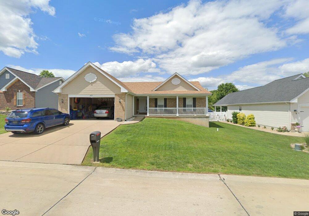
1829 Cairo Dr Festus, MO 63028
Festus/Crystal City NeighborhoodEstimated Value: $333,078 - $382,000
Studio
--
Bath
1,671
Sq Ft
$219/Sq Ft
Est. Value
About This Home
This home is located at 1829 Cairo Dr, Festus, MO 63028 and is currently estimated at $366,020, approximately $219 per square foot. 1829 Cairo Dr is a home located in Jefferson County with nearby schools including Festus Intermediate School, Festus Elementary School, and Festus Middle School.
Ownership History
Date
Name
Owned For
Owner Type
Purchase Details
Closed on
Dec 13, 2005
Sold by
J Ridge Corp
Bought by
Bielefeld John E and Bielefeld Virginia L
Current Estimated Value
Home Financials for this Owner
Home Financials are based on the most recent Mortgage that was taken out on this home.
Original Mortgage
$155,007
Outstanding Balance
$86,779
Interest Rate
6.3%
Mortgage Type
Fannie Mae Freddie Mac
Estimated Equity
$279,241
Create a Home Valuation Report for This Property
The Home Valuation Report is an in-depth analysis detailing your home's value as well as a comparison with similar homes in the area
Home Values in the Area
Average Home Value in this Area
Purchase History
| Date | Buyer | Sale Price | Title Company |
|---|---|---|---|
| Bielefeld John E | -- | None Available |
Source: Public Records
Mortgage History
| Date | Status | Borrower | Loan Amount |
|---|---|---|---|
| Open | Bielefeld John E | $155,007 |
Source: Public Records
Tax History
| Year | Tax Paid | Tax Assessment Tax Assessment Total Assessment is a certain percentage of the fair market value that is determined by local assessors to be the total taxable value of land and additions on the property. | Land | Improvement |
|---|---|---|---|---|
| 2025 | $2,491 | $46,800 | $9,600 | $37,200 |
| 2024 | $2,491 | $44,000 | $9,600 | $34,400 |
| 2023 | $2,491 | $44,000 | $9,600 | $34,400 |
| 2022 | $2,331 | $41,400 | $7,000 | $34,400 |
| 2021 | $2,363 | $41,400 | $7,000 | $34,400 |
| 2020 | $2,236 | $36,700 | $6,100 | $30,600 |
| 2019 | $2,235 | $36,700 | $6,100 | $30,600 |
| 2018 | $1,975 | $35,900 | $6,100 | $29,800 |
| 2017 | $1,974 | $35,900 | $6,100 | $29,800 |
| 2016 | $1,849 | $33,400 | $6,000 | $27,400 |
| 2015 | $1,762 | $33,400 | $6,000 | $27,400 |
| 2013 | $1,762 | $33,100 | $6,000 | $27,100 |
Source: Public Records
Map
Nearby Homes
- 1829 Belmont Ct
- 1816 Belmont Ct
- 0 Bailey School Rd
- 716 Rosemary Ln
- 0 Tbb Birchwood Overlook-Dogwood Unit MAR24022693
- 0
- 0 Tbb Birchwood Overlook - Maple
- 2310 Peterein Ct
- 0 Tbb Birchwood Overlook Birchwo Unit MAR24022701
- 530 Cedar Ln
- 1868 Sunset Ridge
- TBD Cedar Ln
- 0 Tbb Birchwood Overlook-Red Bud Unit MAR24022708
- 0 Tbb Bichwood Overlook-Sycamore Unit MAR24022712
- 707 Jerome Dr
- 1833 Sunset Ridge
- 1810 Valley View Cir
- 131 Blue Ridge Trace
- 202 Sunshine Dr
- 1206 N 3rd St
- 1825 Cairo Dr
- 1826 Iron Mountain Dr
- 1821 Cairo Dr
- 1901 Cairo Dr
- 1822 Iron Mountain Dr
- 1836 Cairo Dr
- 1830 Iron Mountain Dr
- 1818 Iron Mountain Dr
- 1832 Cairo Dr
- 1834 Iron Mountain Dr
- 1834 Iron Mountain Dr
- 1817 Cairo Dr
- 1905 Cairo Dr
- 1900 Cairo Dr
- 2036 Belmont Dr
- 1828 Cairo Dr
- 1814 Iron Mountain Dr
- 1838 Iron Mountain Dr
- 2033 Belmont Dr
- 1813 Cairo Dr
Your Personal Tour Guide
Ask me questions while you tour the home.