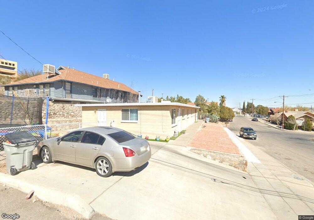
1829 E Nevada Ave Unit both El Paso, TX 79902
West Central NeighborhoodEstimated Value: $195,420 - $276,000
--
Bed
2
Baths
1,700
Sq Ft
$146/Sq Ft
Est. Value
About This Home
This home is located at 1829 E Nevada Ave Unit both, El Paso, TX 79902 and is currently estimated at $247,855, approximately $145 per square foot. 1829 E Nevada Ave Unit both is a home located in El Paso County with nearby schools including Lamar Elementary School, Wiggs Middle School, and El Paso High School.
Ownership History
Date
Name
Owned For
Owner Type
Purchase Details
Closed on
May 29, 2008
Sold by
Rangel Ed H
Bought by
Dorman Matthew A
Current Estimated Value
Purchase Details
Closed on
Feb 3, 2003
Sold by
Sidemera Ltd
Bought by
Rangel Ed H
Home Financials for this Owner
Home Financials are based on the most recent Mortgage that was taken out on this home.
Original Mortgage
$42,000
Interest Rate
5.9%
Create a Home Valuation Report for This Property
The Home Valuation Report is an in-depth analysis detailing your home's value as well as a comparison with similar homes in the area
Home Values in the Area
Average Home Value in this Area
Purchase History
| Date | Buyer | Sale Price | Title Company |
|---|---|---|---|
| Dorman Matthew A | -- | None Available | |
| Rangel Ed H | -- | -- |
Source: Public Records
Mortgage History
| Date | Status | Borrower | Loan Amount |
|---|---|---|---|
| Previous Owner | Rangel Ed H | $42,000 |
Source: Public Records
Tax History Compared to Growth
Tax History
| Year | Tax Paid | Tax Assessment Tax Assessment Total Assessment is a certain percentage of the fair market value that is determined by local assessors to be the total taxable value of land and additions on the property. | Land | Improvement |
|---|---|---|---|---|
| 2025 | $4,199 | $165,506 | $37,884 | $127,622 |
| 2024 | $4,199 | $165,506 | $37,884 | $127,622 |
| 2023 | $3,729 | $134,800 | $17,220 | $117,580 |
| 2022 | $3,884 | $131,202 | $17,220 | $113,982 |
| 2021 | $2,492 | $79,817 | $17,220 | $62,597 |
| 2020 | $1,507 | $49,042 | $12,300 | $36,742 |
| 2018 | $1,452 | $49,042 | $12,300 | $36,742 |
| 2017 | $1,361 | $48,324 | $12,300 | $36,024 |
| 2016 | $1,361 | $48,324 | $12,300 | $36,024 |
| 2015 | $1,322 | $48,324 | $12,300 | $36,024 |
| 2014 | $1,322 | $48,324 | $12,300 | $36,024 |
Source: Public Records
Map
Nearby Homes
- 1805 Arizona Ave
- 1725 Arizona Ave
- 1907 Grandview Ave
- 1911 Grandview Ave
- 2007 Atlanta Ave
- 1531 E Rio Grande Ave
- 1701 Murchison Dr
- 2208 Montana Ave
- 1181 N Cotton St
- 2230 Arizona Ave
- 1405 E Nevada Ave
- 1609 Georgia Place
- 2407 Grant Ave
- 1307 E California Ave
- 1536 Rocky Bluff Dr
- 1229 Ohio St
- 1240 & 1242 N Cotton St
- 1207 E Rio Grande Ave
- 1609 Camino Alto Rd
- 1501 Brown St Unit 1505
- 1829 E Nevada Ave Unit 1831
- 1303 N Laurel St
- 1221 N Laurel St
- 1825 E Nevada Ave
- 1219 N Laurel St
- 1300 N Laurel St
- 1823 E Nevada Ave
- 1217 N Laurel St
- 1217 Laurel (A B & C) St
- 1822 E Nevada Ave
- 1821 E Nevada Ave
- 1222 N Laurel St
- 1820 E Nevada Ave
- 1215 N Laurel St
- 1214 N Laurel St
- 1834 Grandview Ave
- 1819 E Nevada Ave
- 1212 N Laurel St
- 1212 N Laurel St Unit B
- 1203 N Laurel St