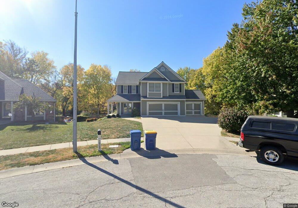
1829 Welleslay Ct Liberty, MO 64068
Estimated Value: $432,000 - $479,000
4
Beds
3
Baths
2,665
Sq Ft
$172/Sq Ft
Est. Value
About This Home
This home is located at 1829 Welleslay Ct, Liberty, MO 64068 and is currently estimated at $457,138, approximately $171 per square foot. 1829 Welleslay Ct is a home located in Clay County with nearby schools including Alexander Doniphan Elementary School, Liberty Middle School, and Liberty High School.
Ownership History
Date
Name
Owned For
Owner Type
Purchase Details
Closed on
Jun 25, 2024
Sold by
Cox Larry A and Cox Kelli Lynn
Bought by
Dice Bradley D
Current Estimated Value
Purchase Details
Closed on
Dec 15, 2020
Sold by
Cox Larry A and Cox Kelli Lynn
Bought by
Cox Larry A and Cox Kelli Lynn
Home Financials for this Owner
Home Financials are based on the most recent Mortgage that was taken out on this home.
Original Mortgage
$226,100
Interest Rate
2.8%
Mortgage Type
New Conventional
Create a Home Valuation Report for This Property
The Home Valuation Report is an in-depth analysis detailing your home's value as well as a comparison with similar homes in the area
Home Values in the Area
Average Home Value in this Area
Purchase History
| Date | Buyer | Sale Price | Title Company |
|---|---|---|---|
| Dice Bradley D | -- | Thomson Affinity Title | |
| Cox Larry A | -- | None Listed On Document |
Source: Public Records
Mortgage History
| Date | Status | Borrower | Loan Amount |
|---|---|---|---|
| Previous Owner | Cox Larry A | $226,100 |
Source: Public Records
Tax History Compared to Growth
Tax History
| Year | Tax Paid | Tax Assessment Tax Assessment Total Assessment is a certain percentage of the fair market value that is determined by local assessors to be the total taxable value of land and additions on the property. | Land | Improvement |
|---|---|---|---|---|
| 2025 | $5,274 | $78,360 | -- | -- |
| 2024 | $5,274 | $68,570 | -- | -- |
| 2023 | $5,363 | $68,570 | $0 | $0 |
| 2022 | $4,576 | $57,760 | $0 | $0 |
| 2021 | $4,540 | $57,760 | $6,650 | $51,110 |
| 2020 | $3,914 | $46,760 | $0 | $0 |
| 2019 | $3,913 | $46,760 | $0 | $0 |
| 2018 | $3,710 | $43,530 | $0 | $0 |
| 2017 | $3,586 | $43,530 | $4,750 | $38,780 |
| 2016 | $3,586 | $42,470 | $4,750 | $37,720 |
| 2015 | $3,587 | $42,470 | $4,750 | $37,720 |
| 2014 | $3,432 | $40,320 | $4,370 | $35,950 |
Source: Public Records
Map
Nearby Homes
- 1733 Welleslay Ln
- 1507 Amesbury Ave
- 1537 Canterbury Ln
- 1323 Amesbury Ave
- 1218 Canterbury Ln
- 1124 Amesbury Ave
- 1327 Easton Ct
- 509 Belmont St
- 415 Monterey Ave
- 1304 Wellington Way
- 420 Belmont St
- 2116 Winding Woods Dr
- 1205 Blackberry Dr
- 1836 Green Meadow Dr
- 1856 Arbor Trail
- 918 Amesbury Ave
- 1991 Harvest Rd
- Lot 2A Oak Crest Dr
- 1841 Vintage Ln
- 1845 Arbor Trail
- 1825 Welleslay Ct
- 1833 Welleslay Ct
- 1821 Welleslay Ct
- 1832 Welleslay Ct
- 1828 Welleslay Ct
- 1817 Welleslay Ct
- 101 Adkins Rd
- 1824 Welleslay Ct
- 107 Adkins Rd
- 105 Adkins Rd
- 1804 Welleslay Ct
- 1813 Welleslay Ct
- 1805 Welleslay Ct
- 100 Adkins Rd
- 109 Adkins Rd
- 1805 Dunwich Ct
- 1809 Welleslay Ct
- 1800 Welleslay Ct
- 1809 Dunwich Ct
- 102 Adkins Rd