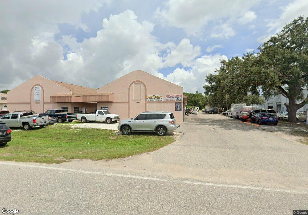
18290 Paulson Dr Unit A Port Charlotte, FL 33954
Estimated Value: $1,503,892
--
Bed
4
Baths
15,840
Sq Ft
$95/Sq Ft
Est. Value
About This Home
This home is located at 18290 Paulson Dr Unit A, Port Charlotte, FL 33954 and is currently estimated at $1,503,892, approximately $94 per square foot. 18290 Paulson Dr Unit A is a home located in Charlotte County with nearby schools including Liberty Elementary School, Murdock Middle School, and Port Charlotte High School.
Ownership History
Date
Name
Owned For
Owner Type
Purchase Details
Closed on
Oct 9, 2015
Sold by
Julies Warehouse Rentals Llc
Bought by
Moonstone Holdings Llc
Current Estimated Value
Home Financials for this Owner
Home Financials are based on the most recent Mortgage that was taken out on this home.
Original Mortgage
$585,000
Outstanding Balance
$461,533
Interest Rate
3.88%
Mortgage Type
Seller Take Back
Estimated Equity
$1,042,359
Purchase Details
Closed on
Jul 17, 2007
Sold by
Smith Julie M and Roughton Julie M
Bought by
Julies Warehouse Rentals Llc
Create a Home Valuation Report for This Property
The Home Valuation Report is an in-depth analysis detailing your home's value as well as a comparison with similar homes in the area
Home Values in the Area
Average Home Value in this Area
Purchase History
| Date | Buyer | Sale Price | Title Company |
|---|---|---|---|
| Moonstone Holdings Llc | $780,000 | Attorney | |
| Julies Warehouse Rentals Llc | -- | Attorney |
Source: Public Records
Mortgage History
| Date | Status | Borrower | Loan Amount |
|---|---|---|---|
| Open | Moonstone Holdings Llc | $585,000 | |
| Previous Owner | Julies Warehouse Rentals Llc | $65,000 | |
| Previous Owner | Julles Warehouse Rentals Llc | $200,000 | |
| Previous Owner | Smith Julie | $48,100 |
Source: Public Records
Tax History Compared to Growth
Tax History
| Year | Tax Paid | Tax Assessment Tax Assessment Total Assessment is a certain percentage of the fair market value that is determined by local assessors to be the total taxable value of land and additions on the property. | Land | Improvement |
|---|---|---|---|---|
| 2024 | $25,448 | $1,756,092 | $240,667 | $1,515,425 |
| 2023 | $25,448 | $1,093,864 | $0 | $0 |
| 2022 | $21,649 | $1,129,545 | $154,027 | $975,518 |
| 2021 | $20,195 | $934,262 | $109,744 | $824,518 |
| 2020 | $18,434 | $821,836 | $109,744 | $712,092 |
| 2019 | $17,905 | $804,012 | $109,744 | $694,268 |
| 2018 | $15,825 | $709,292 | $109,744 | $599,548 |
| 2017 | $15,838 | $707,360 | $109,744 | $597,616 |
| 2016 | $15,082 | $655,964 | $0 | $0 |
| 2015 | $12,332 | $486,214 | $0 | $0 |
| 2014 | $12,351 | $515,995 | $0 | $0 |
Source: Public Records
Map
Nearby Homes
- 18362 Cordoba Ave
- 329 Overbrook St
- 481 Overbrook St
- 458 Overbrook St
- 498 Overbrook St
- 18393 Cordoba Ave
- 521 Overbrook St
- 475 Barrett St
- 18394 Sagamore Ave
- 472 Shoreland St
- 480 Shoreland St
- 18452 Cordoba Ave
- 491 Stevensville St
- 362 Barrett St
- 168 Prineville St
- 160 Prineville St
- 319 Prineville St
- 240 Prineville St
- 18384 Tulane Ave
- 378 Troutdale St
- 18260 Paulson Dr Unit C1,2,3
- 18260 Paulson Dr Unit B2
- 18260 Paulson Dr Unit A3
- 18260 Paulson Dr Unit B1
- 18350 Paulson Dr Unit 4B
- 18350 Paulson Dr Unit B-1
- 18350 Paulson Dr Unit B2
- 18350 Paulson Dr Unit A2
- 18350 Paulson Dr Unit A1
- 18350 Paulson Dr Unit B4
- 18350 Paulson Dr Unit A4
- 18350 Paulson Dr Unit A3
- 18350 Paulson Dr Unit 1-4
- 18350 Paulson Dr Unit 3
- 18350 Paulson Dr
- 18350 Paulson Dr Unit 2
- 18350 Paulson Dr Unit A1 & A2
- 18350 Paulson Dr Unit 4
- 18327 N Cordova Ave
- 18327 Cordoba Ave