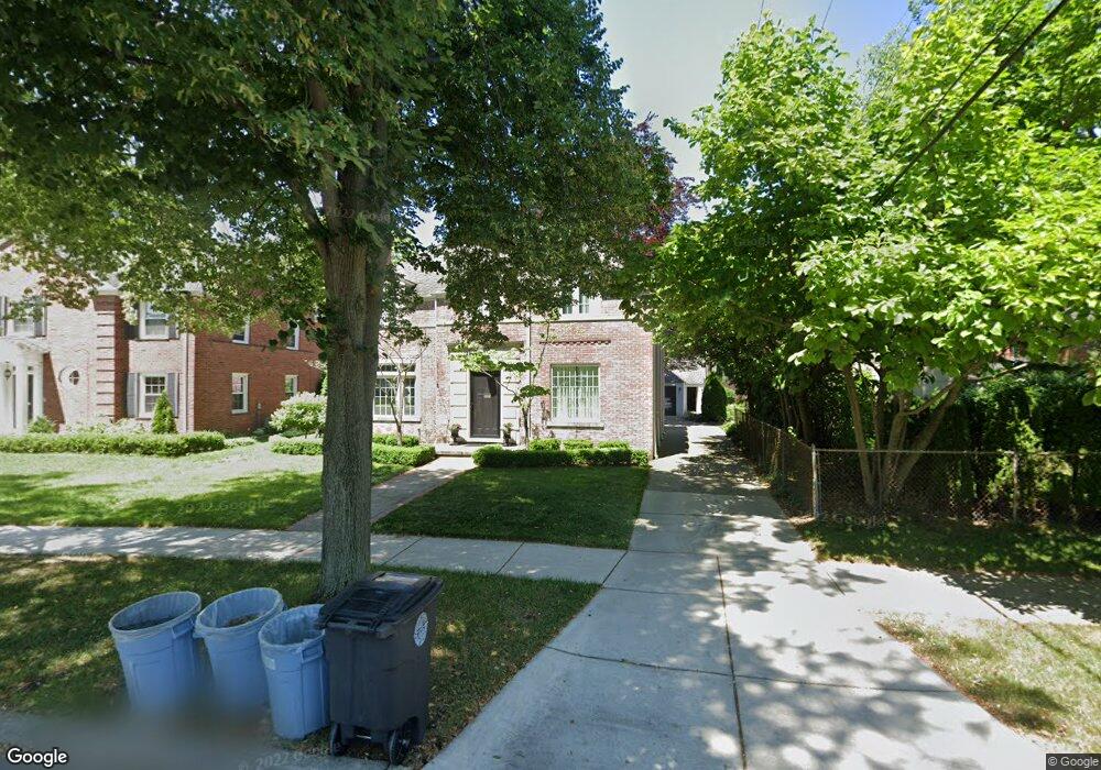
183 Beaupre Ave Grosse Pointe Farms, MI 48236
Estimated Value: $744,828 - $1,031,000
--
Bed
1
Bath
3,136
Sq Ft
$268/Sq Ft
Est. Value
About This Home
This home is located at 183 Beaupre Ave, Grosse Pointe Farms, MI 48236 and is currently estimated at $839,457, approximately $267 per square foot. 183 Beaupre Ave is a home located in Wayne County with nearby schools including Richard Elementary School, Brownell Middle School, and Grosse Pointe South High School.
Ownership History
Date
Name
Owned For
Owner Type
Purchase Details
Closed on
Jun 25, 2021
Sold by
Greening and Katherine
Bought by
Katherine B Greening Trust
Current Estimated Value
Home Financials for this Owner
Home Financials are based on the most recent Mortgage that was taken out on this home.
Original Mortgage
$486,650
Interest Rate
2.34%
Purchase Details
Closed on
May 30, 2020
Sold by
Greening Bruce and Greening Katherine B
Bought by
Greening Katherine B and Katherine B Greening Trust
Home Financials for this Owner
Home Financials are based on the most recent Mortgage that was taken out on this home.
Original Mortgage
$510,400
Interest Rate
2.7%
Mortgage Type
Stand Alone Refi Refinance Of Original Loan
Create a Home Valuation Report for This Property
The Home Valuation Report is an in-depth analysis detailing your home's value as well as a comparison with similar homes in the area
Home Values in the Area
Average Home Value in this Area
Purchase History
| Date | Buyer | Sale Price | Title Company |
|---|---|---|---|
| Katherine B Greening Trust | -- | National Deed Network Inc | |
| Greening Bruce | -- | National Deed Network Inc | |
| Greening Katherine B | -- | Amrock Inc | |
| Greening Katherine B | -- | Amrock Inc |
Source: Public Records
Mortgage History
| Date | Status | Borrower | Loan Amount |
|---|---|---|---|
| Previous Owner | Greening Bruce | $486,650 | |
| Previous Owner | Greening Katherine B | $510,400 |
Source: Public Records
Tax History Compared to Growth
Tax History
| Year | Tax Paid | Tax Assessment Tax Assessment Total Assessment is a certain percentage of the fair market value that is determined by local assessors to be the total taxable value of land and additions on the property. | Land | Improvement |
|---|---|---|---|---|
| 2025 | $5,870 | $357,700 | $0 | $0 |
| 2024 | $5,870 | $336,400 | $0 | $0 |
| 2023 | $5,377 | $309,400 | $0 | $0 |
| 2022 | $5,377 | $283,900 | $0 | $0 |
| 2021 | $9,868 | $269,600 | $0 | $0 |
| 2019 | $9,703 | $256,600 | $0 | $0 |
| 2018 | $4,966 | $241,700 | $0 | $0 |
| 2017 | $8,616 | $235,700 | $0 | $0 |
| 2016 | $9,032 | $225,100 | $0 | $0 |
| 2015 | $17,889 | $199,300 | $0 | $0 |
| 2013 | $17,330 | $173,300 | $0 | $0 |
| 2012 | $4,709 | $177,100 | $35,800 | $141,300 |
Source: Public Records
Map
Nearby Homes
- 317 Mount Vernon Ave
- 314 Mount Vernon Ave
- 302 Mount Vernon Ave
- 341 Mcmillan Rd
- 343 Mount Vernon Ave
- 352 Mckinley Ave
- 380 Merriweather Rd
- 259 Mount Vernon Ave
- 276 Lewiston Rd
- 827 Fisher Rd
- 194 Charlevoix Ave
- 415 Lothrop Rd
- 218 Merriweather Rd
- 876 Washington Rd
- 240 Mckinley Ave
- 745 Lincoln Rd
- 975 Fisher Rd
- 233 Mcmillan Rd
- 216 Ridge Rd
- 213 Muir Rd