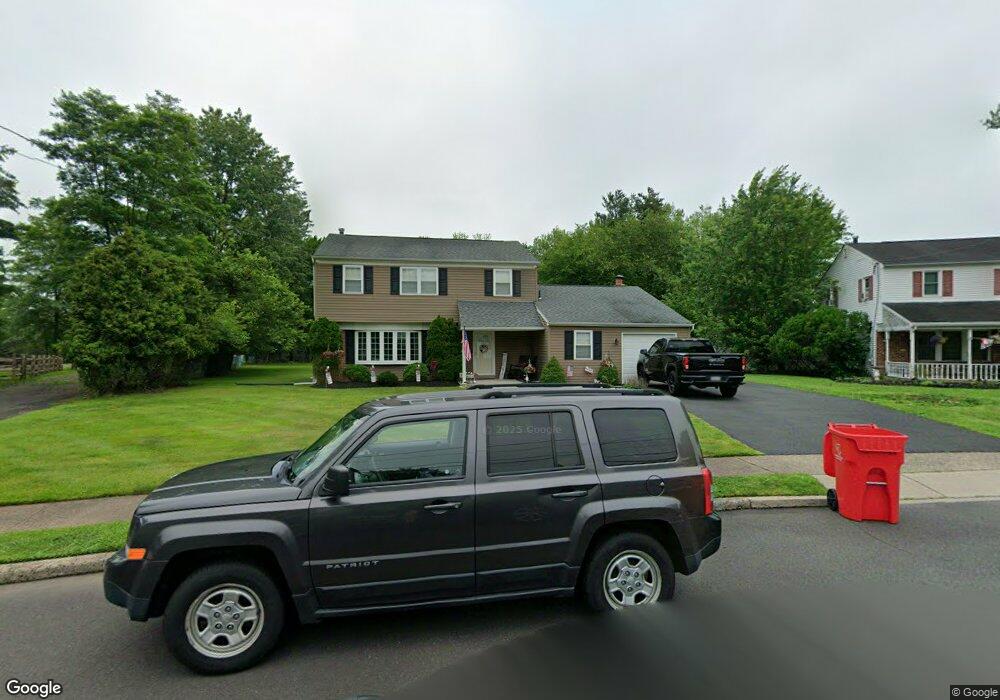
183 Belair Rd Warminster, PA 18974
Estimated Value: $523,000 - $576,000
3
Beds
3
Baths
2,388
Sq Ft
$231/Sq Ft
Est. Value
About This Home
This home is located at 183 Belair Rd, Warminster, PA 18974 and is currently estimated at $550,887, approximately $230 per square foot. 183 Belair Rd is a home located in Bucks County with nearby schools including Willow Dale El School, Log College Middle School, and William Tennent High School.
Ownership History
Date
Name
Owned For
Owner Type
Purchase Details
Closed on
Dec 21, 2009
Sold by
Scafidi John and Scafidi Katherine M
Bought by
Gregg Jeffrey D
Current Estimated Value
Home Financials for this Owner
Home Financials are based on the most recent Mortgage that was taken out on this home.
Original Mortgage
$160,000
Outstanding Balance
$104,468
Interest Rate
4.92%
Mortgage Type
New Conventional
Estimated Equity
$446,419
Purchase Details
Closed on
Sep 11, 1972
Bought by
Scafidi John A and Scafidi Katherine M
Create a Home Valuation Report for This Property
The Home Valuation Report is an in-depth analysis detailing your home's value as well as a comparison with similar homes in the area
Home Values in the Area
Average Home Value in this Area
Purchase History
| Date | Buyer | Sale Price | Title Company |
|---|---|---|---|
| Gregg Jeffrey D | $315,000 | Old Republic National Title | |
| Scafidi John A | -- | -- |
Source: Public Records
Mortgage History
| Date | Status | Borrower | Loan Amount |
|---|---|---|---|
| Open | Gregg Jeffrey D | $160,000 |
Source: Public Records
Tax History Compared to Growth
Tax History
| Year | Tax Paid | Tax Assessment Tax Assessment Total Assessment is a certain percentage of the fair market value that is determined by local assessors to be the total taxable value of land and additions on the property. | Land | Improvement |
|---|---|---|---|---|
| 2025 | $6,397 | $30,310 | $5,200 | $25,110 |
| 2024 | $6,397 | $30,310 | $5,200 | $25,110 |
| 2023 | $6,200 | $30,310 | $5,200 | $25,110 |
| 2022 | $6,068 | $30,310 | $5,200 | $25,110 |
| 2021 | $5,927 | $30,310 | $5,200 | $25,110 |
| 2020 | $5,843 | $30,310 | $5,200 | $25,110 |
| 2019 | $5,533 | $30,310 | $5,200 | $25,110 |
| 2018 | $5,401 | $30,310 | $5,200 | $25,110 |
| 2017 | $5,242 | $30,310 | $5,200 | $25,110 |
| 2016 | $5,242 | $30,310 | $5,200 | $25,110 |
| 2015 | $5,109 | $30,310 | $5,200 | $25,110 |
| 2014 | $5,109 | $30,310 | $5,200 | $25,110 |
Source: Public Records
Map
Nearby Homes
- 1130 Victoria Rd
- 1002 Windsor Rd
- 1277 Beverly Rd
- 1274 Beverly Rd
- 159 Villa Dr Unit 91
- 1309 Clyde Rd
- 64 Villa Dr Unit 206
- 100 Villa Dr Unit 224
- 990 Meadow Glen Rd
- 1334 Mallard Cir
- Faraday Plan at Liberty Ridge
- Westmont Plan at Liberty Ridge
- Northbrook Plan at Liberty Ridge
- 603 Liberty Ridge Rd
- 605 Liberty Ridge Rd
- L:26 Street Rd
- 604 Liberty Ridge Rd
- 607 Liberty Ridge Rd
- 611 Liberty Ridge Rd
- 616 Liberty Ridge Rd
- 175 Belair Rd
- 189 Belair Rd
- 178 Belair Rd
- 171 Belair Rd
- 193 Belair Rd
- 174 Belair Rd
- 1131 Victoria Rd
- 178 Norristown Rd
- 1125 Victoria Rd
- 186 Belair Rd
- 1157 Victoria Rd
- 194 Norristown Rd
- 195 Belair Rd
- 200 Norristown Rd
- 1117 Victoria Rd
- 1167 Victoria Rd
- 199 Belair Rd
- 196 Belair Rd
- 170 Norristown Rd
- 1175 Victoria Rd