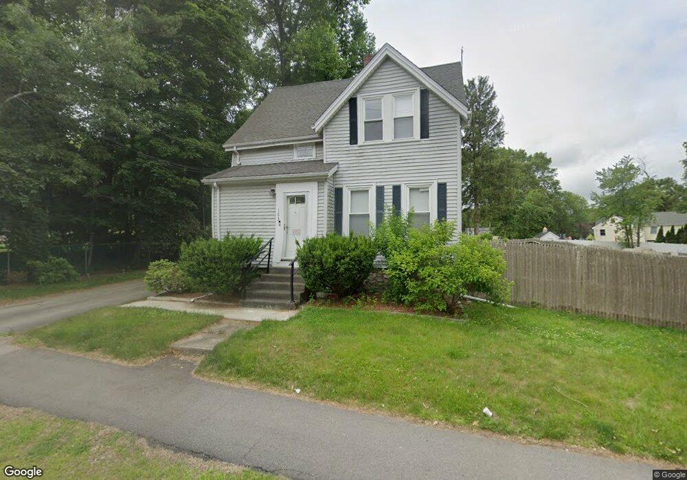
183 High Plain St (Rte 27) Walpole, MA 02081
Estimated Value: $678,000 - $729,000
3
Beds
1
Bath
1,321
Sq Ft
$529/Sq Ft
Est. Value
About This Home
This home is located at 183 High Plain St (Rte 27), Walpole, MA 02081 and is currently estimated at $699,086, approximately $529 per square foot. 183 High Plain St (Rte 27) is a home located in Norfolk County with nearby schools including Old Post Road School, Walpole Middle School, and Walpole High School.
Ownership History
Date
Name
Owned For
Owner Type
Purchase Details
Closed on
Dec 22, 2021
Sold by
Redfinnow Borrower Llc
Bought by
Mui King and Chac Annie
Current Estimated Value
Home Financials for this Owner
Home Financials are based on the most recent Mortgage that was taken out on this home.
Original Mortgage
$517,500
Outstanding Balance
$474,133
Interest Rate
2.98%
Mortgage Type
Purchase Money Mortgage
Estimated Equity
$224,953
Purchase Details
Closed on
Aug 24, 2021
Sold by
Debenedictis Dante and Debenedictis Nicolle M
Bought by
Redfinnow Borrower Llc
Purchase Details
Closed on
Aug 28, 2015
Sold by
Burkhart Thomas
Bought by
Debenedictis Dante and Stracqualursi Nicolle M
Home Financials for this Owner
Home Financials are based on the most recent Mortgage that was taken out on this home.
Original Mortgage
$369,550
Interest Rate
4.09%
Mortgage Type
New Conventional
Purchase Details
Closed on
Sep 30, 2013
Sold by
Ocorcora Eoin and Carmichael Julie
Bought by
Burkhart Thomas
Home Financials for this Owner
Home Financials are based on the most recent Mortgage that was taken out on this home.
Original Mortgage
$256,500
Interest Rate
4.42%
Mortgage Type
New Conventional
Purchase Details
Closed on
Jan 29, 2003
Sold by
Hayes Lisa A and Hayes William G
Bought by
Carmicahel Julie and Oorcora Eoin
Home Financials for this Owner
Home Financials are based on the most recent Mortgage that was taken out on this home.
Original Mortgage
$205,500
Interest Rate
6.09%
Mortgage Type
Purchase Money Mortgage
Purchase Details
Closed on
Sep 29, 2000
Sold by
Noonan George F and Noonan Kathleen M
Bought by
Hayes William G and Hayes Lisa A
Home Financials for this Owner
Home Financials are based on the most recent Mortgage that was taken out on this home.
Original Mortgage
$183,000
Interest Rate
7.94%
Mortgage Type
Purchase Money Mortgage
Create a Home Valuation Report for This Property
The Home Valuation Report is an in-depth analysis detailing your home's value as well as a comparison with similar homes in the area
Home Values in the Area
Average Home Value in this Area
Purchase History
| Date | Buyer | Sale Price | Title Company |
|---|---|---|---|
| Mui King | $575,000 | None Available | |
| Redfinnow Borrower Llc | $534,000 | None Available | |
| Debenedictis Dante | $389,000 | -- | |
| Burkhart Thomas | $285,000 | -- | |
| Burkhart Thomas | $285,000 | -- | |
| Carmicahel Julie | $265,000 | -- | |
| Carmicahel Julie | $265,000 | -- | |
| Hayes William G | $188,500 | -- |
Source: Public Records
Mortgage History
| Date | Status | Borrower | Loan Amount |
|---|---|---|---|
| Open | Mui King | $517,500 | |
| Previous Owner | Debenedictis Dante | $369,550 | |
| Previous Owner | Burkhart Thomas | $256,500 | |
| Previous Owner | Hayes William G | $225,000 | |
| Previous Owner | Carmicahel Julie | $205,500 | |
| Previous Owner | Hayes William G | $183,000 |
Source: Public Records
Tax History Compared to Growth
Tax History
| Year | Tax Paid | Tax Assessment Tax Assessment Total Assessment is a certain percentage of the fair market value that is determined by local assessors to be the total taxable value of land and additions on the property. | Land | Improvement |
|---|---|---|---|---|
| 2025 | $6,728 | $524,400 | $275,100 | $249,300 |
| 2024 | $6,535 | $494,300 | $264,500 | $229,800 |
| 2023 | $6,376 | $459,000 | $230,000 | $229,000 |
| 2022 | $5,999 | $414,900 | $213,000 | $201,900 |
| 2021 | $5,713 | $385,000 | $201,000 | $184,000 |
| 2020 | $5,602 | $373,700 | $179,600 | $194,100 |
| 2019 | $5,335 | $353,300 | $172,700 | $180,600 |
| 2018 | $4,818 | $315,500 | $157,100 | $158,400 |
| 2017 | $4,654 | $303,600 | $151,000 | $152,600 |
| 2016 | $4,172 | $268,100 | $153,700 | $114,400 |
| 2015 | $3,787 | $241,200 | $130,000 | $111,200 |
| 2014 | $3,521 | $223,400 | $130,000 | $93,400 |
Source: Public Records
Map
Nearby Homes
- 2 Alexandra Way
- 52 Baker St
- 8 Rainbow Pond Dr Unit 8
- 486 Washington St
- 1 Palace Ct
- 4403 Pennington Dr Unit 4403
- 363 - 367 Washington St
- 2213 Pennington Dr Unit 2213
- 270 Moosehill Rd
- 305 Centre Ln
- 103 Centre Ln
- 7 Washington Green
- 224 School St Unit 10
- 11 Park Ln
- 1156 Washington St
- 634 Main St Unit 14
- 21 Spear Ave
- Unit 11 Powder House Ln Unit 11
- 8 Powder House Ln Unit 2
- Unit 12 Powder House Ln Unit 12
- 183 High Plain St
- 180 High Plain St
- 173 High Plain St
- 184 High Plain St
- 174 High Plain St
- 17 Highland St
- 684 Washington St Unit 3
- 680 Washington St Unit 3
- 688 Washington St Unit 4
- 680 Washington St Unit 1
- 680 Washington St
- 686 Washington St Unit 3
- 688 Washington St
- 686 Washington St Unit 4
- 686 Washington St
- 200 High Plain St
- 8 Holland Way
- 640 Washington St
- 199 High Plain St
- 22 Highland St