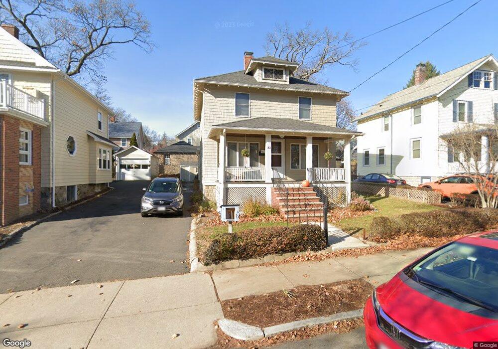
183 Highland Ave Arlington, MA 02476
Arlington Center NeighborhoodEstimated Value: $1,208,000 - $1,518,000
3
Beds
2
Baths
2,711
Sq Ft
$489/Sq Ft
Est. Value
About This Home
This home is located at 183 Highland Ave, Arlington, MA 02476 and is currently estimated at $1,325,893, approximately $489 per square foot. 183 Highland Ave is a home located in Middlesex County with nearby schools including Brackett Elementary School, Ottoson Middle School, and Arlington High School.
Ownership History
Date
Name
Owned For
Owner Type
Purchase Details
Closed on
Nov 25, 2024
Sold by
Kamya Hugo A and Lewis Norah W
Bought by
Kamya-Lewis Ft and Kamya
Current Estimated Value
Purchase Details
Closed on
Jan 21, 1994
Sold by
Dooley Clarence W and Dooley Margaret B
Bought by
Kamya Hugo A and Lewis Norah W
Create a Home Valuation Report for This Property
The Home Valuation Report is an in-depth analysis detailing your home's value as well as a comparison with similar homes in the area
Home Values in the Area
Average Home Value in this Area
Purchase History
| Date | Buyer | Sale Price | Title Company |
|---|---|---|---|
| Kamya-Lewis Ft | -- | None Available | |
| Kamya-Lewis Ft | -- | None Available | |
| Kamya Hugo A | $205,000 | -- | |
| Kamya Hugo A | $205,000 | -- |
Source: Public Records
Mortgage History
| Date | Status | Borrower | Loan Amount |
|---|---|---|---|
| Previous Owner | Kamya Hugo A | $24,500 | |
| Previous Owner | Kamya Hugo A | $20,000 |
Source: Public Records
Tax History Compared to Growth
Tax History
| Year | Tax Paid | Tax Assessment Tax Assessment Total Assessment is a certain percentage of the fair market value that is determined by local assessors to be the total taxable value of land and additions on the property. | Land | Improvement |
|---|---|---|---|---|
| 2025 | $10,815 | $1,004,200 | $456,800 | $547,400 |
| 2024 | $10,230 | $966,000 | $451,200 | $514,800 |
| 2023 | $9,837 | $877,500 | $406,700 | $470,800 |
| 2022 | $9,319 | $816,000 | $390,000 | $426,000 |
| 2021 | $9,104 | $802,800 | $390,000 | $412,800 |
| 2020 | $8,878 | $802,700 | $389,900 | $412,800 |
| 2019 | $7,975 | $708,300 | $395,500 | $312,800 |
| 2018 | $7,375 | $608,000 | $295,200 | $312,800 |
| 2017 | $7,287 | $580,200 | $267,400 | $312,800 |
| 2016 | $7,284 | $569,100 | $256,300 | $312,800 |
| 2015 | $7,077 | $522,300 | $217,300 | $305,000 |
Source: Public Records
Map
Nearby Homes
- 39 Newport St
- 53 Highland Ave
- 10 Plymouth St Unit 10
- 789 Concord Turnpike
- 37 Fountain Rd Unit 2
- 37 Fountain Rd
- 36 Churchill Ave Unit 1
- 995 Massachusetts Ave Unit 404
- 975 Mass Ave Unit 106
- 204 Plan at Majestic Mill Brook
- 1025 Massachusetts Ave Unit 404
- 1025 Massachusetts Ave Unit 506
- 1025 Massachusetts Ave Unit 401
- 1025 Massachusetts Ave Unit 210
- 1025 Massachusetts Ave Unit 402
- 1025 Massachusetts Ave Unit 308
- 1025 Massachusetts Ave Unit 411
- 1025 Massachusetts Ave Unit 313
- 1025 Massachusetts Ave Unit 304
- 1025 Massachusetts Ave Unit 414
- 179 Highland Ave
- 187 Highland Ave
- 175 Highland Ave
- 191 Highland Ave
- 198 Highland Ave
- 204 Highland Ave
- 138 Newport St
- 142 Newport St
- 3 Ottawa Rd
- 146 Newport St
- 202 Highland Ave
- 134 Newport St
- 171 Highland Ave
- 150 Newport St
- 130 Newport St
- 186 Highland Ave
- 206 Highland Ave
- 9 Ottawa Rd
- 11 Ottawa Rd
- 126 Newport St