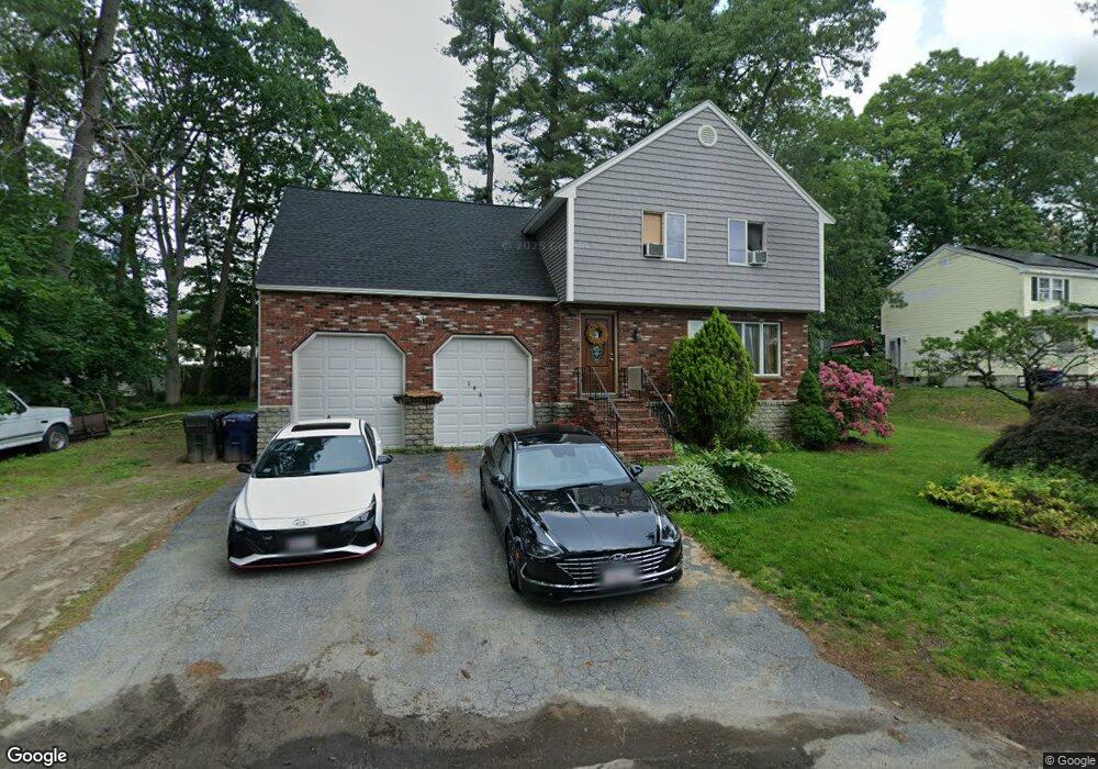
183 Long Pond Dr Dracut, MA 01826
Estimated Value: $555,000 - $575,000
4
Beds
2
Baths
1,704
Sq Ft
$332/Sq Ft
Est. Value
About This Home
This home is located at 183 Long Pond Dr, Dracut, MA 01826 and is currently estimated at $565,310, approximately $331 per square foot. 183 Long Pond Dr is a home located in Middlesex County with nearby schools including Brookside Elementary School, Richardson Middle School, and Dracut Senior High School.
Ownership History
Date
Name
Owned For
Owner Type
Purchase Details
Closed on
Mar 8, 2017
Sold by
Robertson Stanley W and Robertson Janet L
Bought by
Robertson Ft
Current Estimated Value
Purchase Details
Closed on
May 10, 2010
Sold by
Marchand Robert A and Marchand Judith A
Bought by
Robertson Stanley W and Robertson Janet L
Home Financials for this Owner
Home Financials are based on the most recent Mortgage that was taken out on this home.
Original Mortgage
$168,000
Interest Rate
5.03%
Mortgage Type
Purchase Money Mortgage
Purchase Details
Closed on
Oct 15, 1998
Sold by
Reyes Aida E
Bought by
Trabucco Jason E and Trabucco Roseann M
Home Financials for this Owner
Home Financials are based on the most recent Mortgage that was taken out on this home.
Original Mortgage
$136,800
Interest Rate
6.68%
Create a Home Valuation Report for This Property
The Home Valuation Report is an in-depth analysis detailing your home's value as well as a comparison with similar homes in the area
Home Values in the Area
Average Home Value in this Area
Purchase History
| Date | Buyer | Sale Price | Title Company |
|---|---|---|---|
| Robertson Ft | -- | -- | |
| Robertson Stanley W | $210,000 | -- | |
| Trabucco Jason E | $168,000 | -- |
Source: Public Records
Mortgage History
| Date | Status | Borrower | Loan Amount |
|---|---|---|---|
| Previous Owner | Robertson Stanley W | $168,000 | |
| Previous Owner | Trabucco Jason E | $233,750 | |
| Previous Owner | Trabucco Jason E | $136,800 | |
| Previous Owner | Trabucco Jason E | $130,000 | |
| Previous Owner | Trabucco Jason E | $14,800 |
Source: Public Records
Tax History
| Year | Tax Paid | Tax Assessment Tax Assessment Total Assessment is a certain percentage of the fair market value that is determined by local assessors to be the total taxable value of land and additions on the property. | Land | Improvement |
|---|---|---|---|---|
| 2025 | $4,623 | $456,800 | $193,000 | $263,800 |
| 2024 | $4,460 | $426,800 | $183,700 | $243,100 |
| 2023 | $4,317 | $372,800 | $159,700 | $213,100 |
| 2022 | $4,192 | $341,100 | $145,200 | $195,900 |
| 2021 | $4,045 | $310,900 | $132,000 | $178,900 |
| 2020 | $4,090 | $306,400 | $128,200 | $178,200 |
| 2019 | $3,956 | $287,700 | $122,100 | $165,600 |
| 2018 | $3,966 | $280,500 | $122,100 | $158,400 |
| 2017 | $3,943 | $280,500 | $122,100 | $158,400 |
| 2016 | $3,838 | $258,600 | $117,400 | $141,200 |
| 2015 | $3,819 | $255,800 | $117,400 | $138,400 |
| 2014 | $3,576 | $246,800 | $117,400 | $129,400 |
Source: Public Records
Map
Nearby Homes
- 17 Spare St
- 43 & 53 5th St
- 29 Mill St Unit B
- 70 Faith Ave
- 1905 Lakeview Ave
- 13 Dallas Dr Unit 305
- 13 Dallas Dr Unit 107
- 124 Tennis Plaza Rd Unit 40
- 1 Elm Grove Ave
- 12 Lands-End Rd
- 53 Vinal St
- 94 Tennis Plaza Rd Unit 10
- 74 Tennis Plaza Rd Unit 34
- 9 Arbor Dr
- 83 Turgeon Ave
- 9 Cornstalk Ln
- 104 Long Pond Rd
- 4 Mascuppic Trail
- 154 New Boston Rd
- 91 Frederick St Unit 77
- 173 Long Pond Dr
- 68 Valley Rd
- 5 Overlook Terrace
- 62 Valley Rd
- 11 Overlook Terrace
- 184 Long Pond Dr
- 188 Long Pond Dr
- 188 Long Pond Dr
- 60 Valley Rd
- 178 Long Pond Dr
- 163 Long Pond Dr
- 163 Long Pond Dr Unit 163
- 163 Long Pond Dr
- 165 Long Pond Dr
- 165 Long Pond Dr Unit 165
- 200 Long Pond Dr
- 56 Valley Rd
- 2 Overlook Terrace
- 63 Valley Rd
- 48 Valley Rd
Your Personal Tour Guide
Ask me questions while you tour the home.