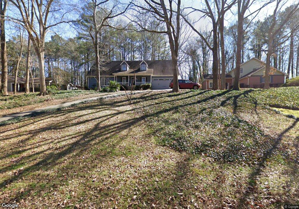
183 Newport Rd SW Lilburn, GA 30047
Estimated Value: $353,000 - $433,000
4
Beds
3
Baths
1,693
Sq Ft
$225/Sq Ft
Est. Value
About This Home
This home is located at 183 Newport Rd SW, Lilburn, GA 30047 and is currently estimated at $381,658, approximately $225 per square foot. 183 Newport Rd SW is a home located in Gwinnett County with nearby schools including Knight Elementary School, Trickum Middle School, and Parkview High School.
Ownership History
Date
Name
Owned For
Owner Type
Purchase Details
Closed on
Jun 24, 2004
Sold by
Scott Michael A
Bought by
Scott Michael A
Current Estimated Value
Home Financials for this Owner
Home Financials are based on the most recent Mortgage that was taken out on this home.
Original Mortgage
$147,900
Outstanding Balance
$69,344
Interest Rate
5.5%
Mortgage Type
New Conventional
Estimated Equity
$312,314
Purchase Details
Closed on
Jun 25, 1993
Sold by
Engineers C R S Sirrine
Bought by
Himalstein Bernice C
Create a Home Valuation Report for This Property
The Home Valuation Report is an in-depth analysis detailing your home's value as well as a comparison with similar homes in the area
Home Values in the Area
Average Home Value in this Area
Purchase History
| Date | Buyer | Sale Price | Title Company |
|---|---|---|---|
| Scott Michael A | $184,900 | -- | |
| Scott Michael A | $184,900 | -- | |
| Himalstein Bernice C | $120,000 | -- |
Source: Public Records
Mortgage History
| Date | Status | Borrower | Loan Amount |
|---|---|---|---|
| Open | Scott Michael A | $147,900 | |
| Closed | Scott Michael A | $36,950 |
Source: Public Records
Tax History Compared to Growth
Tax History
| Year | Tax Paid | Tax Assessment Tax Assessment Total Assessment is a certain percentage of the fair market value that is determined by local assessors to be the total taxable value of land and additions on the property. | Land | Improvement |
|---|---|---|---|---|
| 2025 | $3,003 | $114,760 | $30,000 | $84,760 |
| 2024 | $2,558 | $87,280 | $30,000 | $57,280 |
| 2023 | $2,558 | $103,880 | $24,800 | $79,080 |
| 2022 | $2,899 | $103,880 | $24,800 | $79,080 |
| 2021 | $2,461 | $80,040 | $19,600 | $60,440 |
| 2020 | $3,006 | $80,040 | $19,600 | $60,440 |
| 2019 | $2,825 | $73,480 | $19,600 | $53,880 |
| 2018 | $2,587 | $66,680 | $16,800 | $49,880 |
| 2016 | $1,962 | $50,000 | $12,400 | $37,600 |
| 2015 | $2,310 | $58,680 | $10,400 | $48,280 |
| 2014 | -- | $58,680 | $10,400 | $48,280 |
Source: Public Records
Map
Nearby Homes
- 4627 Nantucket Dr SW
- 4740 Nantucket Dr SW
- 146 King David Dr SW
- The Tyndall Plan at Annsbury Park
- The Maisie II Plan at Annsbury Park
- The Sadler Plan at Annsbury Park
- The Talbot Plan at Annsbury Park
- The Idlewild Plan at Annsbury Park
- 4151 Tillrock Ln
- 4171 Tillrock Ln
- 4191 Tillrock Ln
- 4131 Tillrock Ln
- 4160 Tillrock Ln
- 4181 Tillrock Ln
- 4909 Woodfall Dr SW
- 147 Railroad Ave NW
- Oxford Plan at The Preserve at Killian Hill - Townhomes
- 217 Sandra Dr NW Unit 4
- 4879 Joy Ln SW
- 4989 Woodfall Dr SW
- 173 Newport Rd SW
- 193 Newport Rd SW
- 0 Newport Rd SW Unit 7018445
- 0 Newport Rd SW Unit 8849986
- 0 Newport Rd SW Unit 8458348
- 0 Newport Rd SW Unit 8431090
- 0 Newport Rd SW Unit 8156825
- 0 Newport Rd SW Unit 7040111
- 0 Newport Rd SW Unit 3230521
- 0 Newport Rd SW Unit 3173523
- 203 Newport Rd SW
- 163 Newport Rd SW
- 4577 Nantucket Dr SW
- 4587 Nantucket Dr SW
- 4567 Nantucket Dr SW
- 253 Newport Rd SW
- 153 Newport Rd SW
- 153 Newport Rd SW
- 4557 Nantucket Dr SW
- 194 Newport Rd SW