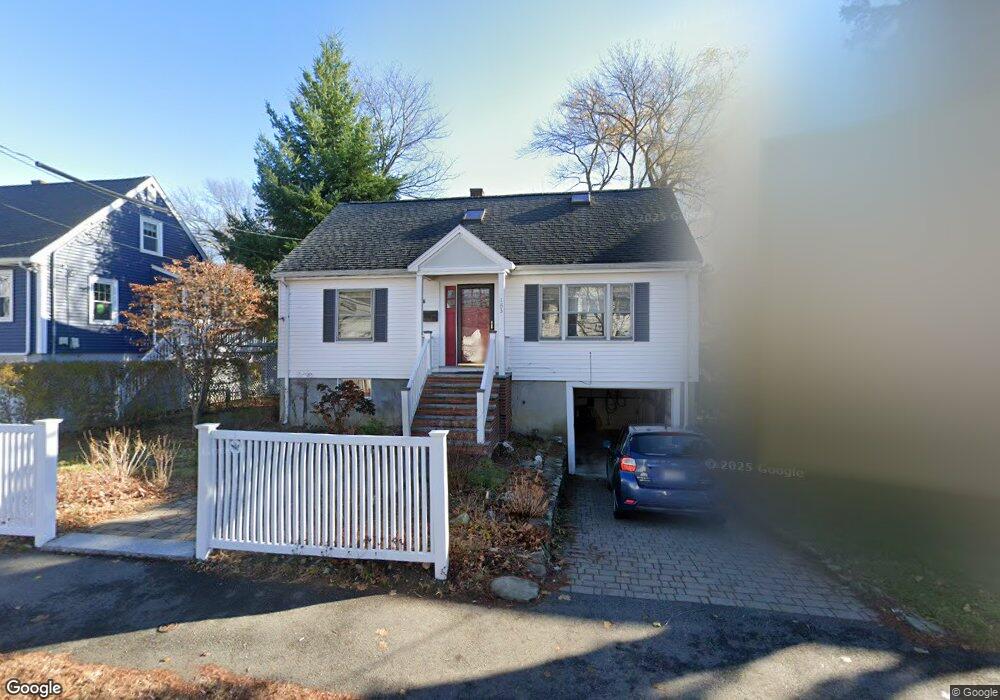
183 Overlook Rd Arlington, MA 02474
Arlington Heights NeighborhoodEstimated Value: $1,016,000 - $1,262,860
3
Beds
2
Baths
1,680
Sq Ft
$680/Sq Ft
Est. Value
About This Home
This home is located at 183 Overlook Rd, Arlington, MA 02474 and is currently estimated at $1,142,965, approximately $680 per square foot. 183 Overlook Rd is a home located in Middlesex County with nearby schools including M. Norcross Stratton Elementary School, Ottoson Middle School, and Arlington High School.
Ownership History
Date
Name
Owned For
Owner Type
Purchase Details
Closed on
Jun 28, 2021
Sold by
Mcmanus John and Golden Andrea M
Bought by
M Golden Family 2021 Ret and Mcmanus
Current Estimated Value
Purchase Details
Closed on
May 31, 1991
Sold by
Etkin Donald J and Etkin Dagmar S
Bought by
Mcmanus John and Golden Andrea M
Home Financials for this Owner
Home Financials are based on the most recent Mortgage that was taken out on this home.
Original Mortgage
$154,600
Interest Rate
9.35%
Mortgage Type
Purchase Money Mortgage
Purchase Details
Closed on
Sep 1, 1988
Sold by
Leonard William M
Bought by
Etkin Donald J
Home Financials for this Owner
Home Financials are based on the most recent Mortgage that was taken out on this home.
Original Mortgage
$95,000
Interest Rate
10.38%
Mortgage Type
Purchase Money Mortgage
Create a Home Valuation Report for This Property
The Home Valuation Report is an in-depth analysis detailing your home's value as well as a comparison with similar homes in the area
Home Values in the Area
Average Home Value in this Area
Purchase History
| Date | Buyer | Sale Price | Title Company |
|---|---|---|---|
| M Golden Family 2021 Ret | -- | None Available | |
| Mcmanus John | $182,000 | -- | |
| Etkin Donald J | $210,000 | -- |
Source: Public Records
Mortgage History
| Date | Status | Borrower | Loan Amount |
|---|---|---|---|
| Previous Owner | Etkin Donald J | $151,400 | |
| Previous Owner | Etkin Donald J | $152,000 | |
| Previous Owner | Etkin Donald J | $154,600 | |
| Previous Owner | Etkin Donald J | $95,000 |
Source: Public Records
Tax History
| Year | Tax Paid | Tax Assessment Tax Assessment Total Assessment is a certain percentage of the fair market value that is determined by local assessors to be the total taxable value of land and additions on the property. | Land | Improvement |
|---|---|---|---|---|
| 2025 | $11,214 | $1,041,200 | $506,800 | $534,400 |
| 2024 | $10,356 | $977,900 | $500,600 | $477,300 |
| 2023 | $9,589 | $855,400 | $451,100 | $404,300 |
| 2022 | $9,347 | $818,500 | $432,600 | $385,900 |
| 2021 | $9,133 | $805,400 | $432,600 | $372,800 |
| 2020 | $8,908 | $805,400 | $432,600 | $372,800 |
| 2019 | $8,303 | $737,400 | $438,800 | $298,600 |
| 2018 | $7,595 | $626,100 | $327,500 | $298,600 |
| 2017 | $7,476 | $595,200 | $296,600 | $298,600 |
| 2016 | $7,461 | $582,900 | $284,300 | $298,600 |
| 2015 | $7,001 | $516,700 | $241,000 | $275,700 |
Source: Public Records
Map
Nearby Homes
- 33 Dickson Ave
- 92 Overlook Rd
- 455-457 Summer St
- 455 Summer St Unit 455
- 66 Hutchinson Rd
- 10 Trinity Rd
- 7 Trinity Rd
- 4 Beck Rd
- 39 Forest St Unit 39A
- 12 Elwern Rd
- 10 Viking Rd
- 52-56 Dudley St
- 11 Lowell St Unit B
- 37 Mayflower Rd
- 1 Watermill Place Unit 212
- 58 Alpine St
- 15 Higgins St Unit 17
- 17 Oakledge St
- 15 College Ave
- 1025 Massachusetts Ave Unit 204
- 187 Overlook Rd
- 179 Overlook Rd
- 182 Overlook Rd
- 186 Overlook Rd
- 191 Overlook Rd
- 175 Overlook Rd
- 178 Overlook Rd
- 190 Overlook Rd
- 24 Teresa Cir
- 174 Overlook Rd
- 32 Teresa Cir
- 195 Overlook Rd
- 194 Overlook Rd
- 12 Dickson Ave
- 11 Hiawatha Ln
- 7 Hiawatha Ln
- 15 Hiawatha Ln
- 16 Dickson Ave
- 20 Teresa Cir
- 198 Overlook Rd
Your Personal Tour Guide
Ask me questions while you tour the home.