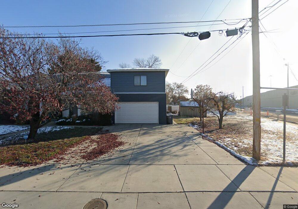
183 S 300 W American Fork, UT 84003
Estimated Value: $566,000 - $677,719
6
Beds
2
Baths
2,824
Sq Ft
$220/Sq Ft
Est. Value
About This Home
This home is located at 183 S 300 W, American Fork, UT 84003 and is currently estimated at $622,180, approximately $220 per square foot. 183 S 300 W is a home located in Utah County with nearby schools including Greenwood Elementary School, American Fork Junior High School, and American Fork High School.
Ownership History
Date
Name
Owned For
Owner Type
Purchase Details
Closed on
Nov 7, 2024
Sold by
Howell Angela
Bought by
American Fork City
Current Estimated Value
Purchase Details
Closed on
Oct 30, 2024
Sold by
Howell Austin W and Howell Angela Keller
Bought by
American Fork City
Purchase Details
Closed on
Jun 5, 2014
Sold by
Baum Nicholas D
Bought by
Buchanan F Neal and Buchanan Rachel
Home Financials for this Owner
Home Financials are based on the most recent Mortgage that was taken out on this home.
Original Mortgage
$225,150
Interest Rate
4.27%
Mortgage Type
New Conventional
Purchase Details
Closed on
Apr 2, 2007
Sold by
Baum Nicholas D
Bought by
Baum Nicholas D
Home Financials for this Owner
Home Financials are based on the most recent Mortgage that was taken out on this home.
Original Mortgage
$182,000
Interest Rate
6.12%
Mortgage Type
New Conventional
Purchase Details
Closed on
Mar 16, 2007
Sold by
Baum Nicholas D
Bought by
Baum Nicholas D
Home Financials for this Owner
Home Financials are based on the most recent Mortgage that was taken out on this home.
Original Mortgage
$182,000
Interest Rate
6.12%
Mortgage Type
New Conventional
Purchase Details
Closed on
Jan 31, 2007
Sold by
Wood Marion J
Bought by
Baum Nicholas D
Purchase Details
Closed on
Apr 26, 2005
Sold by
Leifson Frank V
Bought by
Wood Marion J and Baum Nicholas D
Purchase Details
Closed on
Jul 15, 2004
Sold by
Boyle Donald A and Boyle Ann P
Bought by
Leifson Frank
Home Financials for this Owner
Home Financials are based on the most recent Mortgage that was taken out on this home.
Original Mortgage
$146,000
Interest Rate
6.27%
Mortgage Type
Purchase Money Mortgage
Create a Home Valuation Report for This Property
The Home Valuation Report is an in-depth analysis detailing your home's value as well as a comparison with similar homes in the area
Home Values in the Area
Average Home Value in this Area
Purchase History
| Date | Buyer | Sale Price | Title Company |
|---|---|---|---|
| American Fork City | -- | Prospect Title | |
| American Fork City | -- | Prospect Title | |
| Buchanan F Neal | -- | Keystone Title Ins Agen | |
| Baum Nicholas D | -- | Affiliated First Title Comp | |
| Baum Nicholas D | -- | Affiliated First Title Comp | |
| Baum Nicholas D | -- | Action Title Company Inc | |
| Wood Marion J | -- | Affiliated First Title Comp | |
| Leifson Frank | -- | First American Title Agency |
Source: Public Records
Mortgage History
| Date | Status | Borrower | Loan Amount |
|---|---|---|---|
| Previous Owner | Buchanan F Neal | $225,150 | |
| Previous Owner | Baum Nicholas D | $182,000 | |
| Previous Owner | Leifson Frank | $146,000 |
Source: Public Records
Tax History Compared to Growth
Tax History
| Year | Tax Paid | Tax Assessment Tax Assessment Total Assessment is a certain percentage of the fair market value that is determined by local assessors to be the total taxable value of land and additions on the property. | Land | Improvement |
|---|---|---|---|---|
| 2025 | $2,506 | $0 | $0 | $0 |
| 2024 | $2,506 | $278,410 | $0 | $0 |
| 2023 | $2,320 | $273,240 | $0 | $0 |
| 2022 | $2,448 | $284,570 | $0 | $0 |
| 2021 | $2,098 | $380,900 | $154,300 | $226,600 |
| 2020 | $1,963 | $345,700 | $137,800 | $207,900 |
| 2019 | $1,790 | $326,100 | $118,200 | $207,900 |
| 2018 | $1,649 | $287,100 | $106,300 | $180,800 |
| 2017 | $1,544 | $145,145 | $0 | $0 |
| 2016 | $1,355 | $118,360 | $0 | $0 |
| 2015 | $1,411 | $116,930 | $0 | $0 |
| 2014 | $1,283 | $104,885 | $0 | $0 |
Source: Public Records
Map
Nearby Homes
- 351 Washington Ave
- 82 S Lincoln Ave
- 55 S 200 W
- 271 S Barratt Cir
- 55 Roosevelt Ave
- 217 W Main St
- 382 W 330 S
- 120 N 350 W Unit 127
- 120 N 350 W Unit 133
- 120 N 350 W Unit 130
- 365 W 370 S
- 316 W 390 S
- 129 W Pacific Dr
- 195 S Center St
- Evergreen Plan at Storrs Court
- Juniper Plan at Storrs Court
- Redwood Plan at Storrs Court
- Ashwood Plan at Storrs Court
- 105 N 100 W
- 429 S Storrs Ave
- 163 S 300 W
- 153 S 300 W
- 174 S 270 West Cir Unit 101
- 174 S 270 West Cir
- 143 S 300 W
- 162 S 270 West Cir Unit 102
- 162 S 270 West Cir
- 162 S 300 W
- 179 S 270 West Cir Unit 109
- 179 S 270 West Cir
- 284 W 200 S
- 144 S 300 W
- 146 S 300 W
- 158 S 270 West Cir Unit 103
- 158 S 270 West Cir
- 157 S 270 West Cir Unit 108
- 157 S 270 West Cir
- 254 W 200 S
- 135 S 300 W
- 146 S 270 West Cir