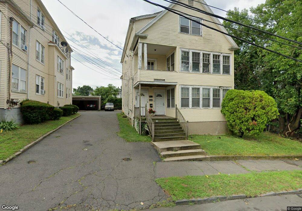
183 Whittier St Unit 1ST F Bridgeport, CT 06605
Black Rock NeighborhoodEstimated Value: $605,000 - $785,000
2
Beds
1
Bath
1,000
Sq Ft
$692/Sq Ft
Est. Value
About This Home
This home is located at 183 Whittier St Unit 1ST F, Bridgeport, CT 06605 and is currently estimated at $692,000, approximately $692 per square foot. 183 Whittier St Unit 1ST F is a home located in Fairfield County with nearby schools including Bassick High School, Great Oaks Charter School Bridgeport, and St. Ann Campus - Catholic Academy of Bridgeport.
Ownership History
Date
Name
Owned For
Owner Type
Purchase Details
Closed on
Jan 30, 2013
Sold by
Griffin Eric
Bought by
Shore Winds Llc
Current Estimated Value
Purchase Details
Closed on
Jul 16, 1999
Sold by
Ocwen Fed Bk Fsb
Bought by
Griffin Eric
Home Financials for this Owner
Home Financials are based on the most recent Mortgage that was taken out on this home.
Original Mortgage
$40,500
Interest Rate
7.39%
Create a Home Valuation Report for This Property
The Home Valuation Report is an in-depth analysis detailing your home's value as well as a comparison with similar homes in the area
Home Values in the Area
Average Home Value in this Area
Purchase History
| Date | Buyer | Sale Price | Title Company |
|---|---|---|---|
| Shore Winds Llc | -- | -- | |
| Shore Winds Llc | -- | -- | |
| Griffin Eric | $45,000 | -- | |
| Griffin Eric | $45,000 | -- |
Source: Public Records
Mortgage History
| Date | Status | Borrower | Loan Amount |
|---|---|---|---|
| Previous Owner | Griffin Eric | $40,500 |
Source: Public Records
Tax History Compared to Growth
Tax History
| Year | Tax Paid | Tax Assessment Tax Assessment Total Assessment is a certain percentage of the fair market value that is determined by local assessors to be the total taxable value of land and additions on the property. | Land | Improvement |
|---|---|---|---|---|
| 2025 | $9,948 | $228,950 | $77,910 | $151,040 |
| 2024 | $9,948 | $228,950 | $77,910 | $151,040 |
| 2023 | $9,948 | $228,950 | $77,910 | $151,040 |
| 2022 | $9,948 | $228,950 | $77,910 | $151,040 |
| 2021 | $9,948 | $228,950 | $77,910 | $151,040 |
| 2020 | $8,558 | $158,510 | $33,440 | $125,070 |
| 2019 | $8,558 | $158,510 | $33,440 | $125,070 |
| 2018 | $8,618 | $158,510 | $33,440 | $125,070 |
| 2017 | $8,618 | $158,510 | $33,440 | $125,070 |
| 2016 | $8,618 | $158,510 | $33,440 | $125,070 |
| 2015 | $7,935 | $188,040 | $21,420 | $166,620 |
| 2014 | $7,935 | $188,040 | $21,420 | $166,620 |
Source: Public Records
Map
Nearby Homes
- 135 Whittier St
- 82 Waldorf Ave
- 144 Whittier St
- 31 Whittier St
- 25 Whittier St
- 167 Scofield Ave
- 105 Scofield Ave
- 185 Shell St
- 166 Alfred St
- 51 Princeton St
- 95 Bedford Ave
- 118 Berwick Ave
- 2773 Fairfield Ave Unit 3
- 37 Rowsley St Unit 6
- 130 Brentwood Ave
- 222 Ellsworth St
- 855 Brewster St Unit 857
- 26 Rowsley St Unit 3
- 20 Haddon St Unit 5
- 145 Brentwood Ave
- 183 Whittier St
- 764 Ellsworth St
- 764 Ellsworth St Unit 3
- 766 Ellsworth St
- 756 Ellsworth St
- 180 Whittier St
- 784 Ellsworth St
- 173 Whittier St
- 740 Ellsworth St Unit A
- 740 Ellsworth St Unit A8
- 740 Ellsworth St Unit c3
- 740 Ellsworth St Unit 2ND FLR
- 740 Ellsworth St Unit A2
- 740 Ellsworth St Unit C4
- 740 Ellsworth St Unit c7
- 740 Ellsworth St Unit a6
- 740 Ellsworth St
- 800 Ellsworth St
- 165 Whittier St
- 816 Ellsworth St Unit 820