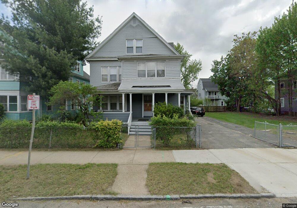
183 Wilbraham Rd Springfield, MA 01109
Upper Hill NeighborhoodEstimated Value: $294,268 - $419,000
6
Beds
3
Baths
3,616
Sq Ft
$94/Sq Ft
Est. Value
About This Home
This home is located at 183 Wilbraham Rd, Springfield, MA 01109 and is currently estimated at $339,317, approximately $93 per square foot. 183 Wilbraham Rd is a home located in Hampden County with nearby schools including Mary M. Walsh Elementary School, M Marcus Kiley Middle, and Springfield High School of Science and Technology.
Ownership History
Date
Name
Owned For
Owner Type
Purchase Details
Closed on
Aug 17, 2010
Sold by
Atkinson Henry and Atkinson Beverly
Bought by
Atkinson Tricia and Atkinson Henry
Current Estimated Value
Purchase Details
Closed on
Jan 17, 1990
Sold by
Sternowski James W
Bought by
Atkinson Henry
Purchase Details
Closed on
Sep 13, 1988
Sold by
Investment Enterpr
Bought by
Basile Ferdinando C
Create a Home Valuation Report for This Property
The Home Valuation Report is an in-depth analysis detailing your home's value as well as a comparison with similar homes in the area
Home Values in the Area
Average Home Value in this Area
Purchase History
| Date | Buyer | Sale Price | Title Company |
|---|---|---|---|
| Atkinson Tricia | -- | -- | |
| Atkinson Tricia | -- | -- | |
| Atkinson Henry | $100,000 | -- | |
| Atkinson Henry | $100,000 | -- | |
| Basile Ferdinando C | $120,000 | -- |
Source: Public Records
Mortgage History
| Date | Status | Borrower | Loan Amount |
|---|---|---|---|
| Previous Owner | Basile Ferdinando C | $94,500 | |
| Previous Owner | Basile Ferdinando C | $94,500 | |
| Previous Owner | Basile Ferdinando C | $100,000 |
Source: Public Records
Tax History
| Year | Tax Paid | Tax Assessment Tax Assessment Total Assessment is a certain percentage of the fair market value that is determined by local assessors to be the total taxable value of land and additions on the property. | Land | Improvement |
|---|---|---|---|---|
| 2025 | $3,326 | $212,100 | $30,500 | $181,600 |
| 2024 | $3,406 | $212,100 | $30,500 | $181,600 |
| 2023 | $2,985 | $175,100 | $27,800 | $147,300 |
| 2022 | $3,574 | $189,900 | $25,900 | $164,000 |
| 2021 | $2,894 | $153,100 | $18,400 | $134,700 |
| 2020 | $2,992 | $153,200 | $18,400 | $134,800 |
| 2019 | $2,615 | $132,900 | $15,700 | $117,200 |
| 2018 | $2,493 | $126,700 | $15,700 | $111,000 |
| 2017 | $2,459 | $125,100 | $14,700 | $110,400 |
| 2016 | $2,113 | $107,500 | $14,700 | $92,800 |
| 2015 | -- | $105,800 | $14,700 | $91,100 |
Source: Public Records
Map
Nearby Homes
- 19 Westford Ave
- 48-50 Dresden St
- 25 Dresden St
- 46 Mapledell St
- 31-33 Suffolk St
- 65 Montrose St
- 62-64 Bristol St
- 124-126 Westford Cir
- 52-56 Andrew St
- 21 Westford Cir
- 15 Kenyon St
- 89 Bristol St
- 135-137 Suffolk St
- 145 Cambridge St
- 111 Marlborough St
- 290 Quincy St
- 189 Northampton Ave
- 90 Cambridge St
- 163 Marion St
- 0 NS (24) Alden St
- 187 Wilbraham Rd
- 175 Wilbraham Rd
- 175 Wilbraham Rd Unit 2
- 5 Massachusetts Ave Unit 1
- 16 Dunmoreland St Unit 18
- 15 Massachusetts Ave
- 195 Wilbraham Rd
- 20 Dunmoreland St Unit 22
- 20-22 Dunmoreland St
- 15 Dunmoreland St
- 21 Massachusetts Ave
- 21 Massachusetts Ave Unit 1
- 201 Wilbraham Rd
- 17 Dunmoreland St
- 203 Wilbraham Rd
- 26 Dunmoreland St Unit 28
- 19 Dunmoreland St
- 25 Massachusetts Ave
- 207 Wilbraham Rd
- 21 Dunmoreland St
Your Personal Tour Guide
Ask me questions while you tour the home.