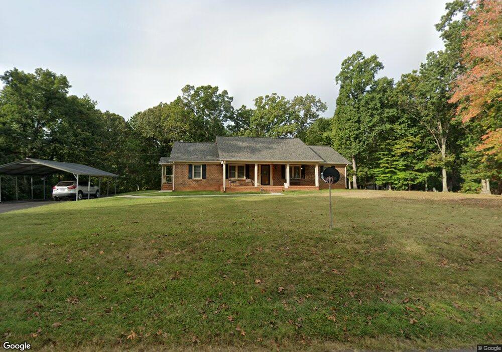
183 Woodrow Ave Monroe, VA 24574
Estimated Value: $247,000 - $302,000
3
Beds
2
Baths
1,680
Sq Ft
$167/Sq Ft
Est. Value
About This Home
This home is located at 183 Woodrow Ave, Monroe, VA 24574 and is currently estimated at $280,408, approximately $166 per square foot. 183 Woodrow Ave is a home located in Amherst County with nearby schools including Amelon Elementary School, Monelison Middle School, and Amherst County High School.
Ownership History
Date
Name
Owned For
Owner Type
Purchase Details
Closed on
Mar 21, 2016
Sold by
Robertson William Blake and Robertson Lisa Scrivener
Bought by
Ford Ford A
Current Estimated Value
Home Financials for this Owner
Home Financials are based on the most recent Mortgage that was taken out on this home.
Original Mortgage
$70,000
Outstanding Balance
$55,405
Interest Rate
3.65%
Mortgage Type
New Conventional
Estimated Equity
$225,003
Purchase Details
Closed on
Dec 14, 2015
Sold by
Robertson W Blake
Bought by
William E And Joanne M Robertson Family
Create a Home Valuation Report for This Property
The Home Valuation Report is an in-depth analysis detailing your home's value as well as a comparison with similar homes in the area
Home Values in the Area
Average Home Value in this Area
Purchase History
| Date | Buyer | Sale Price | Title Company |
|---|---|---|---|
| Ford Ford A | $105,000 | Attorney | |
| William E And Joanne M Robertson Family | -- | None Available |
Source: Public Records
Mortgage History
| Date | Status | Borrower | Loan Amount |
|---|---|---|---|
| Open | Ford Ford A | $70,000 |
Source: Public Records
Tax History Compared to Growth
Tax History
| Year | Tax Paid | Tax Assessment Tax Assessment Total Assessment is a certain percentage of the fair market value that is determined by local assessors to be the total taxable value of land and additions on the property. | Land | Improvement |
|---|---|---|---|---|
| 2025 | $996 | $163,300 | $27,900 | $135,400 |
| 2024 | $996 | $163,300 | $27,900 | $135,400 |
| 2023 | $996 | $163,300 | $27,900 | $135,400 |
| 2022 | $996 | $163,300 | $27,900 | $135,400 |
| 2021 | $996 | $163,300 | $27,900 | $135,400 |
| 2020 | $996 | $163,300 | $27,900 | $135,400 |
| 2019 | $959 | $157,200 | $33,900 | $123,300 |
| 2018 | $959 | $157,200 | $33,900 | $123,300 |
| 2017 | $959 | $157,200 | $33,900 | $123,300 |
| 2016 | $959 | $159,300 | $36,000 | $123,300 |
| 2015 | $892 | $159,300 | $36,000 | $123,300 |
| 2014 | $892 | $159,300 | $36,000 | $123,300 |
Source: Public Records
Map
Nearby Homes
- 0 McIvor Ln
- 0 S Amherst Hwy Unit 360067
- 0 S Amherst Hwy Unit 362100
- 0 S Amherst Hwy Unit 336267
- 124-138 Cedar Gate Rd
- S Amherst Hwy
- 379 Winesap Rd
- 157 Old Country Rd
- 51 Patrick Ct
- 505 Royal Gardens Ct
- 116 Winridge Dr
- 561 Oak Grove Dr
- 139 Grimes Dr
- 621 Cedar Gate Rd
- 272 Dixie Airport Rd
- 150 Glenwood Dr
- 138 Magnolia Ln
- 327 Dixie Airport Rd
- 687 Elon Rd
- 1358 S Coolwell Rd