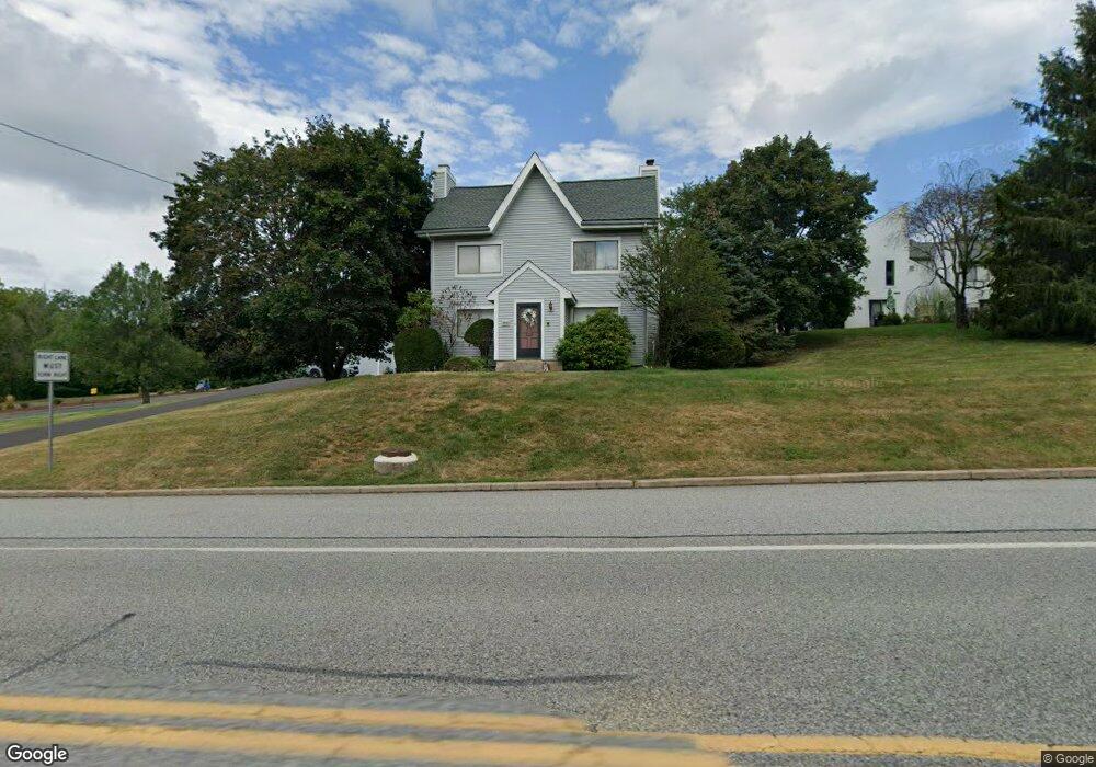
1830 Bustard Rd Unit 436 Harleysville, PA 19438
Estimated Value: $690,000 - $888,604
4
Beds
3
Baths
2,931
Sq Ft
$260/Sq Ft
Est. Value
About This Home
This home is located at 1830 Bustard Rd Unit 436, Harleysville, PA 19438 and is currently estimated at $761,651, approximately $259 per square foot. 1830 Bustard Rd Unit 436 is a home located in Montgomery County with nearby schools including General Nash El School, Pennfield Middle School, and North Penn Senior High School.
Ownership History
Date
Name
Owned For
Owner Type
Purchase Details
Closed on
Sep 15, 2020
Sold by
1900 Bustard Llc
Bought by
Damore Glenn
Current Estimated Value
Purchase Details
Closed on
Sep 10, 2018
Sold by
Ninja Properties
Bought by
1900 Bustard Llc
Home Financials for this Owner
Home Financials are based on the most recent Mortgage that was taken out on this home.
Original Mortgage
$450,000
Interest Rate
4.5%
Mortgage Type
Seller Take Back
Purchase Details
Closed on
Jun 15, 2018
Sold by
Rivers Michael
Bought by
Ninja Properties
Purchase Details
Closed on
Jan 12, 2018
Sold by
Tax Claim Bureau
Bought by
Ninja Properties
Purchase Details
Closed on
Aug 27, 2013
Sold by
Charlestown Village Ltd Partnership
Bought by
Rivers Michael
Create a Home Valuation Report for This Property
The Home Valuation Report is an in-depth analysis detailing your home's value as well as a comparison with similar homes in the area
Home Values in the Area
Average Home Value in this Area
Purchase History
| Date | Buyer | Sale Price | Title Company |
|---|---|---|---|
| Damore Glenn | $596,500 | None Available | |
| 1900 Bustard Llc | $105,000 | None Available | |
| Ninja Properties | -- | None Available | |
| Ninja Properties | $3,000 | -- | |
| Rivers Michael | $12,000 | None Available |
Source: Public Records
Mortgage History
| Date | Status | Borrower | Loan Amount |
|---|---|---|---|
| Previous Owner | 1900 Bustard Llc | $450,000 |
Source: Public Records
Tax History Compared to Growth
Tax History
| Year | Tax Paid | Tax Assessment Tax Assessment Total Assessment is a certain percentage of the fair market value that is determined by local assessors to be the total taxable value of land and additions on the property. | Land | Improvement |
|---|---|---|---|---|
| 2025 | $10,716 | $264,580 | -- | -- |
| 2024 | $10,716 | $264,580 | -- | -- |
| 2023 | $10,262 | $264,580 | $0 | $0 |
| 2022 | $9,633 | $264,580 | $0 | $0 |
| 2021 | $9,354 | $264,580 | $0 | $0 |
| 2020 | $2,743 | $81,260 | $81,260 | $0 |
| 2019 | $2,695 | $81,260 | $81,260 | $0 |
| 2018 | $622 | $81,260 | $81,260 | $0 |
| 2017 | $2,588 | $81,260 | $81,260 | $0 |
| 2016 | $2,556 | $81,260 | $81,260 | $0 |
| 2015 | $2,449 | $81,260 | $81,260 | $0 |
| 2014 | $2,449 | $81,260 | $81,260 | $0 |
Source: Public Records
Map
Nearby Homes
- 557 Broxton Ct
- 592 Blackmoor Ct
- 205 Green Bank Way
- 30 Greenbriar Ct
- 19 Wildbriar Ct
- 10 Bentwood Ct W
- 14 Ash Ct
- 11 Elder Ct
- 25 Chestnut Ct E
- 1825 Flintlock Cir
- 506 Clarella Ct
- 912B Stockton Ct
- 1217A Crosshill Ct
- 1017 Winfield Ct
- 2110 Marshall Ct
- 1653 Bridle Path Dr
- 2225 Mulberry Ct
- 2212 Mulberry Ct
- 2415 Hillock Ct
- 128 Wellington Terrace
- 1830 Bustard Rd
- 1830 Bustard Rd Unit 436
- 605 Independence Dr
- 604 Independence Dr
- 603 Independence Dr Unit CONDO 305
- 602 Independence Dr
- 602 Independence Dr Unit CONDO 304
- 601 Independence Dr
- 503 Independence Dr
- 505 Independence Dr
- 502 Independence Dr
- 1704 Dager Cir
- 808 Independence Dr Unit CONDO 289
- 1702 Dager Cir
- 806 Independence Dr
- 804 Independence Dr
- 1700 Dager Cir
- 1706 Dager Cir
- 410 Independence Dr
- 409 Independence Dr