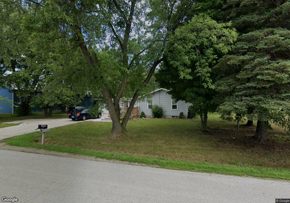
1830 Cypress Rd de Pere, WI 54115
Estimated Value: $202,000 - $402,000
3
Beds
2
Baths
1,568
Sq Ft
$205/Sq Ft
Est. Value
About This Home
This home is located at 1830 Cypress Rd, de Pere, WI 54115 and is currently estimated at $320,838, approximately $204 per square foot. 1830 Cypress Rd is a home located in Brown County with nearby schools including Hemlock Creek Elementary School, West De Pere Middle School, and West De Pere High School.
Ownership History
Date
Name
Owned For
Owner Type
Purchase Details
Closed on
May 25, 2012
Sold by
Hietpas Gerad R
Bought by
Hietpas Garard R and Hietpas Sheri A
Current Estimated Value
Purchase Details
Closed on
Mar 6, 2007
Sold by
Deutsche Bank National Trust Co
Bought by
Hietpas Gerard R
Purchase Details
Closed on
Aug 31, 2006
Sold by
Kocken Linda
Bought by
Deutsche Bank National Trust Co and Morgan Stanley Abs Capital 1 Inc Trust
Purchase Details
Closed on
Mar 12, 1998
Sold by
Kocken Irene T
Bought by
Kocken Linda
Create a Home Valuation Report for This Property
The Home Valuation Report is an in-depth analysis detailing your home's value as well as a comparison with similar homes in the area
Home Values in the Area
Average Home Value in this Area
Purchase History
| Date | Buyer | Sale Price | Title Company |
|---|---|---|---|
| Hietpas Garard R | -- | None Available | |
| Hietpas Gerard R | $75,000 | None Available | |
| Deutsche Bank National Trust Co | -- | Bay Title | |
| Kocken Linda | -- | -- |
Source: Public Records
Tax History Compared to Growth
Tax History
| Year | Tax Paid | Tax Assessment Tax Assessment Total Assessment is a certain percentage of the fair market value that is determined by local assessors to be the total taxable value of land and additions on the property. | Land | Improvement |
|---|---|---|---|---|
| 2024 | $2,632 | $168,000 | $40,000 | $128,000 |
| 2023 | $2,453 | $168,000 | $40,000 | $128,000 |
| 2022 | $2,429 | $168,000 | $40,000 | $128,000 |
| 2021 | $2,443 | $168,000 | $40,000 | $128,000 |
| 2020 | $2,545 | $127,600 | $30,100 | $97,500 |
| 2019 | $2,523 | $127,600 | $30,100 | $97,500 |
| 2018 | $2,398 | $127,600 | $30,100 | $97,500 |
| 2017 | $2,423 | $127,600 | $30,100 | $97,500 |
| 2016 | $2,454 | $127,600 | $30,100 | $97,500 |
| 2015 | $2,412 | $127,600 | $30,100 | $97,500 |
| 2014 | $2,573 | $127,600 | $30,100 | $97,500 |
| 2013 | $2,573 | $127,600 | $30,100 | $97,500 |
Source: Public Records
Map
Nearby Homes
- 0 Fernando Dr
- 1280 W Main Ave
- 3566 W Hank Ave
- 3629 W Hank Ave
- 3581 W Hank Ave
- 3578 W Hank Ave
- 3571 Sand Acres Dr
- 0 Contract Dr
- 1338 Highland Ridge Dr
- 3644 E Hank Ave
- 1359 Shelby Ln
- 1477 Wexford Ln
- 3683 Ponds Edge Ct
- 3161 Trinity Ct
- 3106 Trinity Ct
- 3166 Trinity Ct
- 1108 Hoks Ridge Ln
- 2689 Clive St
- 1308 Carole Ln
- 2549 Babcock Rd Unit 2551
- 2141 Short Rd
- 1825 Cypress Rd
- 1825 1825 Cypress Rd
- 1854 Cypress Rd
- 1682 Ledgestone Ct
- 1683 Ledgestone Ct
- 3343 Short Rd
- 1580 W Main Ave
- 1683 1683 Ledgestone Ct
- 1674 Ledgestone Ct
- 1679 Ledgestone Ct
- 1864 Cypress Rd
- 1682 1682 Ledgestone Ct
- 1674 1674 Ledgestone Ct
- 1678 1678 Ledgestone Ct
- 3401 Riverstone Ct Unit 24
- 3405 Riverstone Ct
- 3429 Riverstone Ct Unit 15
- 1678 Ledgestone Ct
- 3421 Riverstone Ct