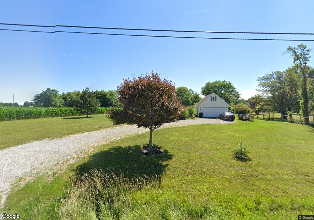
1830 Olivesburg Rd Mansfield, OH 44903
Estimated Value: $219,000 - $245,000
2
Beds
1
Bath
1,096
Sq Ft
$210/Sq Ft
Est. Value
About This Home
This home is located at 1830 Olivesburg Rd, Mansfield, OH 44903 and is currently estimated at $230,554, approximately $210 per square foot. 1830 Olivesburg Rd is a home located in Richland County with nearby schools including Madison High School, Temple-Christian School, and St. Mary Catholic School.
Ownership History
Date
Name
Owned For
Owner Type
Purchase Details
Closed on
Nov 30, 2004
Sold by
Bowman Tracy E
Bought by
Cushler James R
Current Estimated Value
Home Financials for this Owner
Home Financials are based on the most recent Mortgage that was taken out on this home.
Original Mortgage
$120,000
Outstanding Balance
$60,016
Interest Rate
5.71%
Mortgage Type
Purchase Money Mortgage
Estimated Equity
$170,538
Purchase Details
Closed on
Sep 1, 2000
Sold by
Thomas Tad L
Bought by
Masters Virgil Q
Create a Home Valuation Report for This Property
The Home Valuation Report is an in-depth analysis detailing your home's value as well as a comparison with similar homes in the area
Home Values in the Area
Average Home Value in this Area
Purchase History
| Date | Buyer | Sale Price | Title Company |
|---|---|---|---|
| Cushler James R | $120,000 | Fidelity Title | |
| Masters Virgil Q | $6,000 | -- |
Source: Public Records
Mortgage History
| Date | Status | Borrower | Loan Amount |
|---|---|---|---|
| Open | Cushler James R | $120,000 |
Source: Public Records
Tax History Compared to Growth
Tax History
| Year | Tax Paid | Tax Assessment Tax Assessment Total Assessment is a certain percentage of the fair market value that is determined by local assessors to be the total taxable value of land and additions on the property. | Land | Improvement |
|---|---|---|---|---|
| 2024 | $2,757 | $56,810 | $11,090 | $45,720 |
| 2023 | $2,757 | $56,810 | $11,090 | $45,720 |
| 2022 | $2,532 | $46,330 | $9,910 | $36,420 |
| 2021 | $2,531 | $46,330 | $9,910 | $36,420 |
| 2020 | $2,551 | $46,330 | $9,910 | $36,420 |
| 2019 | $2,454 | $39,610 | $8,400 | $31,210 |
| 2018 | $2,294 | $39,610 | $8,400 | $31,210 |
| 2017 | $2,289 | $39,610 | $8,400 | $31,210 |
| 2016 | $2,332 | $39,740 | $7,980 | $31,760 |
| 2015 | $2,224 | $39,740 | $7,980 | $31,760 |
| 2014 | $2,216 | $39,740 | $7,980 | $31,760 |
| 2012 | $1,101 | $41,830 | $8,400 | $33,430 |
Source: Public Records
Map
Nearby Homes
- 0 Hoover Rd
- 920 Piper Rd
- 1171 Hoover Rd
- 1585 Beal Rd
- 1791 Beal Rd
- 1292 Wolford Rd
- 1140 5th Ave
- 1245 N Stewart Rd
- 1158 Delwood Rd
- 1150 Delwood Dr
- 0 Wesley
- 1151 Beal Rd
- 741 Yale Ave
- 1106 Keller Dr Unit 1108
- 0 Miller Pkwy
- 735 Pennsylvania Ave
- 1199 Evergreen Ave W
- 1183 Evergreen Ave W
- 588 Michigan Ave
- 903 Mayflower Ave
- 1820 Olivesburg Rd
- 1850 Ohio 545
- 675 Hoover Rd
- 1900 Olivesburg Rd
- 1768 Olivesburg Rd
- 698 Hoover Rd
- 715 Hoover Rd
- 1930 Olivesburg Rd
- 753 Hoover Rd
- 727 Hoover Rd
- 708 Hoover Rd
- 1720 Olivesburg Rd
- 725 Hoover Rd
- 769 Hoover Rd
- 1720 Ohio 545
- 1721 Olivesburg Rd
- 1966 Olivesburg Rd
- 785 Hoover Rd
- 1955 Olivesburg Rd
- 1955 Olivesburg Rd