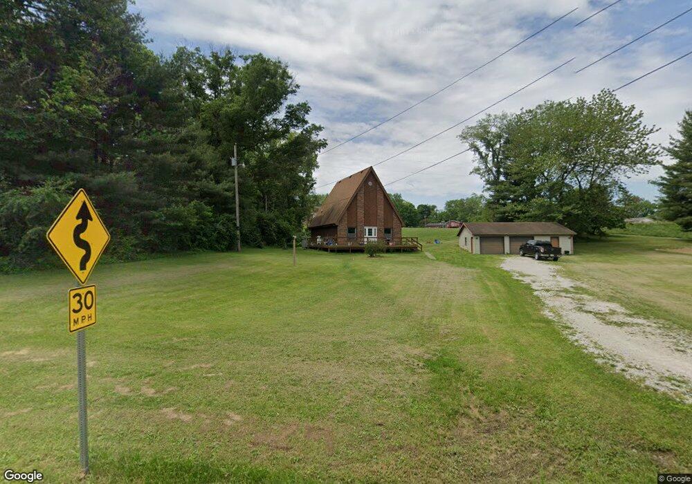
1830 State Road 550 Loogootee, IN 47553
Estimated Value: $191,000 - $301,000
2
Beds
1
Bath
1,512
Sq Ft
$148/Sq Ft
Est. Value
About This Home
This home is located at 1830 State Road 550, Loogootee, IN 47553 and is currently estimated at $224,228, approximately $148 per square foot. 1830 State Road 550 is a home located in Martin County with nearby schools including Loogootee Elementary School, Loogootee Middle School, and Loogootee Junior/Senior High School.
Ownership History
Date
Name
Owned For
Owner Type
Purchase Details
Closed on
Oct 1, 2008
Sold by
Phillip M Smith
Bought by
Daniel M Steiner
Current Estimated Value
Purchase Details
Closed on
Jul 29, 2008
Sold by
Cheryl L Jones
Bought by
Smith Phillip M and Smith Amber N
Create a Home Valuation Report for This Property
The Home Valuation Report is an in-depth analysis detailing your home's value as well as a comparison with similar homes in the area
Home Values in the Area
Average Home Value in this Area
Purchase History
| Date | Buyer | Sale Price | Title Company |
|---|---|---|---|
| Daniel M Steiner | $88,500 | Dubois County Title | |
| Smith Phillip M | $70,000 | Lett & Jones Attorneys |
Source: Public Records
Tax History Compared to Growth
Tax History
| Year | Tax Paid | Tax Assessment Tax Assessment Total Assessment is a certain percentage of the fair market value that is determined by local assessors to be the total taxable value of land and additions on the property. | Land | Improvement |
|---|---|---|---|---|
| 2024 | $764 | $150,600 | $14,200 | $136,400 |
| 2023 | $764 | $140,600 | $13,500 | $127,100 |
| 2022 | $565 | $131,500 | $12,900 | $118,600 |
| 2021 | $546 | $114,400 | $12,000 | $102,400 |
| 2020 | $493 | $110,200 | $11,600 | $98,600 |
| 2019 | $449 | $105,600 | $11,100 | $94,500 |
| 2018 | $418 | $101,800 | $10,700 | $91,100 |
| 2017 | $349 | $92,700 | $10,400 | $82,300 |
| 2016 | $293 | $90,900 | $10,200 | $80,700 |
| 2014 | $248 | $88,100 | $9,600 | $78,500 |
| 2013 | -- | $85,500 | $9,600 | $75,900 |
Source: Public Records
Map
Nearby Homes
- 690 E Southridge Rd
- 0 Friends Creek Rd
- 102 Eastgate Ave
- 214 Cedar St
- 1559 Scenic Hill Rd
- 508 E Broadway St
- 513 Park St
- 108 SW 2nd St
- 501 E Main St
- 98+/- Acres U S 231
- 803 & 805 Reason Ave Unit INCLUDES 111 TRUELOV
- 419 SW 3rd St
- 106 Queen St
- 13163 E 200 S
- Lot 24 Country Court S D V
- Lot 28 Country Court S D V
- Lot 23 Country Court S D V
- Lot 12 Country Court S D V
- Lot 6 Country Court S D V
- Lot 16 Country Court S D V
- 1830 State Road 550
- 1830 State Road 550
- 1830 State Road 550
- 1850 State Road 550
- 1850 State Road 550
- 1848 State Road 550
- 1795 State Road 550
- 1849 Pleasant Ln
- 1849 Pleasant Ln
- 1769 State Road 550
- 1734 State Road 550
- 1815 Pleasant Ln
- 10760 Brooks House Rd
- 10708 Brooks House Rd
- 10819 Brooks House Rd
- 1799 Mount Pleasant Rd
- 1837 Mount Pleasant Rd
- 1718 Pleasant Ln
- 1753 Mount Pleasant Rd
- 10724 Hart Rd