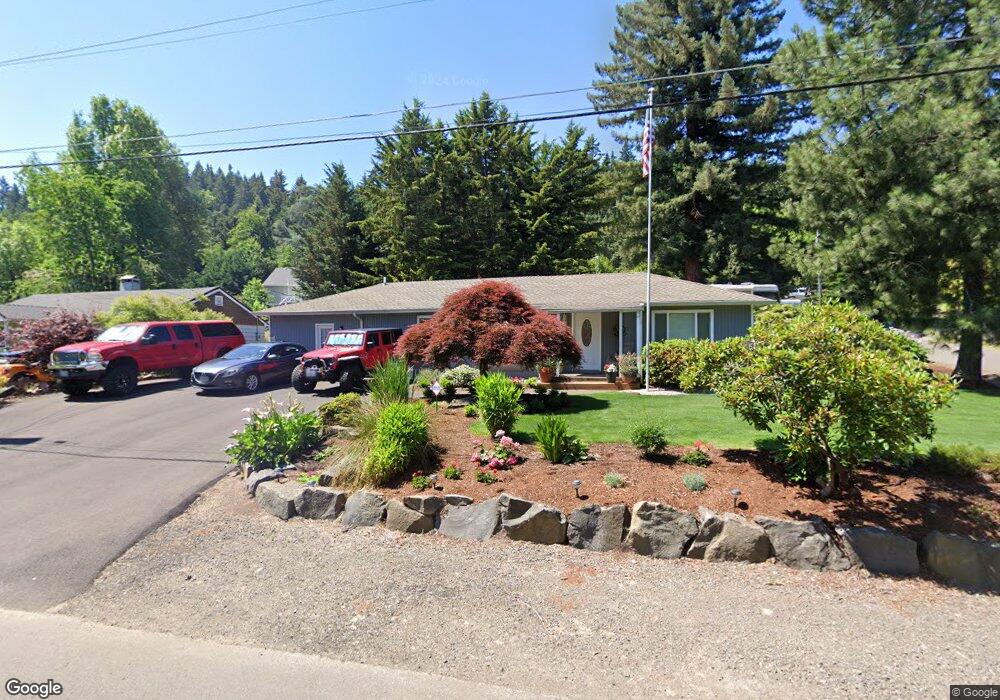
18305 Lower Midhill Dr West Linn, OR 97068
Robinwood NeighborhoodEstimated Value: $394,000 - $578,000
3
Beds
1
Bath
1,342
Sq Ft
$371/Sq Ft
Est. Value
About This Home
This home is located at 18305 Lower Midhill Dr, West Linn, OR 97068 and is currently estimated at $498,348, approximately $371 per square foot. 18305 Lower Midhill Dr is a home located in Clackamas County with nearby schools including Cedaroak Park Primary School, West Linn High School, and Harmony Academy.
Ownership History
Date
Name
Owned For
Owner Type
Purchase Details
Closed on
Sep 3, 2025
Sold by
Timeus Terry D
Bought by
Terry D Timeus Trust and Timeus
Current Estimated Value
Purchase Details
Closed on
Oct 8, 2019
Sold by
Zak Stanley E and Zak Yvonetta M
Bought by
Timeus Terry D
Home Financials for this Owner
Home Financials are based on the most recent Mortgage that was taken out on this home.
Original Mortgage
$234,400
Interest Rate
3.65%
Mortgage Type
New Conventional
Purchase Details
Closed on
Aug 8, 2019
Sold by
Zak Stanley and Zak Yvonetta
Bought by
Timeus Terry D
Purchase Details
Closed on
Aug 8, 2011
Sold by
Zak Stanley E and Zak Yvonetta M
Bought by
Timeus Terry D
Create a Home Valuation Report for This Property
The Home Valuation Report is an in-depth analysis detailing your home's value as well as a comparison with similar homes in the area
Home Values in the Area
Average Home Value in this Area
Purchase History
| Date | Buyer | Sale Price | Title Company |
|---|---|---|---|
| Terry D Timeus Trust | -- | None Listed On Document | |
| Timeus Terry D | $270,000 | Accommodation | |
| Timeus Terry D | $270,000 | First American | |
| Timeus Terry D | $270,000 | First Amer Title Ins Co Or |
Source: Public Records
Mortgage History
| Date | Status | Borrower | Loan Amount |
|---|---|---|---|
| Previous Owner | Timeus Terry D | $234,400 |
Source: Public Records
Tax History Compared to Growth
Tax History
| Year | Tax Paid | Tax Assessment Tax Assessment Total Assessment is a certain percentage of the fair market value that is determined by local assessors to be the total taxable value of land and additions on the property. | Land | Improvement |
|---|---|---|---|---|
| 2025 | $3,928 | $203,840 | -- | -- |
| 2024 | $3,781 | $197,903 | -- | -- |
| 2023 | $3,781 | $192,139 | $0 | $0 |
| 2022 | $3,569 | $186,543 | $0 | $0 |
| 2021 | $3,388 | $181,110 | $0 | $0 |
| 2020 | $3,411 | $175,835 | $0 | $0 |
| 2019 | $3,253 | $170,714 | $0 | $0 |
| 2018 | $3,108 | $165,742 | $0 | $0 |
| 2017 | $2,987 | $160,915 | $0 | $0 |
| 2016 | $2,910 | $156,228 | $0 | $0 |
| 2015 | $2,827 | $151,678 | $0 | $0 |
| 2014 | $2,716 | $147,260 | $0 | $0 |
Source: Public Records
Map
Nearby Homes
- 2041 Marylhurst Dr
- 18194 Shady Hollow Way
- 2636 Maria Ct
- 2167 Marylwood Ct
- 3340 Arbor Dr
- 18711 Willamette Dr
- 17833 Marylcreek Dr
- 2455 College Hill Place
- 17911 Hillside Dr
- 1354 Skye Pkwy
- 1397 Skye Pkwy
- 18649 Old River Dr
- 1384 Celtic Ct
- 17634 Brookhurst Dr
- 2090 Valley View Dr
- 17623 Brookhurst Dr
- 19655 Sun Cir
- 19661 Sun Cir
- 1777 Skyland Dr
- 4400 Calaroga Dr
- 18355 Lower Midhill Dr
- 2612 Robinwood Way
- 18295 Lower Midhill Dr
- 2631 Marylhurst Dr
- 2716 Robinwood Way
- 18350 Lower Midhill Dr
- 18395 Lower Midhill Dr
- 2645 Robinwood Way
- 2735 Robinwood Way
- 18380 Lower Midhill Dr
- 18265 Lower Midhill Dr
- 18757 Upper Midhill Dr Unit DR
- 18757 Upper Midhill Dr
- 2551 Robinwood Way
- 18717 Upper Midhill Dr
- 18777 Upper Midhill Dr
- 2748 Robinwood Way
- 2767 Robinwood Way
- 18445 Lower Midhill Dr
- 18260 Lower Midhill Dr