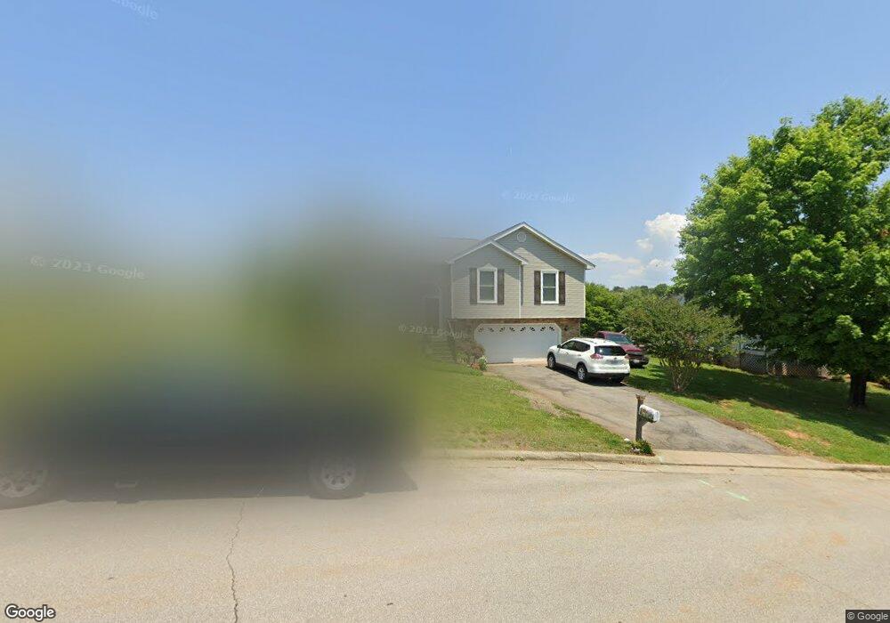
1831 Bloomfield Ave Roanoke, VA 24012
Estimated Value: $365,000 - $396,000
3
Beds
3
Baths
1,937
Sq Ft
$196/Sq Ft
Est. Value
About This Home
This home is located at 1831 Bloomfield Ave, Roanoke, VA 24012 and is currently estimated at $379,094, approximately $195 per square foot. 1831 Bloomfield Ave is a home located in Roanoke County with nearby schools including Bonsack Elementary School, William Byrd Middle School, and William Byrd High School.
Ownership History
Date
Name
Owned For
Owner Type
Purchase Details
Closed on
Mar 29, 2006
Sold by
Hollie Oliver O
Bought by
Taylor Benjamin F and Taylor Brenda L
Current Estimated Value
Home Financials for this Owner
Home Financials are based on the most recent Mortgage that was taken out on this home.
Original Mortgage
$136,000
Outstanding Balance
$6,852
Interest Rate
6.32%
Mortgage Type
New Conventional
Estimated Equity
$372,242
Create a Home Valuation Report for This Property
The Home Valuation Report is an in-depth analysis detailing your home's value as well as a comparison with similar homes in the area
Home Values in the Area
Average Home Value in this Area
Purchase History
| Date | Buyer | Sale Price | Title Company |
|---|---|---|---|
| Taylor Benjamin F | -- | None Available |
Source: Public Records
Mortgage History
| Date | Status | Borrower | Loan Amount |
|---|---|---|---|
| Open | Taylor Benjamin F | $136,000 |
Source: Public Records
Tax History Compared to Growth
Tax History
| Year | Tax Paid | Tax Assessment Tax Assessment Total Assessment is a certain percentage of the fair market value that is determined by local assessors to be the total taxable value of land and additions on the property. | Land | Improvement |
|---|---|---|---|---|
| 2025 | $3,224 | $313,000 | $59,000 | $254,000 |
| 2024 | $3,093 | $297,400 | $54,000 | $243,400 |
| 2023 | $3,054 | $288,100 | $54,000 | $234,100 |
| 2022 | $2,624 | $240,700 | $49,000 | $191,700 |
| 2021 | $2,408 | $220,900 | $45,000 | $175,900 |
| 2020 | $2,220 | $203,700 | $40,000 | $163,700 |
| 2019 | $2,155 | $197,700 | $39,000 | $158,700 |
| 2018 | $2,098 | $194,300 | $39,000 | $155,300 |
| 2017 | $2,098 | $192,500 | $39,000 | $153,500 |
| 2016 | $2,049 | $188,000 | $38,000 | $150,000 |
| 2015 | $2,012 | $184,600 | $38,000 | $146,600 |
| 2014 | $1,990 | $182,600 | $36,000 | $146,600 |
Source: Public Records
Map
Nearby Homes
- 1802 W Ruritan Rd
- 1713 Ashbury Ct
- 0 E Ruritan Rd
- 2414 Carlsbad Cir
- 4127 Mockingbird Hill Rd
- 1525 W Ruritan Rd
- 1944 W Ruritan Rd
- 1971 W Ruritan Rd
- 2910 Mystique Ct
- 2020 Ruritan Rd
- 2054 Ruritan Rd
- 2206 Coachman Dr
- 5018 Carter Grove Ln
- 5114 Huntridge Rd
- 2826 Greggin Dr
- 6110 Wisteria Place Ct
- 5508 Rome Dr
- 5679 Huntridge Rd
- 5687 Huntridge Rd
- 5695 Huntridge Rd
- 1825 Bloomfield Ave
- 1891 Mulholland Cir
- 1885 Mulholland Cir
- 1819 Bloomfield Ave
- 1760 W Ruritan Rd
- 1768 W Ruritan Rd
- 1752 W Ruritan Rd
- 1910 High Crest Ct
- 1824 Bloomfield Ave
- 1800 W Ruritan Rd
- 1811 Bloomfield Ave
- 1880 Mulholland Cir
- 1816 Bloomfield Ave
- 1905 Bloomfield Ave
- 1742 W Ruritan Rd
- 1886 Mulholland Cir
- 1804 W Ruritan Rd
- 1805 Bloomfield Ave
- 1920 High Crest Ct
- 1909 High Crest Ct