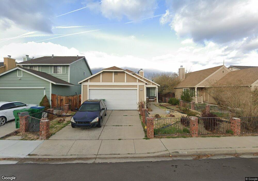
1831 Burnside Dr Sparks, NV 89434
O'Callaghan NeighborhoodEstimated Value: $410,000 - $445,000
2
Beds
2
Baths
1,164
Sq Ft
$367/Sq Ft
Est. Value
About This Home
This home is located at 1831 Burnside Dr, Sparks, NV 89434 and is currently estimated at $427,303, approximately $367 per square foot. 1831 Burnside Dr is a home located in Washoe County with nearby schools including Katherine Dunn Elementary School, George L Dilworth Middle School, and Edward C Reed High School.
Ownership History
Date
Name
Owned For
Owner Type
Purchase Details
Closed on
Jun 23, 1997
Sold by
Martin Eugene H and Martin Kathryn A
Bought by
Barner Hermann and Barner Ofelia P
Current Estimated Value
Home Financials for this Owner
Home Financials are based on the most recent Mortgage that was taken out on this home.
Original Mortgage
$76,000
Outstanding Balance
$10,810
Interest Rate
7.91%
Estimated Equity
$416,493
Purchase Details
Closed on
Feb 12, 1997
Sold by
Martin Eugene H
Bought by
Martin Eugene H and Martin Kathryn A
Create a Home Valuation Report for This Property
The Home Valuation Report is an in-depth analysis detailing your home's value as well as a comparison with similar homes in the area
Home Values in the Area
Average Home Value in this Area
Purchase History
| Date | Buyer | Sale Price | Title Company |
|---|---|---|---|
| Barner Hermann | $126,000 | Stewart Title | |
| Martin Eugene H | -- | -- |
Source: Public Records
Mortgage History
| Date | Status | Borrower | Loan Amount |
|---|---|---|---|
| Open | Barner Hermann | $76,000 |
Source: Public Records
Tax History Compared to Growth
Tax History
| Year | Tax Paid | Tax Assessment Tax Assessment Total Assessment is a certain percentage of the fair market value that is determined by local assessors to be the total taxable value of land and additions on the property. | Land | Improvement |
|---|---|---|---|---|
| 2025 | $1,867 | $65,127 | $34,580 | $30,547 |
| 2024 | $1,867 | $63,958 | $32,725 | $31,233 |
| 2023 | $1,729 | $62,237 | $32,305 | $29,932 |
| 2022 | $1,602 | $51,248 | $26,005 | $25,243 |
| 2021 | $1,484 | $45,288 | $19,845 | $25,443 |
| 2020 | $1,395 | $45,557 | $19,775 | $25,782 |
| 2019 | $1,328 | $44,160 | $18,935 | $25,225 |
| 2018 | $1,268 | $38,876 | $13,965 | $24,911 |
| 2017 | $1,217 | $37,861 | $12,670 | $25,191 |
| 2016 | $1,186 | $37,341 | $11,410 | $25,931 |
| 2015 | $1,184 | $35,774 | $9,625 | $26,149 |
| 2014 | $1,139 | $34,077 | $8,225 | $25,852 |
| 2013 | -- | $30,479 | $6,090 | $24,389 |
Source: Public Records
Map
Nearby Homes
- 1770 Burnside Dr
- 1655 Sabatino Dr
- 1990 Fargo Way
- 2252 Sycamore Glen Dr
- 1280 O'Callaghan Dr
- 1332 Coachman Ct
- 2435 Sycamore Glen Dr Unit 2
- 1544 Woodhaven Ln
- 2407 Sunny Slope Dr Unit 1
- 1970 Woodhaven Ln
- 1218 Junction Dr
- 2688 Laguna Way
- 1897 Bonita Vista Dr
- 2763 Blossom View Dr
- 1688 Round Mountain Cir
- 2002 Wabash Cir
- 1973 Rio Tinto Dr
- 1051 Glen Martin Dr
- 914 Glen Martin Dr
- 913 Glen Molly Dr
- 1841 Burnside Dr
- 1851 Burnside Dr
- 1801 Burnside Dr
- 1782 Union St
- 1772 Union St
- 1792 Union St
- 1871 Burnside Dr
- 1762 Union St
- 1781 Burnside Dr
- 1802 Union St
- 1830 Burnside Dr
- 1752 Union St
- 1820 Burnside Dr
- 1840 Burnside Dr
- 1761 Burnside Dr
- 1901 Burnside Dr
- 1810 Burnside Dr
- 1822 Union St
- 1850 Burnside Dr
- 1800 Burnside Dr