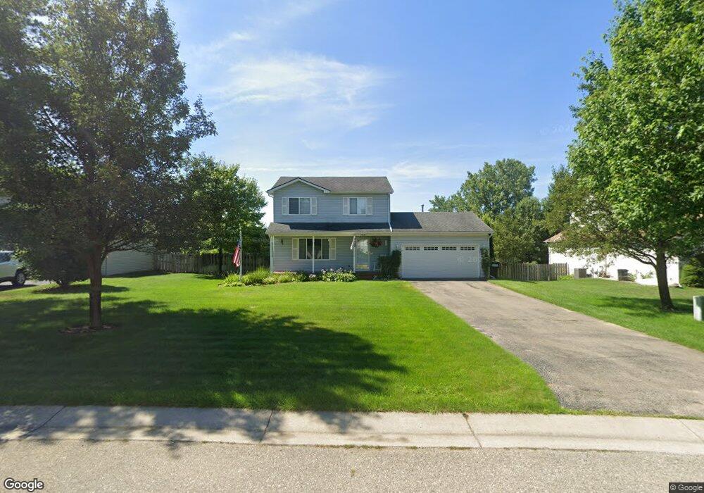
1831 Chesapeake Ct Oxford, MI 48371
Estimated Value: $340,839 - $406,000
4
Beds
2
Baths
1,600
Sq Ft
$233/Sq Ft
Est. Value
About This Home
This home is located at 1831 Chesapeake Ct, Oxford, MI 48371 and is currently estimated at $372,710, approximately $232 per square foot. 1831 Chesapeake Ct is a home located in Oakland County with nearby schools including Clear Lake Elementary School, Oxford Middle School, and Oxford High School.
Ownership History
Date
Name
Owned For
Owner Type
Purchase Details
Closed on
Apr 25, 2008
Sold by
Runestad Sherry A and Runestad Ronald
Bought by
Tonkovich Michael and Tonkovich Jessica
Current Estimated Value
Home Financials for this Owner
Home Financials are based on the most recent Mortgage that was taken out on this home.
Original Mortgage
$152,000
Outstanding Balance
$96,261
Interest Rate
5.88%
Mortgage Type
Purchase Money Mortgage
Estimated Equity
$276,449
Purchase Details
Closed on
Aug 30, 2000
Sold by
Tarrant Patrick R
Bought by
Runestad Sherry A
Create a Home Valuation Report for This Property
The Home Valuation Report is an in-depth analysis detailing your home's value as well as a comparison with similar homes in the area
Home Values in the Area
Average Home Value in this Area
Purchase History
| Date | Buyer | Sale Price | Title Company |
|---|---|---|---|
| Tonkovich Michael | $160,000 | Multiple | |
| Runestad Sherry A | -- | -- |
Source: Public Records
Mortgage History
| Date | Status | Borrower | Loan Amount |
|---|---|---|---|
| Open | Tonkovich Michael | $152,000 |
Source: Public Records
Tax History Compared to Growth
Tax History
| Year | Tax Paid | Tax Assessment Tax Assessment Total Assessment is a certain percentage of the fair market value that is determined by local assessors to be the total taxable value of land and additions on the property. | Land | Improvement |
|---|---|---|---|---|
| 2024 | $1,802 | $151,780 | $0 | $0 |
| 2023 | $1,719 | $138,480 | $0 | $0 |
| 2022 | $2,661 | $129,570 | $0 | $0 |
| 2021 | $2,543 | $122,390 | $0 | $0 |
| 2020 | $1,624 | $117,000 | $0 | $0 |
| 2019 | $2,375 | $111,610 | $0 | $0 |
| 2018 | $2,330 | $104,440 | $0 | $0 |
| 2017 | $2,167 | $99,430 | $0 | $0 |
| 2016 | $2,162 | $93,930 | $0 | $0 |
| 2015 | -- | $88,020 | $0 | $0 |
| 2014 | -- | $81,250 | $0 | $0 |
| 2011 | -- | $65,170 | $0 | $0 |
Source: Public Records
Map
Nearby Homes
- 967 Keith St
- 1612 Royal Birkdale Dr Unit 77
- 1628 Royal Birkdale Dr Unit 76
- 2060 W Drahner Rd
- 1667 Royal Birkdale Dr
- 774 Keith St
- 1910 Royal Birkdale Dr
- 1320 W Drahner Rd
- 1315 Beemer Ct
- 1 Pinery Ct
- 1126 Watersmeet Dr
- 1611 Harwood Dr
- 815 Pinery Blvd
- 302 Tanview Dr
- 1060 Tinley Blvd
- 948 Watersmeet Dr
- 767 Pinery Blvd
- 1858 Sandy Shores Dr
- 1904 Sandy Shores Dr
- 101 N Newman Rd
- 1817 Chesapeake Ct
- 1843 Chesapeake Ct
- 1834 Worcester Dr
- 1820 Worcester Dr
- 1846 Worcester Dr
- 1818 Chesapeake Ct
- 1832 Chesapeake Ct
- 1235 Somerville Dr
- 1223 Somerville Dr
- 1247 Somerville Dr Unit Bldg-Unit
- 1247 Somerville Dr
- 1200 Somerville Dr
- 1864 Chesapeake Ct
- 1211 Somerville Dr
- 1844 Chesapeake Ct
- 1833 Worcester Dr
- 1263 Somerville Dr
- 1819 Worcester Dr
- 1845 Worcester Dr
- 1188 Somerville Dr