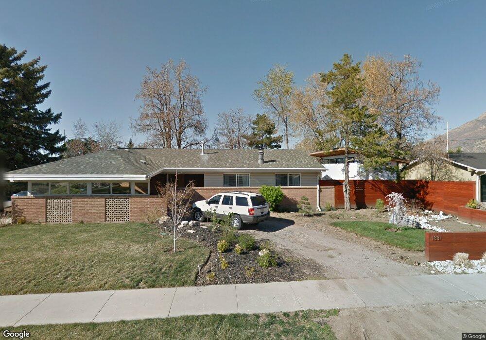
1831 E 7030 S Salt Lake City, UT 84121
Estimated Value: $614,000 - $651,000
4
Beds
3
Baths
1,142
Sq Ft
$559/Sq Ft
Est. Value
About This Home
This home is located at 1831 E 7030 S, Salt Lake City, UT 84121 and is currently estimated at $638,679, approximately $559 per square foot. 1831 E 7030 S is a home located in Salt Lake County with nearby schools including Ridgecrest School, Butler Middle School, and Brighton High School.
Ownership History
Date
Name
Owned For
Owner Type
Purchase Details
Closed on
Jun 12, 2013
Sold by
Lahue Greg and Lahue Meikle
Bought by
Kato Mutsumi and Campbell Forrest
Current Estimated Value
Home Financials for this Owner
Home Financials are based on the most recent Mortgage that was taken out on this home.
Original Mortgage
$240,562
Outstanding Balance
$170,281
Interest Rate
3.38%
Mortgage Type
FHA
Estimated Equity
$468,398
Purchase Details
Closed on
Mar 16, 2005
Sold by
Lahue Meikle
Bought by
Lahue Greg and Lahue Meikle
Home Financials for this Owner
Home Financials are based on the most recent Mortgage that was taken out on this home.
Original Mortgage
$144,000
Interest Rate
5.87%
Mortgage Type
New Conventional
Create a Home Valuation Report for This Property
The Home Valuation Report is an in-depth analysis detailing your home's value as well as a comparison with similar homes in the area
Home Values in the Area
Average Home Value in this Area
Purchase History
| Date | Buyer | Sale Price | Title Company |
|---|---|---|---|
| Kato Mutsumi | -- | United Title Services | |
| Lahue Greg | -- | Superior Title | |
| Lahue Meikle | -- | Superior Title |
Source: Public Records
Mortgage History
| Date | Status | Borrower | Loan Amount |
|---|---|---|---|
| Open | Kato Mutsumi | $240,562 | |
| Previous Owner | Lahue Meikle | $144,000 |
Source: Public Records
Tax History Compared to Growth
Tax History
| Year | Tax Paid | Tax Assessment Tax Assessment Total Assessment is a certain percentage of the fair market value that is determined by local assessors to be the total taxable value of land and additions on the property. | Land | Improvement |
|---|---|---|---|---|
| 2025 | $3,365 | $613,700 | $159,800 | $453,900 |
| 2024 | $3,365 | $600,100 | $147,900 | $452,200 |
| 2023 | $3,624 | $628,400 | $140,700 | $487,700 |
| 2022 | $3,341 | $571,600 | $137,900 | $433,700 |
| 2021 | $2,742 | $390,400 | $115,200 | $275,200 |
| 2020 | $2,630 | $352,000 | $105,400 | $246,600 |
| 2019 | $2,504 | $325,400 | $105,400 | $220,000 |
| 2018 | $2,377 | $321,100 | $105,400 | $215,700 |
| 2017 | $2,127 | $278,700 | $88,700 | $190,000 |
| 2016 | $2,148 | $273,100 | $88,700 | $184,400 |
| 2015 | $2,185 | $249,700 | $86,000 | $163,700 |
| 2014 | $2,008 | $229,900 | $80,000 | $149,900 |
Source: Public Records
Map
Nearby Homes
- 6851 Meadow Dr E
- 1895 E 7160 S
- 7138 S Chris Ln
- 1920 E 7130 S
- 1938 E 7130 S
- 7044 S 1700 E
- 7265 S 1950 E Unit 18
- 7265 S 1950 E Unit 14
- 1695 E Ensign Place
- 2063 E Kane Cir
- 6700 S 1655 E
- 7034 S Cadens Cove
- 7094 S Cadens Cove
- 2099 Worchester Dr
- 7187 Villandrie Ln
- 7195 S Villandrie Ln
- 7391 S Viscayne Dr
- 2134 Somerset Dr
- 6587 S 1570 E
- 1706 E 6485 S
- 1831 E 7020 S
- 7003 Brookhill Dr
- 1917 E 7020 S
- 1906 E 7020 S
- 1914 E 7020 S
- 1939 E 7020 S
- 1929 E 7020 S
- 1922 E 7020 S
- 1841 E 7020 S
- 1841 E 7030 S
- 7033 Brookhill Dr
- 6993 Brookhill Dr
- 6981 Brookhill Dr E
- 1851 E 7020 S
- 6993 Brookhill Dr E
- 7020 Brookhill Dr
- 7004 Brookhill Dr
- 1840 E 7030 S
- 7020 S Brookhill Dr
- 7004 S Brookhill Dr