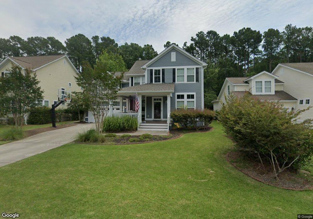
1831 Hall Point Rd Mount Pleasant, SC 29466
Park West NeighborhoodEstimated Value: $923,404 - $1,128,000
4
Beds
4
Baths
3,006
Sq Ft
$330/Sq Ft
Est. Value
About This Home
This home is located at 1831 Hall Point Rd, Mount Pleasant, SC 29466 and is currently estimated at $991,601, approximately $329 per square foot. 1831 Hall Point Rd is a home located in Charleston County with nearby schools including Charles Pinckney Elementary School, Laurel Hill Primary School, and Thomas C. Cario Middle School.
Ownership History
Date
Name
Owned For
Owner Type
Purchase Details
Closed on
Mar 14, 2022
Sold by
Douglas Ramsay William
Bought by
William Douglas Ramsay Living Trust
Current Estimated Value
Purchase Details
Closed on
Mar 5, 2018
Sold by
Ramsay Kelle Gray
Bought by
Ramsay William Douglas
Purchase Details
Closed on
Mar 5, 2009
Sold by
The Ryland Group Inc
Bought by
Ramsay William Douglas and Ramsay Kelle Gray
Home Financials for this Owner
Home Financials are based on the most recent Mortgage that was taken out on this home.
Original Mortgage
$345,000
Interest Rate
4.79%
Mortgage Type
Future Advance Clause Open End Mortgage
Purchase Details
Closed on
Jan 25, 2006
Sold by
Decker Edgar N and Decker Mary K
Bought by
The Ryland Group Inc
Purchase Details
Closed on
Jun 16, 2005
Sold by
The Ryland Group Inc
Bought by
Decker Edgar N and Decker Mary K
Purchase Details
Closed on
Feb 11, 2005
Sold by
Park West Development Inc
Bought by
The Ryland Group Inc
Create a Home Valuation Report for This Property
The Home Valuation Report is an in-depth analysis detailing your home's value as well as a comparison with similar homes in the area
Home Values in the Area
Average Home Value in this Area
Purchase History
| Date | Buyer | Sale Price | Title Company |
|---|---|---|---|
| William Douglas Ramsay Living Trust | -- | Suttles Law Firm Llc | |
| Ramsay William Douglas | -- | None Available | |
| Ramsay William Douglas | $460,000 | -- | |
| The Ryland Group Inc | -- | None Available | |
| Decker Edgar N | $98,000 | -- | |
| The Ryland Group Inc | $1,875,000 | -- |
Source: Public Records
Mortgage History
| Date | Status | Borrower | Loan Amount |
|---|---|---|---|
| Previous Owner | Ramsay William Douglas | $345,000 |
Source: Public Records
Tax History Compared to Growth
Tax History
| Year | Tax Paid | Tax Assessment Tax Assessment Total Assessment is a certain percentage of the fair market value that is determined by local assessors to be the total taxable value of land and additions on the property. | Land | Improvement |
|---|---|---|---|---|
| 2024 | $1,964 | $19,430 | $0 | $0 |
| 2023 | $1,964 | $19,430 | $0 | $0 |
| 2022 | $1,801 | $19,430 | $0 | $0 |
| 2021 | $1,980 | $19,430 | $0 | $0 |
| 2020 | $2,047 | $19,430 | $0 | $0 |
| 2019 | $1,879 | $17,860 | $0 | $0 |
| 2017 | $1,852 | $17,860 | $0 | $0 |
| 2016 | $1,763 | $17,860 | $0 | $0 |
| 2015 | $1,843 | $17,860 | $0 | $0 |
| 2014 | $1,619 | $0 | $0 | $0 |
| 2011 | -- | $0 | $0 | $0 |
Source: Public Records
Map
Nearby Homes
- 3456 Claremont St
- 3447 Claremont St
- 3431 Claremont St
- 1535 Capel St
- 2296 Middlesex St
- 3261 Beaconsfield Rd
- 1844 Hubbell Dr
- 1563 Capel St
- 2064 Promenade Ct
- 3052 Ashburton Way
- 2217 Beckenham Dr
- 2296 Beckenham Dr
- 2196 Beckenham Dr
- 2208 Beckenham Dr
- 2254 Beckenham Dr
- 314 Commonwealth Rd
- 2225 Black Oak Ct
- 3336 Toomer Kiln Cir
- 2293 Beckenham Dr
- 2103 Shell Ring Cir
- 1835 Hall Point Rd
- 1827 Hall Point Rd
- 1823 Hall Point Rd
- 1839 Hall Point Rd
- 1832 Hall Point Rd
- 1828 Hall Point Rd
- 1836 Hall Point Rd
- 1819 Hall Point Rd
- 1824 Hall Point Rd
- 1840 Hall Point Rd
- 1705 Wellstead St
- 1820 Hall Point Rd
- 1844 Hall Point Rd
- 1843 Hall Point Rd
- 1709 Wellstead St
- 1816 Hall Point Rd
- 1848 Hall Point Rd
- 1812 Hall Point Rd
- 1847 Hall Point Rd
- 1713 Wellstead St