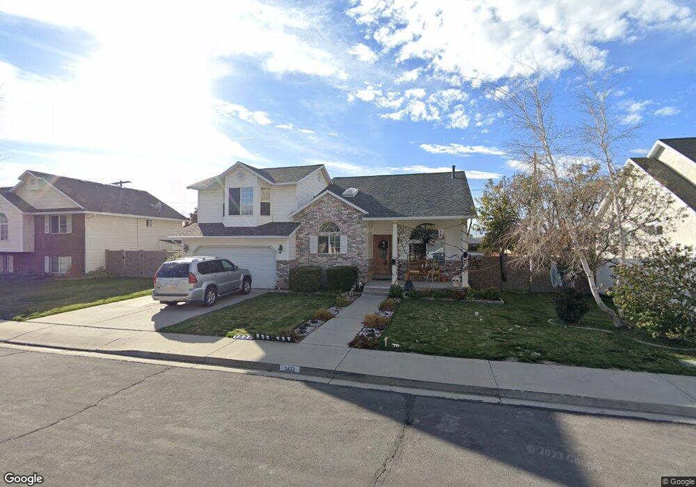
1831 N 350 W Orem, UT 84057
Northridge NeighborhoodEstimated Value: $564,000 - $652,000
6
Beds
3
Baths
2,847
Sq Ft
$217/Sq Ft
Est. Value
About This Home
This home is located at 1831 N 350 W, Orem, UT 84057 and is currently estimated at $617,043, approximately $216 per square foot. 1831 N 350 W is a home located in Utah County with nearby schools including Northridge Elementary School, Oak Canyon Junior High School, and Timpanogos High School.
Ownership History
Date
Name
Owned For
Owner Type
Purchase Details
Closed on
Oct 8, 2015
Sold by
Swallow James R and Swallow Miguelina E
Bought by
Skinner Joseph W and Skinner Janet P
Current Estimated Value
Purchase Details
Closed on
Sep 21, 2010
Sold by
Porter Michael and Porter Kristen
Bought by
Swallow James R and Swallow Miguelina E
Home Financials for this Owner
Home Financials are based on the most recent Mortgage that was taken out on this home.
Original Mortgage
$241,152
Outstanding Balance
$158,673
Interest Rate
4.37%
Mortgage Type
FHA
Estimated Equity
$458,370
Purchase Details
Closed on
May 29, 2003
Sold by
Whitehurst Ralph A and Whitehurst Bonnie Colleen
Bought by
Porter Michael and Porter Kristen
Create a Home Valuation Report for This Property
The Home Valuation Report is an in-depth analysis detailing your home's value as well as a comparison with similar homes in the area
Home Values in the Area
Average Home Value in this Area
Purchase History
| Date | Buyer | Sale Price | Title Company |
|---|---|---|---|
| Skinner Joseph W | -- | Titan Title Insurance Agency | |
| Swallow James R | -- | Inwest Title Services Inc | |
| Porter Michael | -- | Empire Land Title Company |
Source: Public Records
Mortgage History
| Date | Status | Borrower | Loan Amount |
|---|---|---|---|
| Open | Swallow James R | $241,152 |
Source: Public Records
Tax History Compared to Growth
Tax History
| Year | Tax Paid | Tax Assessment Tax Assessment Total Assessment is a certain percentage of the fair market value that is determined by local assessors to be the total taxable value of land and additions on the property. | Land | Improvement |
|---|---|---|---|---|
| 2025 | $2,384 | $313,610 | $255,200 | $315,000 |
| 2024 | $2,384 | $291,500 | $0 | $0 |
| 2023 | $2,229 | $292,930 | $0 | $0 |
| 2022 | $2,368 | $301,455 | $0 | $0 |
| 2021 | $2,128 | $410,400 | $152,400 | $258,000 |
| 2020 | $1,978 | $374,800 | $121,900 | $252,900 |
| 2019 | $1,791 | $353,000 | $121,900 | $231,100 |
| 2018 | $1,745 | $328,700 | $114,900 | $213,800 |
| 2017 | $1,602 | $161,645 | $0 | $0 |
| 2016 | $1,738 | $161,645 | $0 | $0 |
| 2015 | $1,824 | $160,490 | $0 | $0 |
| 2014 | -- | $159,335 | $0 | $0 |
Source: Public Records
Map
Nearby Homes
- 1527 N 275 St W Unit 4
- 1543 N 275 St W Unit 2
- 1531 N 275 St W Unit 3
- 1570 N 275 St W
- 1557 N 275 St W Unit 1
- 1542 N 275 St W Unit 5
- 1556 N 275 St W Unit 5
- 1961 N 85 W
- 129 S 630 E
- 1545 N State St Unit 11
- 613 W 1550 N
- 1455 N Amiron Way Unit A
- 1482 N 550 St W Unit 18
- 40 E 1850 N
- 1438 N Amiron Way Unit B
- 330 E 1600 St N
- 332 W Amiron Way Unit D
- 375 E 1600 St N Unit 8
- 1561 N 740 W
- 1415 N 550 West St