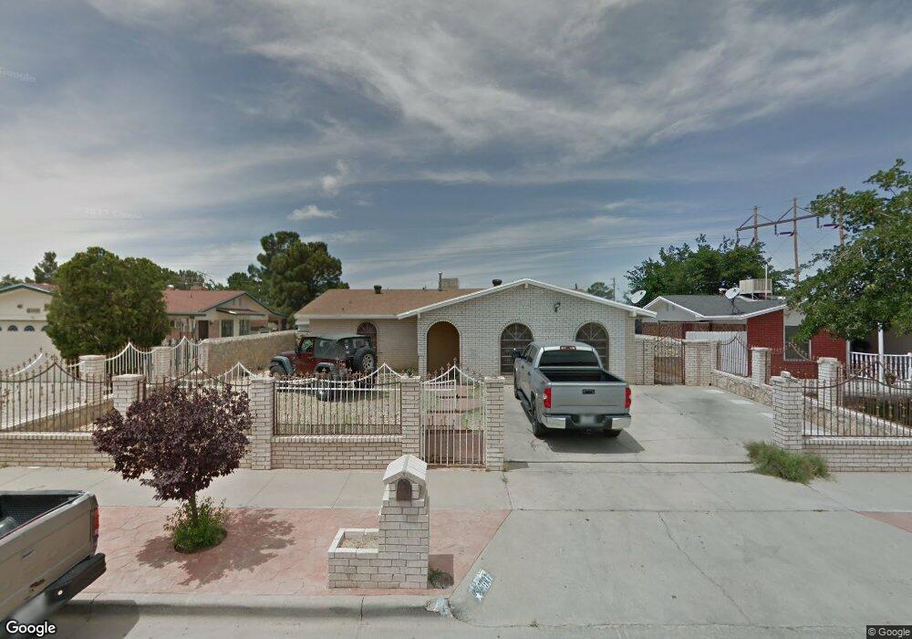
1831 Robert Wynn St El Paso, TX 79936
Vista Del Sol NeighborhoodEstimated Value: $214,611 - $236,000
4
Beds
2
Baths
1,181
Sq Ft
$190/Sq Ft
Est. Value
About This Home
This home is located at 1831 Robert Wynn St, El Paso, TX 79936 and is currently estimated at $224,403, approximately $190 per square foot. 1831 Robert Wynn St is a home located in El Paso County with nearby schools including Tierra Del Sol Elementary School, J M Hanks High School, and Vista Del Futuro Charter School.
Ownership History
Date
Name
Owned For
Owner Type
Purchase Details
Closed on
Oct 14, 2022
Sold by
Grolou Luis A
Bought by
Duran Martha Patricia
Current Estimated Value
Purchase Details
Closed on
Mar 27, 2003
Sold by
Chavez Miguel and Chavez Maria Esther
Bought by
Grolou Luis A and Grolou Evelia O
Home Financials for this Owner
Home Financials are based on the most recent Mortgage that was taken out on this home.
Original Mortgage
$71,000
Interest Rate
5.77%
Create a Home Valuation Report for This Property
The Home Valuation Report is an in-depth analysis detailing your home's value as well as a comparison with similar homes in the area
Home Values in the Area
Average Home Value in this Area
Purchase History
| Date | Buyer | Sale Price | Title Company |
|---|---|---|---|
| Duran Martha Patricia | -- | -- | |
| Grolou Luis A | -- | -- |
Source: Public Records
Mortgage History
| Date | Status | Borrower | Loan Amount |
|---|---|---|---|
| Previous Owner | Grolou Luis A | $71,000 |
Source: Public Records
Tax History Compared to Growth
Tax History
| Year | Tax Paid | Tax Assessment Tax Assessment Total Assessment is a certain percentage of the fair market value that is determined by local assessors to be the total taxable value of land and additions on the property. | Land | Improvement |
|---|---|---|---|---|
| 2025 | $4,928 | $180,915 | -- | -- |
| 2024 | $4,928 | $180,498 | $20,238 | $160,260 |
| 2023 | $4,352 | $149,516 | $20,238 | $129,278 |
| 2022 | $4,643 | $149,516 | $20,238 | $129,278 |
| 2021 | $4,191 | $128,948 | $20,238 | $108,710 |
| 2020 | $3,103 | $98,238 | $18,370 | $79,868 |
| 2018 | $3,138 | $100,907 | $18,370 | $82,537 |
| 2017 | $2,842 | $92,988 | $18,370 | $74,618 |
| 2016 | $2,842 | $92,988 | $18,370 | $74,618 |
| 2015 | $2,811 | $92,988 | $18,370 | $74,618 |
| 2014 | $2,811 | $98,235 | $18,370 | $79,865 |
Source: Public Records
Map
Nearby Homes
- 1804 Jerry Abbott St
- 1739 Jerry Abbott St
- 1913 Seagull Dr
- 1868 Tom Bolt Dr
- 2101 E Glen Dr
- 1703 Robert Wynn St
- 1700 Jerry Abbott St
- 11204 Bob Mitchell Dr
- 1817 Hugh Royer Place
- 2604 Anise Dr
- 3655 George Dieter Dr
- 1901 Bobby Jones Dr
- 1617 Tommy Aaron Dr
- 1607 Tommy Aaron Dr
- 2001 Bobby Jones Dr Unit A
- 2348 Sea Side Dr
- 11016 Bob Stone Dr
- 2009 Bobby Jones Dr Unit B
- 1935 Bay City Place
- 11012 Bob Stone Dr
- 1833 Robert Wynn St
- 1829 Robert Wynn St
- 1827 Robert Wynn St
- 11201 Les Peterson Ln
- 1825 Robert Wynn St
- 1826 Robert Wynn St
- 1826 Robert Wynn St Unit na
- 1844 Dale Douglas Dr
- 1848 Dale Douglas Dr
- 1840 Dale Douglas Dr
- 11203 Les Peterson Ln
- 1824 Robert Wynn St
- 1823 Robert Wynn St
- 1829 Jerry Abbott St
- 1836 Dale Douglas Dr
- 1861 Robert Wynn St Unit B
- 11205 Les Peterson Ln
- 1827 Jerry Abbott St
- 1822 Robert Wynn St
- 1821 Robert Wynn St