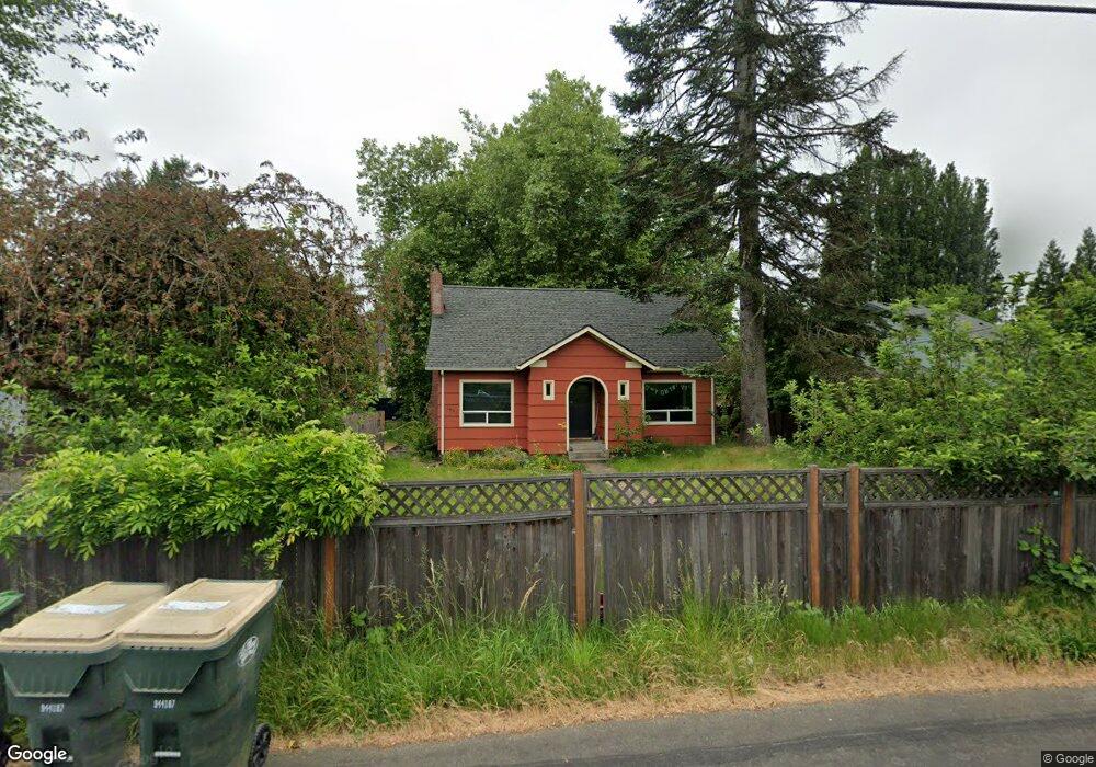
1831 S Bay Rd NE Olympia, WA 98506
Northeast Olympia NeighborhoodEstimated Value: $469,000 - $565,000
3
Beds
2
Baths
1,552
Sq Ft
$342/Sq Ft
Est. Value
About This Home
This home is located at 1831 S Bay Rd NE, Olympia, WA 98506 and is currently estimated at $531,167, approximately $342 per square foot. 1831 S Bay Rd NE is a home located in Thurston County with nearby schools including South Bay Elementary School, Chinook Middle School, and North Thurston High School.
Ownership History
Date
Name
Owned For
Owner Type
Purchase Details
Closed on
Dec 12, 2014
Sold by
Deforest Dale
Bought by
Crabapple Max and Crabapple Dean
Current Estimated Value
Home Financials for this Owner
Home Financials are based on the most recent Mortgage that was taken out on this home.
Original Mortgage
$149,000
Outstanding Balance
$114,259
Interest Rate
3.95%
Mortgage Type
New Conventional
Estimated Equity
$416,908
Purchase Details
Closed on
May 7, 2014
Sold by
The Bank Of New York Mellon Trust Compan
Bought by
Deforest Dale
Purchase Details
Closed on
Jan 13, 2014
Sold by
Murphy Michael D
Bought by
The Bank Of New York Mellon Trust Compan
Create a Home Valuation Report for This Property
The Home Valuation Report is an in-depth analysis detailing your home's value as well as a comparison with similar homes in the area
Home Values in the Area
Average Home Value in this Area
Purchase History
| Date | Buyer | Sale Price | Title Company |
|---|---|---|---|
| Crabapple Max | -- | First American Title | |
| Deforest Dale | $126,600 | First American Title | |
| The Bank Of New York Mellon Trust Compan | $130,786 | Nextitle |
Source: Public Records
Mortgage History
| Date | Status | Borrower | Loan Amount |
|---|---|---|---|
| Open | Crabapple Max | $149,000 |
Source: Public Records
Tax History Compared to Growth
Tax History
| Year | Tax Paid | Tax Assessment Tax Assessment Total Assessment is a certain percentage of the fair market value that is determined by local assessors to be the total taxable value of land and additions on the property. | Land | Improvement |
|---|---|---|---|---|
| 2024 | $4,653 | $479,600 | $149,800 | $329,800 |
| 2023 | $4,653 | $476,300 | $141,700 | $334,600 |
| 2022 | $4,324 | $468,000 | $110,600 | $357,400 |
| 2021 | $3,703 | $362,400 | $89,300 | $273,100 |
| 2020 | $3,371 | $288,300 | $83,900 | $204,400 |
| 2019 | $2,969 | $269,600 | $67,400 | $202,200 |
| 2018 | $3,229 | $230,700 | $59,700 | $171,000 |
| 2017 | $3,106 | $231,150 | $59,950 | $171,200 |
| 2016 | $2,119 | $212,000 | $56,200 | $155,800 |
| 2014 | -- | $152,850 | $56,750 | $96,100 |
Source: Public Records
Map
Nearby Homes
- 1321 S Bay Rd NE
- 1714 Ann St NE
- 1931 Miller Ave NE
- 1832 Fairview St NE
- 2505 Simon Ln NE
- 2932 8th Ave NE Unit 24
- 2002 Marion St NE
- 2908 6th Ave NE Unit 28
- 2908 6th Ave NE
- Noah Plan at Pattison Place
- Rose Plan at Pattison Place
- Lina Plan at Pattison Place
- Finley Plan at Pattison Place
- 2326 Bigelow Ave NE
- 2306 Bigelow Ave NE
- 2902 6th NE
- 2914 6th Ave NE Unit 27
- 2914 6th Ave NE
- 2920 6th NE Unit 26
- 2920 6th NE
- 1831 South Bay Rd NE
- 1814 Meixner St NE
- 2636 18th Ave NE
- 1808 Meixner St NE
- 1812 Meixner St NE
- 1818 Meixner St NE
- 2630 18th Ave NE
- 1816 Meixner St NE
- 2635 18th Ave NE
- 2714 18th Ave NE
- 1900 South Bay Rd NE
- 2626 18th Ave NE
- 1903 South Bay Rd NE
- 2645 18th Ave NE
- 1824 Sullivan St NE
- 1828 Sullivan St NE
- 2526 18th Ave NE
- 1820 Meixner St NE
- 2610 18th Ave NE
- 1840 Sullivan St NE