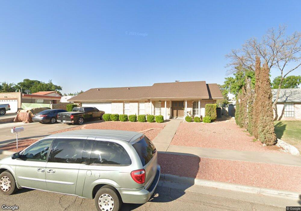
1831 Tom Bolt Dr El Paso, TX 79936
Vista Del Sol NeighborhoodEstimated Value: $289,000 - $332,000
4
Beds
3
Baths
2,038
Sq Ft
$149/Sq Ft
Est. Value
About This Home
This home is located at 1831 Tom Bolt Dr, El Paso, TX 79936 and is currently estimated at $303,379, approximately $148 per square foot. 1831 Tom Bolt Dr is a home located in El Paso County with nearby schools including Tierra Del Sol Elementary School, J M Hanks High School, and EL PASO LEADERSHIP ACADEMY - MIDDLE EAST.
Ownership History
Date
Name
Owned For
Owner Type
Purchase Details
Closed on
Sep 7, 2001
Sold by
Orduno Henry R and Orduno Amelia A
Bought by
Ramos George A and Ramos Leticia
Current Estimated Value
Home Financials for this Owner
Home Financials are based on the most recent Mortgage that was taken out on this home.
Original Mortgage
$127,000
Interest Rate
6.57%
Create a Home Valuation Report for This Property
The Home Valuation Report is an in-depth analysis detailing your home's value as well as a comparison with similar homes in the area
Home Values in the Area
Average Home Value in this Area
Purchase History
| Date | Buyer | Sale Price | Title Company |
|---|---|---|---|
| Ramos George A | -- | -- |
Source: Public Records
Mortgage History
| Date | Status | Borrower | Loan Amount |
|---|---|---|---|
| Previous Owner | Ramos George A | $127,000 |
Source: Public Records
Tax History Compared to Growth
Tax History
| Year | Tax Paid | Tax Assessment Tax Assessment Total Assessment is a certain percentage of the fair market value that is determined by local assessors to be the total taxable value of land and additions on the property. | Land | Improvement |
|---|---|---|---|---|
| 2025 | $4,710 | $267,105 | -- | -- |
| 2024 | $4,710 | $242,823 | -- | -- |
| 2023 | $4,430 | $220,748 | $0 | $0 |
| 2022 | $6,232 | $200,680 | $0 | $0 |
| 2021 | $5,930 | $182,436 | $30,451 | $151,985 |
| 2020 | $5,639 | $178,541 | $27,640 | $150,901 |
| 2018 | $5,384 | $173,119 | $27,640 | $145,479 |
| 2017 | $4,967 | $162,723 | $27,640 | $135,083 |
| 2016 | $4,515 | $147,713 | $27,640 | $120,073 |
| 2015 | $3,609 | $147,713 | $27,640 | $120,073 |
| 2014 | $3,609 | $149,501 | $27,640 | $121,861 |
Source: Public Records
Map
Nearby Homes
- 1868 Tom Bolt Dr
- 1817 Hugh Royer Place
- 1901 Bobby Jones Dr
- 1913 Seagull Dr
- 2001 Bobby Jones Dr Unit A
- 1804 Jerry Abbott St
- 1739 Jerry Abbott St
- 2009 Bobby Jones Dr Unit B
- 11204 Bob Mitchell Dr
- 11016 Bob Stone Dr
- 11012 Bob Stone Dr
- 11013 Bob Stone Dr
- 1703 Robert Wynn St
- 1617 Tommy Aaron Dr
- 1844 Jack Nicklaus Dr Unit 1846
- 1700 Jerry Abbott St
- 2604 Anise Dr
- 11157 Leo Collins Dr
- 1607 Tommy Aaron Dr
- 11262 Enid Wilson Ln
- 1835 Tom Bolt Dr
- 1827 Tom Bolt Dr
- 1820 Mike Hill Dr
- 1824 Mike Hill Dr
- 1816 Mike Hill Dr
- 1837 Tom Bolt Dr
- 1823 Tom Bolt Dr
- 1832 Tom Bolt Dr
- 1828 Tom Bolt Dr
- 1836 Tom Bolt Dr
- 1828 Mike Hill Dr
- 1812 Mike Hill Dr
- 1824 Tom Bolt Dr
- 1817 Tom Bolt Dr
- 1840 Tom Bolt Dr
- 1832 Mike Hill Dr
- 1839 Tom Bolt Dr
- 1808 Mike Hill Dr
- 1841 Tommy Aaron Dr
- 1819 Mike Hill Dr