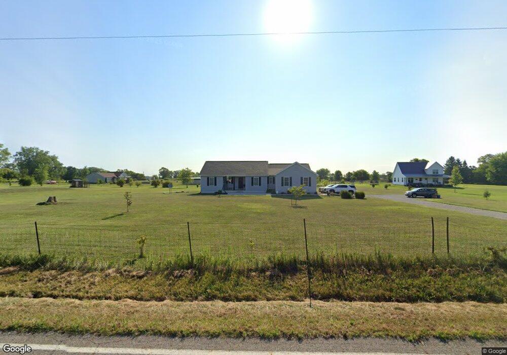
18314 Clarks Run Rd Mount Sterling, OH 43143
Estimated Value: $416,000 - $488,000
3
Beds
2
Baths
3,113
Sq Ft
$144/Sq Ft
Est. Value
About This Home
This home is located at 18314 Clarks Run Rd, Mount Sterling, OH 43143 and is currently estimated at $447,880, approximately $143 per square foot. 18314 Clarks Run Rd is a home with nearby schools including Westfall Elementary School, Westfall Middle School, and Westfall High School.
Ownership History
Date
Name
Owned For
Owner Type
Purchase Details
Closed on
Apr 19, 2016
Sold by
Northpointe Bank
Bought by
Tuttle Tamara and Tuttle Justin
Current Estimated Value
Home Financials for this Owner
Home Financials are based on the most recent Mortgage that was taken out on this home.
Original Mortgage
$24,225
Outstanding Balance
$10,626
Interest Rate
3.73%
Mortgage Type
Unknown
Estimated Equity
$437,254
Create a Home Valuation Report for This Property
The Home Valuation Report is an in-depth analysis detailing your home's value as well as a comparison with similar homes in the area
Home Values in the Area
Average Home Value in this Area
Purchase History
| Date | Buyer | Sale Price | Title Company |
|---|---|---|---|
| Tuttle Tamara | $28,500 | Transcounty Title Agency Llc |
Source: Public Records
Mortgage History
| Date | Status | Borrower | Loan Amount |
|---|---|---|---|
| Open | Tuttle Tamara | $24,225 |
Source: Public Records
Tax History Compared to Growth
Tax History
| Year | Tax Paid | Tax Assessment Tax Assessment Total Assessment is a certain percentage of the fair market value that is determined by local assessors to be the total taxable value of land and additions on the property. | Land | Improvement |
|---|---|---|---|---|
| 2024 | -- | $110,710 | $17,770 | $92,940 |
| 2023 | $3,604 | $110,710 | $17,770 | $92,940 |
| 2022 | $3,209 | $84,940 | $14,290 | $70,650 |
| 2021 | $3,245 | $102,810 | $14,290 | $88,520 |
| 2020 | $3,933 | $102,810 | $14,290 | $88,520 |
| 2019 | $1,592 | $82,660 | $13,150 | $69,510 |
| 2018 | $2,507 | $66,570 | $10,960 | $55,610 |
| 2017 | $656 | $10,960 | $10,960 | $0 |
| 2016 | $208 | $5,420 | $5,420 | $0 |
| 2015 | $133 | $5,420 | $5,420 | $0 |
| 2014 | $134 | $5,420 | $5,420 | $0 |
| 2013 | $63 | $4,440 | $4,440 | $0 |
Source: Public Records
Map
Nearby Homes
- 16270 Cook Yankeetown Rd NE
- 8713 State Route 207
- 15561 Blain Rd
- 16185 State Route 207
- 500 Wingate Place N
- 12343 State Route 316
- 230 W Columbus St
- 233 W Main St
- 223 W Main St
- 67 W Columbus St
- 0 Yankeetown Pike Unit 225019293
- 60 N London St
- 11821 State Route 56 W
- 94 Jefferson St
- 21651 Hannawalt Rd
- 233 Rosewood Ave
- 178 Poplar St
- 14035 Woods Opossum Run Rd Unit R
- 11744 Yankeetown Pike
- 0 Rockwell Rd Unit 225016734
- 15285 Call Rd
- 15251 Call Rd
- 15240 Call Rd
- 18132 Clarks Run Rd
- 18460 Clarks Run Rd
- 15090 Call Rd
- 18532 Clarks Run Rd
- 18555 Clarks Run Rd
- 18550 Clarks Run Rd
- 13242 Clarks Run Rd
- 18636 Clarks Run Rd
- 18670 Clarks Run Rd
- 14861 Call Rd
- 18734 Clarks Run Rd
- 17881 Clarks Run Rd
- 17802 Clarks Run Rd
- 14740 Call Rd
- 17722 Clarks Run Rd
- 17680 Clarks Run Rd
- 17620 Clarks Run Rd