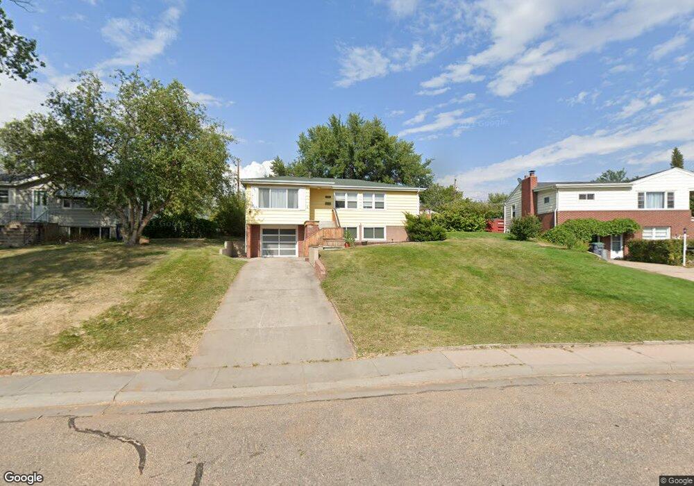
1832 Andover Dr Cheyenne, WY 82001
Estimated Value: $378,000 - $389,479
4
Beds
2
Baths
1,462
Sq Ft
$262/Sq Ft
Est. Value
About This Home
This home is located at 1832 Andover Dr, Cheyenne, WY 82001 and is currently estimated at $383,370, approximately $262 per square foot. 1832 Andover Dr is a home located in Laramie County with nearby schools including Henderson Elementary School, Carey Junior High School, and East High School.
Ownership History
Date
Name
Owned For
Owner Type
Purchase Details
Closed on
Sep 20, 2024
Sold by
Rahrah Real Estate Llc
Bought by
Roascio Jason
Current Estimated Value
Home Financials for this Owner
Home Financials are based on the most recent Mortgage that was taken out on this home.
Original Mortgage
$279,750
Outstanding Balance
$276,605
Interest Rate
6.47%
Mortgage Type
New Conventional
Estimated Equity
$106,765
Purchase Details
Closed on
May 17, 2024
Sold by
Magee Julie M and Kocourek Julie M
Bought by
Rahrah Real Estate Llc
Home Financials for this Owner
Home Financials are based on the most recent Mortgage that was taken out on this home.
Original Mortgage
$200,000
Interest Rate
7.02%
Mortgage Type
Construction
Purchase Details
Closed on
Sep 9, 2015
Sold by
Pannell William D
Bought by
Magee Julie M
Home Financials for this Owner
Home Financials are based on the most recent Mortgage that was taken out on this home.
Original Mortgage
$211,105
Interest Rate
4.37%
Mortgage Type
FHA
Purchase Details
Closed on
Jul 25, 2008
Sold by
Byers Jay D and Byers Lacey A
Bought by
Pannell William D
Purchase Details
Closed on
Apr 13, 2004
Sold by
Household Finance
Bought by
Byers Jay D and Byers Lacey A
Home Financials for this Owner
Home Financials are based on the most recent Mortgage that was taken out on this home.
Original Mortgage
$111,920
Interest Rate
5.61%
Mortgage Type
Purchase Money Mortgage
Purchase Details
Closed on
Jan 9, 2004
Sold by
Taylor Tim and Taylor Stacy
Bought by
Beneficial Wyoming Inc
Purchase Details
Closed on
Sep 8, 2003
Sold by
Hudson D J
Bought by
Beneficial Wyoming Inc
Purchase Details
Closed on
Jul 11, 2001
Sold by
Burdick Gary H and Burdick Kim D
Bought by
Taylor Tim and Taylor Stacy
Home Financials for this Owner
Home Financials are based on the most recent Mortgage that was taken out on this home.
Original Mortgage
$114,300
Interest Rate
7.05%
Create a Home Valuation Report for This Property
The Home Valuation Report is an in-depth analysis detailing your home's value as well as a comparison with similar homes in the area
Home Values in the Area
Average Home Value in this Area
Purchase History
| Date | Buyer | Sale Price | Title Company |
|---|---|---|---|
| Roascio Jason | -- | None Listed On Document | |
| Rahrah Real Estate Llc | -- | None Listed On Document | |
| Magee Julie M | -- | First American Title | |
| Pannell William D | -- | None Available | |
| Byers Jay D | -- | -- | |
| Household Finance | -- | -- | |
| Beneficial Wyoming Inc | $118,440 | -- | |
| Beneficial Wyoming Inc | -- | -- | |
| Taylor Tim | -- | -- |
Source: Public Records
Mortgage History
| Date | Status | Borrower | Loan Amount |
|---|---|---|---|
| Open | Roascio Jason | $279,750 | |
| Previous Owner | Rahrah Real Estate Llc | $200,000 | |
| Previous Owner | Magee Julie M | $211,105 | |
| Previous Owner | Byers Jay D | $111,920 | |
| Previous Owner | Taylor Tim | $114,300 | |
| Closed | Byers Jay D | $20,985 |
Source: Public Records
Tax History Compared to Growth
Tax History
| Year | Tax Paid | Tax Assessment Tax Assessment Total Assessment is a certain percentage of the fair market value that is determined by local assessors to be the total taxable value of land and additions on the property. | Land | Improvement |
|---|---|---|---|---|
| 2025 | $2,483 | $29,644 | $3,461 | $26,183 |
| 2024 | $2,483 | $35,115 | $4,614 | $30,501 |
| 2023 | $2,523 | $35,675 | $4,614 | $31,061 |
| 2022 | $2,155 | $29,853 | $4,614 | $25,239 |
| 2021 | $2,040 | $28,202 | $4,614 | $23,588 |
| 2020 | $1,792 | $24,844 | $4,614 | $20,230 |
| 2019 | $1,706 | $23,628 | $4,614 | $19,014 |
| 2018 | $1,534 | $21,442 | $4,248 | $17,194 |
| 2017 | $1,495 | $20,711 | $4,248 | $16,463 |
| 2016 | $1,401 | $19,398 | $4,021 | $15,377 |
| 2015 | $1,304 | $18,050 | $4,021 | $14,029 |
| 2014 | $1,156 | $15,907 | $4,021 | $11,886 |
Source: Public Records
Map
Nearby Homes
- 1813 Andover Dr
- 1813 Newton Dr
- 1801 Milton Dr
- 1958 Newton Dr
- 3700 Essex Rd
- 3444 Dover Rd
- 1751 E Pershing Blvd
- 1731 E Pershing Blvd
- 1718 Newton Dr
- 3529 Concord Rd
- 1702 Newton Dr
- 1808 E 21st St
- 3561 Boston Rd
- 1610 E 20th St
- TBD Charles St
- TBD E Lincolnway
- 3628 Amherst Rd
- Lot 1 E Phipps Ave
- Tract 1 E Pershing Blvd
- 1408 E 22nd St
- 1836 Andover Dr
- 1826 Andover Dr
- 1822 Andover Dr
- 1823 Milton Dr
- 1840 Andover Dr
- 1827 Milton Dr
- 1819 Milton Dr
- 1831 Milton Dr
- 1815 Milton Dr
- 1837 Andover Dr
- 1835 Milton Dr
- 1814 Andover Dr
- 1831 Andover Dr
- 1846 Andover Dr
- 1825 Andover Dr
- 1839 Milton Dr
- 1811 Milton Dr
- 1847 Andover Dr
- 1819 Andover Dr
- 1810 Andover Dr