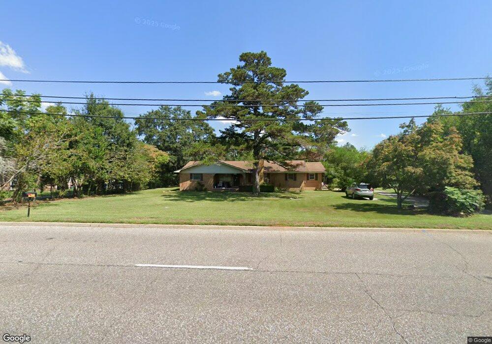
1832 Denton Rd Dothan, AL 36303
Estimated Value: $176,000 - $217,000
3
Beds
2
Baths
1,590
Sq Ft
$123/Sq Ft
Est. Value
About This Home
This home is located at 1832 Denton Rd, Dothan, AL 36303 and is currently estimated at $195,463, approximately $122 per square foot. 1832 Denton Rd is a home located in Houston County with nearby schools including Dothan City Early Education Center, Girard Elementary School, and Dothan 6th Grade Center.
Ownership History
Date
Name
Owned For
Owner Type
Purchase Details
Closed on
May 26, 2009
Sold by
Horton Mary Lisa
Bought by
Perry Vincent Edward
Current Estimated Value
Home Financials for this Owner
Home Financials are based on the most recent Mortgage that was taken out on this home.
Original Mortgage
$117,335
Outstanding Balance
$74,134
Interest Rate
4.77%
Mortgage Type
Purchase Money Mortgage
Estimated Equity
$121,329
Purchase Details
Closed on
Mar 3, 2009
Sold by
Horton Mary Lisa and Horton Isaac M
Bought by
Horton Mary Lisa
Create a Home Valuation Report for This Property
The Home Valuation Report is an in-depth analysis detailing your home's value as well as a comparison with similar homes in the area
Home Values in the Area
Average Home Value in this Area
Purchase History
| Date | Buyer | Sale Price | Title Company |
|---|---|---|---|
| Perry Vincent Edward | $119,500 | -- | |
| Horton Mary Lisa | $100 | -- |
Source: Public Records
Mortgage History
| Date | Status | Borrower | Loan Amount |
|---|---|---|---|
| Open | Perry Vincent Edward | $117,335 |
Source: Public Records
Tax History Compared to Growth
Tax History
| Year | Tax Paid | Tax Assessment Tax Assessment Total Assessment is a certain percentage of the fair market value that is determined by local assessors to be the total taxable value of land and additions on the property. | Land | Improvement |
|---|---|---|---|---|
| 2024 | $497 | $14,600 | $0 | $0 |
| 2023 | $471 | $13,300 | $0 | $0 |
| 2022 | $372 | $12,280 | $0 | $0 |
| 2021 | $347 | $12,780 | $0 | $0 |
| 2020 | $343 | $11,460 | $0 | $0 |
| 2019 | $334 | $11,200 | $0 | $0 |
| 2018 | $334 | $11,200 | $0 | $0 |
| 2017 | $346 | $11,540 | $0 | $0 |
| 2016 | $346 | $0 | $0 | $0 |
| 2015 | $346 | $0 | $0 | $0 |
| 2014 | $343 | $0 | $0 | $0 |
Source: Public Records
Map
Nearby Homes
- 1935 Denton Rd
- 203 Aspen Cir
- 1638 Denton Rd
- 1594 Denton Rd
- 207 Seeba Dr
- 1102 Northfield Cir
- 1700 Randall Rd
- 1404 Hiawatha Dr
- 408 Rebecca Ave
- 1906 Sullivan Dr
- 1702 Impala Dr
- 1709 & 1711 Verde Trail
- 1804 Azure Dr
- 1922 Sullivan Dr
- 1803 Azure Dr
- 2102 Centenial Dr
- 1106 N Pontiac Ave
- 706 Wildwood Ave
- 0 E Wilson St
- 2003 Baker Trace
- 1848 Denton Rd
- 1404 Northfield Cir
- 1821 Denton Rd
- 1860 Denton Rd
- 1845 Denton Rd
- 1402 Northfield Cir
- 2001 Adrian Rd
- 1400 Northfield Cir
- 1874 Denton Rd
- 1859 Denton Rd
- 1793 Denton Rd
- 1403 Northfield Cir
- 1905 Adrian Rd
- 1326 Northfield Cir
- 2000 Adrian Rd
- 1401 Northfield Cir
- 1881 Denton Rd
- 1886 Denton Rd
- 1783 Denton Rd
- 1324 Northfield Cir