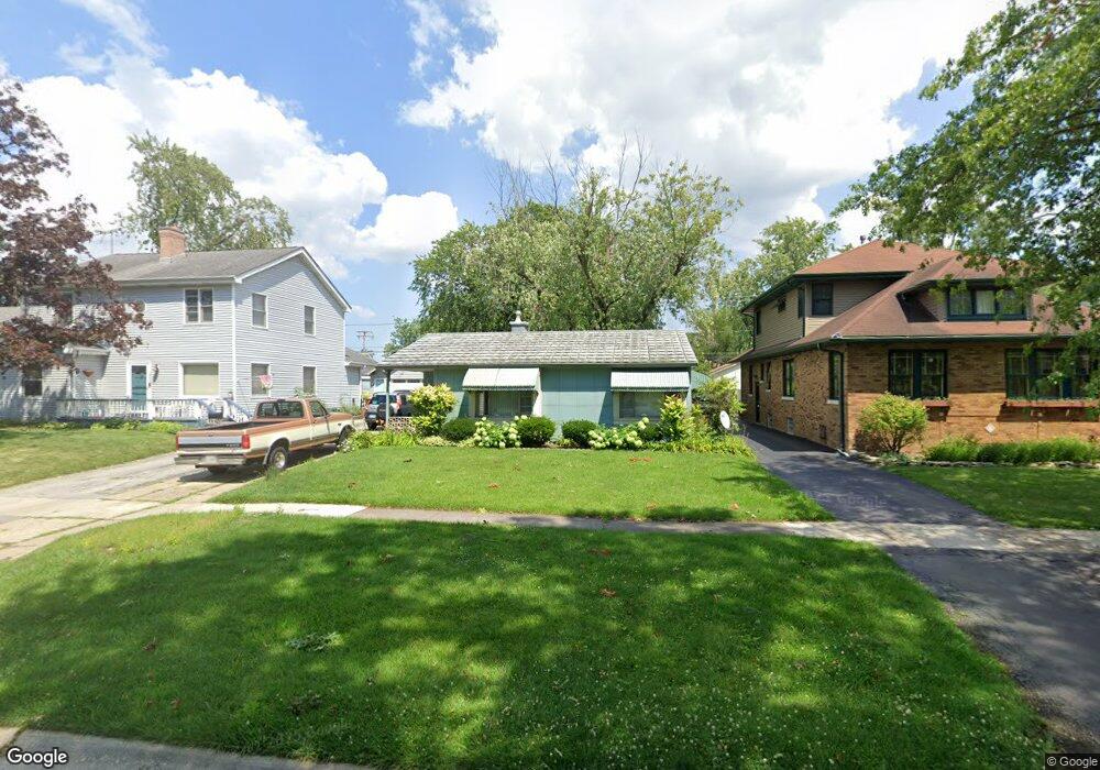
18329 Perth Ave Homewood, IL 60430
Estimated Value: $172,000 - $209,000
2
Beds
1
Bath
997
Sq Ft
$194/Sq Ft
Est. Value
About This Home
This home is located at 18329 Perth Ave, Homewood, IL 60430 and is currently estimated at $193,572, approximately $194 per square foot. 18329 Perth Ave is a home located in Cook County with nearby schools including Western Avenue Elementary School, Parker Junior High School, and Homewood-Flossmoor High School.
Ownership History
Date
Name
Owned For
Owner Type
Purchase Details
Closed on
Dec 15, 1997
Sold by
Andersen Mallory and Kaplan Mallory
Bought by
Triezenberg Sheila and Stoffle Gregg A
Current Estimated Value
Home Financials for this Owner
Home Financials are based on the most recent Mortgage that was taken out on this home.
Original Mortgage
$74,700
Outstanding Balance
$11,221
Interest Rate
7.12%
Estimated Equity
$182,351
Create a Home Valuation Report for This Property
The Home Valuation Report is an in-depth analysis detailing your home's value as well as a comparison with similar homes in the area
Home Values in the Area
Average Home Value in this Area
Purchase History
| Date | Buyer | Sale Price | Title Company |
|---|---|---|---|
| Triezenberg Sheila | $83,000 | Attorneys Natl Title Network |
Source: Public Records
Mortgage History
| Date | Status | Borrower | Loan Amount |
|---|---|---|---|
| Open | Triezenberg Sheila | $74,700 |
Source: Public Records
Tax History
| Year | Tax Paid | Tax Assessment Tax Assessment Total Assessment is a certain percentage of the fair market value that is determined by local assessors to be the total taxable value of land and additions on the property. | Land | Improvement |
|---|---|---|---|---|
| 2025 | $3,327 | $12,001 | $3,738 | $8,263 |
| 2024 | $3,327 | $12,001 | $3,738 | $8,263 |
| 2023 | $2,688 | $12,001 | $3,738 | $8,263 |
| 2022 | $2,688 | $8,898 | $3,250 | $5,648 |
| 2021 | $2,732 | $8,898 | $3,250 | $5,648 |
| 2020 | $2,728 | $8,898 | $3,250 | $5,648 |
| 2019 | $3,516 | $10,559 | $2,925 | $7,634 |
| 2018 | $3,421 | $10,559 | $2,925 | $7,634 |
| 2017 | $3,388 | $10,559 | $2,925 | $7,634 |
| 2016 | $2,954 | $8,552 | $2,600 | $5,952 |
| 2015 | $2,900 | $8,552 | $2,600 | $5,952 |
| 2014 | $2,868 | $8,552 | $2,600 | $5,952 |
| 2013 | $3,493 | $10,586 | $2,600 | $7,986 |
Source: Public Records
Map
Nearby Homes
- 18404 Perth Ave
- 18441 Stewart Ave
- 18210 Perth Ave
- 2301 183rd St Unit 401
- 18450 Stedhall Rd
- 18509 Stedhall Rd
- 18157 Rockwell Ave
- 2619 Alexander St
- 18530 Stedhall Rd
- 625 Perth Ave
- 18310 Cherry Creek Dr Unit 2
- 18400 Cherry Creek Dr Unit 105
- 18537 Palmer Ave
- 18625 Golfview Ave
- 2807 Willow Rd Unit 103
- 710 Bruce Ave
- 18050 Marlin Ln
- 2303 Hutchison Rd
- 2055 183rd St
- 18104 Park Ave
- 18327 Perth Ave
- 18337 Perth Ave
- 18323 Perth Ave
- 18339 Perth Ave
- 18328 Dundee Ave
- 18334 Dundee Ave
- 18322 Dundee Ave
- 18345 Perth Ave
- 18317 Perth Ave
- 18340 Dundee Ave
- 18344 Dundee Ave
- 18344 Dundee Ave
- 2447 Crescent Rd
- 18334 Perth Ave
- 18349 Perth Ave
- 18324 Perth Ave
- 18338 Perth Ave
- 18342 Perth Ave
- 18355 Perth Ave
- 18346 Perth Ave