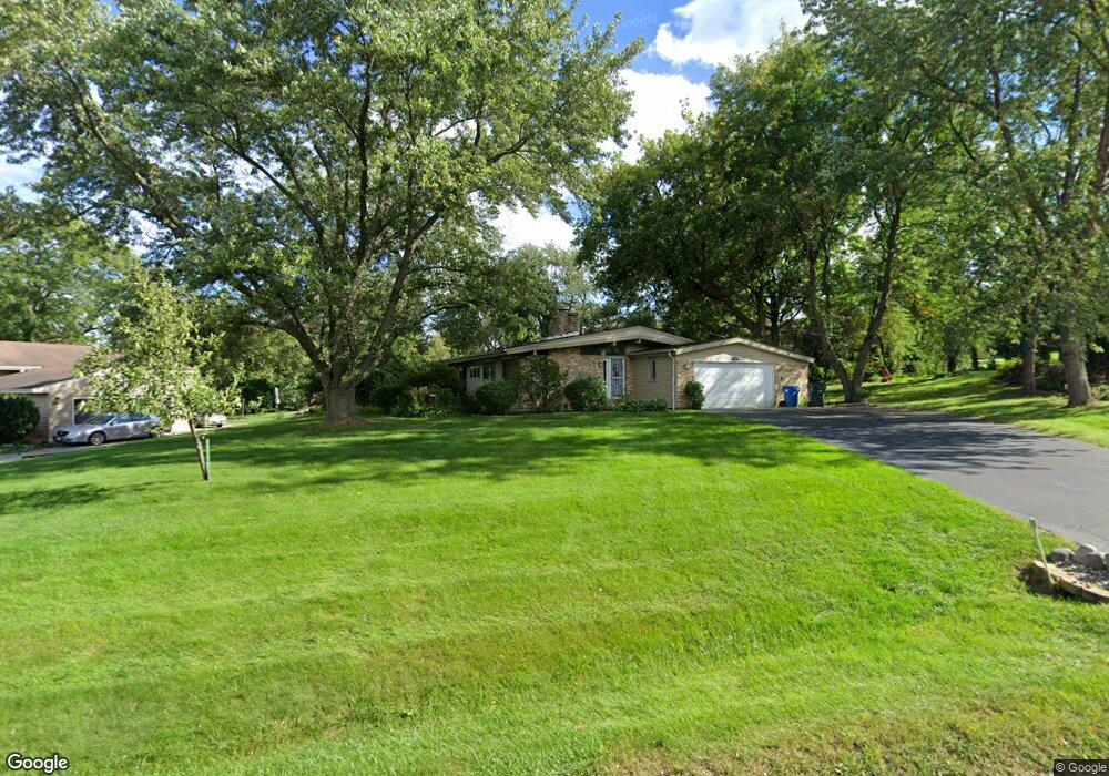
1833 Maple Ln Sleepy Hollow, IL 60118
Estimated Value: $323,266 - $412,000
3
Beds
1
Bath
1,228
Sq Ft
$290/Sq Ft
Est. Value
About This Home
This home is located at 1833 Maple Ln, Sleepy Hollow, IL 60118 and is currently estimated at $356,067, approximately $289 per square foot. 1833 Maple Ln is a home located in Kane County with nearby schools including Sleepy Hollow Elementary School, Dundee Middle School, and Dundee-Crown High School.
Ownership History
Date
Name
Owned For
Owner Type
Purchase Details
Closed on
Jan 8, 2009
Sold by
Peterson Joshua R and Peterson Erin A
Bought by
Miskic Simun and Miskic Snezana
Current Estimated Value
Home Financials for this Owner
Home Financials are based on the most recent Mortgage that was taken out on this home.
Original Mortgage
$168,000
Outstanding Balance
$106,247
Interest Rate
5.19%
Mortgage Type
Purchase Money Mortgage
Estimated Equity
$249,820
Purchase Details
Closed on
Aug 19, 2005
Sold by
Chism Christopher D and Chism Stacy L
Bought by
Peterson Joshua R and Peterson Erin A
Purchase Details
Closed on
Jan 3, 2002
Sold by
Schopp Richard P and Schopp Carol E
Bought by
Chism Christopher D and Chism Stacy L
Home Financials for this Owner
Home Financials are based on the most recent Mortgage that was taken out on this home.
Original Mortgage
$172,197
Interest Rate
7.07%
Mortgage Type
FHA
Create a Home Valuation Report for This Property
The Home Valuation Report is an in-depth analysis detailing your home's value as well as a comparison with similar homes in the area
Home Values in the Area
Average Home Value in this Area
Purchase History
| Date | Buyer | Sale Price | Title Company |
|---|---|---|---|
| Miskic Simun | $224,000 | Multiple | |
| Peterson Joshua R | $235,000 | Law Title Insurance | |
| Chism Christopher D | $175,000 | -- |
Source: Public Records
Mortgage History
| Date | Status | Borrower | Loan Amount |
|---|---|---|---|
| Open | Miskic Simun | $168,000 | |
| Previous Owner | Chism Christopher D | $172,197 |
Source: Public Records
Tax History Compared to Growth
Tax History
| Year | Tax Paid | Tax Assessment Tax Assessment Total Assessment is a certain percentage of the fair market value that is determined by local assessors to be the total taxable value of land and additions on the property. | Land | Improvement |
|---|---|---|---|---|
| 2024 | $2,881 | $81,036 | $29,156 | $51,880 |
| 2023 | $3,080 | $72,914 | $26,234 | $46,680 |
| 2022 | $3,559 | $72,466 | $26,234 | $46,232 |
| 2021 | $3,665 | $68,422 | $24,770 | $43,652 |
| 2020 | $3,686 | $66,884 | $24,213 | $42,671 |
| 2019 | $3,787 | $63,494 | $22,986 | $40,508 |
| 2018 | $3,919 | $62,884 | $22,531 | $40,353 |
| 2017 | $4,454 | $58,825 | $21,077 | $37,748 |
| 2016 | $4,334 | $54,886 | $22,569 | $32,317 |
| 2015 | -- | $51,430 | $21,148 | $30,282 |
| 2014 | -- | $52,782 | $20,564 | $32,218 |
| 2013 | -- | $54,397 | $21,193 | $33,204 |
Source: Public Records
Map
Nearby Homes
- 849 Hemlock Dr
- 1042 Chateau Bluff Ln
- 900 Holly Ct
- 842 Winmoor Dr
- 37 River Ridge Dr
- 0000 Strom Dr
- 937 Willow Ln
- 1214 Carol Crest Dr
- 214 S 7th St
- 503 Edinburgh Ln
- 496 Edinburgh Ln
- 325 Sharon Dr
- 404 Washington St
- 516 S 1st St
- 215 Sharon Dr
- 1715 W Main St
- 936 Glen Oak Dr
- Lot 1 View St
- 10 Chateau Dr
- 825 Lindsay Ln
- 1831 Maple Ln
- 1835 Maple Ln
- 838 Hemlock Dr
- 834 Hemlock Dr
- 842 Hemlock Dr Unit 8
- 830 Hemlock Dr
- 1829 Maple Ln
- 1840 Maple Ln
- 1834 Maple Ln
- 828 Hemlock Dr Unit 8
- 1838 Maple Ln Unit 8
- 1832 Maple Ln
- 826 Hemlock Dr
- 846 Hemlock Dr
- 843 Hemlock Dr
- 841 Hemlock Dr
- 823 Locust Dr
- 859 Willow Ln
- 839 Hemlock Dr
- 835 Hemlock Dr Unit 8