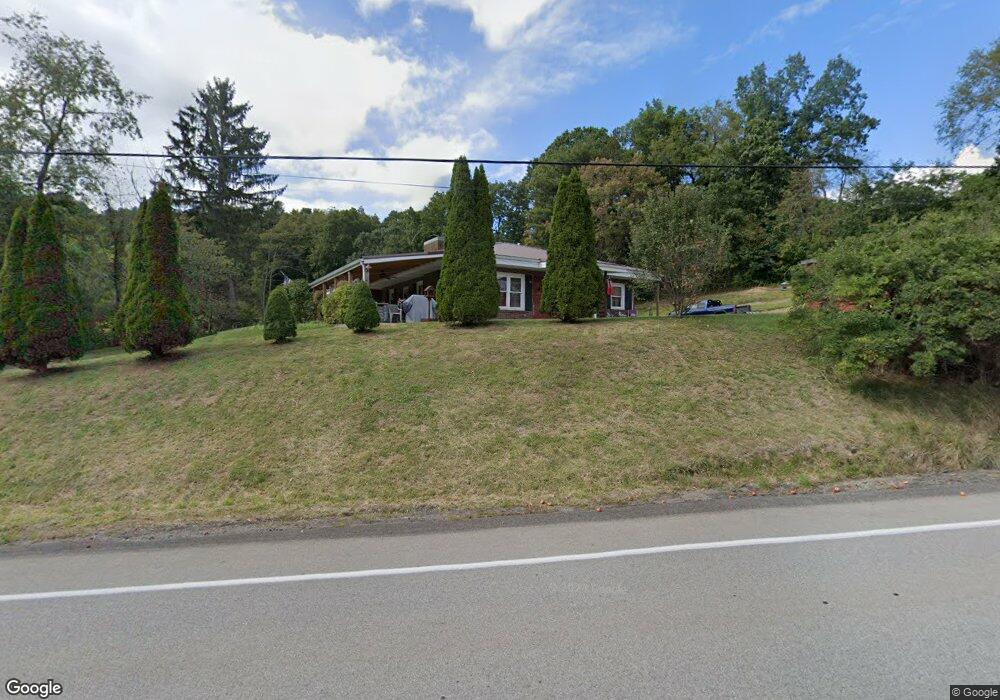
1833 Route 66 New Bethlehem, PA 16242
Estimated Value: $110,096 - $188,000
2
Beds
1
Bath
1,440
Sq Ft
$110/Sq Ft
Est. Value
About This Home
This home is located at 1833 Route 66, New Bethlehem, PA 16242 and is currently estimated at $158,774, approximately $110 per square foot. 1833 Route 66 is a home located in Clarion County with nearby schools including Redbank Valley Primary School, Redbank Valley Intermediate School, and Redbank Valley High School.
Ownership History
Date
Name
Owned For
Owner Type
Purchase Details
Closed on
Feb 21, 2018
Sold by
Ochs Investment Lp
Bought by
Hepler Jeffrey G and Hepler Tena L
Current Estimated Value
Purchase Details
Closed on
Jan 20, 2009
Sold by
Aaron Shirley J
Bought by
Buzard Jeremy L and Shrecengost Ashley D
Home Financials for this Owner
Home Financials are based on the most recent Mortgage that was taken out on this home.
Original Mortgage
$16,058
Interest Rate
5.2%
Mortgage Type
Purchase Money Mortgage
Create a Home Valuation Report for This Property
The Home Valuation Report is an in-depth analysis detailing your home's value as well as a comparison with similar homes in the area
Home Values in the Area
Average Home Value in this Area
Purchase History
| Date | Buyer | Sale Price | Title Company |
|---|---|---|---|
| Hepler Jeffrey G | $2,500 | None Available | |
| Buzard Jeremy L | $87,500 | -- |
Source: Public Records
Mortgage History
| Date | Status | Borrower | Loan Amount |
|---|---|---|---|
| Previous Owner | Buzard Jeremy L | $16,058 | |
| Previous Owner | Buzard Jeremy L | $72,610 |
Source: Public Records
Tax History Compared to Growth
Tax History
| Year | Tax Paid | Tax Assessment Tax Assessment Total Assessment is a certain percentage of the fair market value that is determined by local assessors to be the total taxable value of land and additions on the property. | Land | Improvement |
|---|---|---|---|---|
| 2025 | $2,323 | $32,074 | $1,500 | $30,574 |
| 2024 | $2,276 | $32,074 | $1,500 | $30,574 |
| 2023 | $2,187 | $32,074 | $1,500 | $30,574 |
| 2022 | $2,167 | $32,074 | $1,500 | $30,574 |
| 2021 | $2,066 | $32,074 | $1,500 | $30,574 |
| 2020 | $1,820 | $32,074 | $1,500 | $30,574 |
| 2019 | $1,820 | $32,074 | $1,500 | $30,574 |
| 2018 | $1,784 | $27,680 | $1,500 | $26,180 |
| 2017 | $1,499 | $27,680 | $1,500 | $26,180 |
| 2016 | $1,525 | $27,680 | $1,500 | $26,180 |
| 2014 | -- | $27,680 | $1,500 | $26,180 |
Source: Public Records
Map
Nearby Homes
- 281 Leisure Rd
- 212 Smith Rd
- 519 Wood St
- 415 Washington St
- 121 Dons Rd
- 127 Penn St
- 400 Penn St
- 732 Penn St
- 416 Penn St
- 00 Olean Trail
- 110 Penn St
- 517 Waterloo Rd
- 200 Allison St
- 914 Oak Ridge Rd
- 3711 Brookville St
- 4161 Maple St
- 128 S Hawthorne Dr
- 4239 Brookville St
- Lot 5 Sherman Heights
- 422 Saint Charles Rd