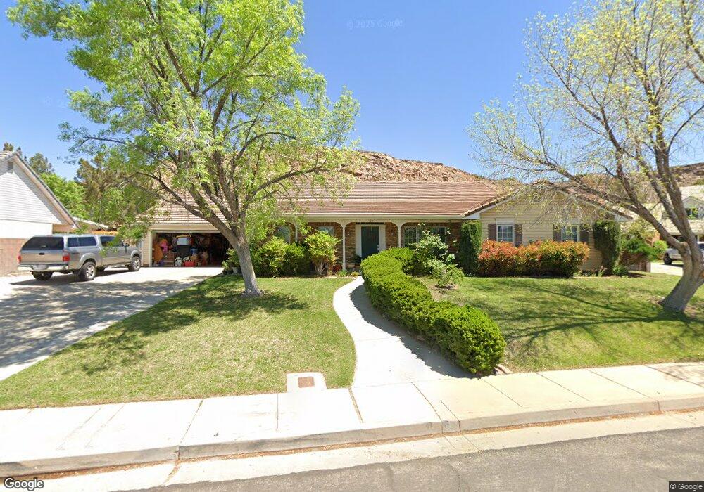
1833 S 1570 E Saint George, UT 84790
Estimated Value: $630,458 - $734,000
5
Beds
3
Baths
2,902
Sq Ft
$238/Sq Ft
Est. Value
About This Home
This home is located at 1833 S 1570 E, Saint George, UT 84790 and is currently estimated at $691,615, approximately $238 per square foot. 1833 S 1570 E is a home located in Washington County with nearby schools including Crimson View Elementary School, Crimson Cliffs Middle School, and Washington Fields Intermediate School.
Ownership History
Date
Name
Owned For
Owner Type
Purchase Details
Closed on
Sep 9, 2021
Sold by
Hunsaker Jared
Bought by
Hunsaker Jared and Hunsaker Susanne
Current Estimated Value
Home Financials for this Owner
Home Financials are based on the most recent Mortgage that was taken out on this home.
Original Mortgage
$268,300
Outstanding Balance
$244,133
Interest Rate
2.8%
Mortgage Type
New Conventional
Estimated Equity
$447,482
Purchase Details
Closed on
Nov 28, 2007
Sold by
Thomas Frank L and Thomas Beverlee
Bought by
Hunsaker Jared
Home Financials for this Owner
Home Financials are based on the most recent Mortgage that was taken out on this home.
Original Mortgage
$333,000
Interest Rate
6.36%
Mortgage Type
Purchase Money Mortgage
Purchase Details
Closed on
Aug 5, 2005
Sold by
Thomas F L F and Thomas Beverlee
Bought by
Thomas Fr Frank L and Thomas Beverlee
Create a Home Valuation Report for This Property
The Home Valuation Report is an in-depth analysis detailing your home's value as well as a comparison with similar homes in the area
Home Values in the Area
Average Home Value in this Area
Purchase History
| Date | Buyer | Sale Price | Title Company |
|---|---|---|---|
| Hunsaker Jared | -- | Accommodation | |
| Hunsaker Jared | -- | Mountain View Title St Georg | |
| Thomas Fr Frank L | -- | Inwest Title Services Inc |
Source: Public Records
Mortgage History
| Date | Status | Borrower | Loan Amount |
|---|---|---|---|
| Open | Hunsaker Jared | $268,300 | |
| Closed | Hunsaker Jared | $333,000 |
Source: Public Records
Tax History Compared to Growth
Tax History
| Year | Tax Paid | Tax Assessment Tax Assessment Total Assessment is a certain percentage of the fair market value that is determined by local assessors to be the total taxable value of land and additions on the property. | Land | Improvement |
|---|---|---|---|---|
| 2025 | $2,151 | $343,695 | $110,715 | $232,980 |
| 2023 | $2,233 | $606,600 | $172,500 | $434,100 |
| 2022 | $4,381 | $615,600 | $147,000 | $468,600 |
| 2021 | $1,903 | $398,800 | $136,500 | $262,300 |
| 2020 | $1,780 | $351,200 | $94,500 | $256,700 |
| 2019 | $1,676 | $323,200 | $89,300 | $233,900 |
| 2018 | $1,711 | $165,330 | $0 | $0 |
| 2017 | $1,617 | $156,310 | $0 | $0 |
| 2016 | $1,645 | $147,015 | $0 | $0 |
| 2015 | $1,621 | $139,040 | $0 | $0 |
| 2014 | $1,615 | $139,370 | $0 | $0 |
Source: Public Records
Map
Nearby Homes
- 1546 E 1850 S
- 1658 Schrund Cir
- 1659 S Cobblestone Ln
- 1523 E Talus Way
- 1596 E Talus Way
- 1365 E Fort Pierce Dr Unit 9
- Cambria Plan at Cottam Cove
- Scarlett Plan at Cottam Cove
- Bryce Plan at Cottam Cove
- Belmont II Plan at Cottam Cove
- Bentley Plan at Cottam Cove
- Mesa Plan at Cottam Cove
- Bayhill II Plan at Cottam Cove
- Vermont Plan at Cottam Cove
- 1790 S River Rd
- 1816 Boulder Cove Cir
- 2045 S 1400 E Unit 14
- 2045 S 1400 E Unit 10
- 2045 S 1400 E Unit 13
- 2018 E Opal Way
- 1827 S 1570 E
- 1845 S 1570 E
- 1559 E 1850 S
- 1819 S 1570 E
- 1830 S 1570 E
- 1568 E 1850 S
- 1560 E 1850 S
- 1558 E 1800 S
- 1545 E 1850 S
- 1791 S 1570 E
- 1552 E 1850 S
- 1621 E Dihedral Dr
- 1621 E Dihedral Dr
- 1615 E Dihedral Dr
- 1643 E Dihedral Dr
- 2027 S River Rd
- 2027 S River Rd
- 1529 E 1850 S
- 1561 E 1800 S
- 1534 E 1800 S