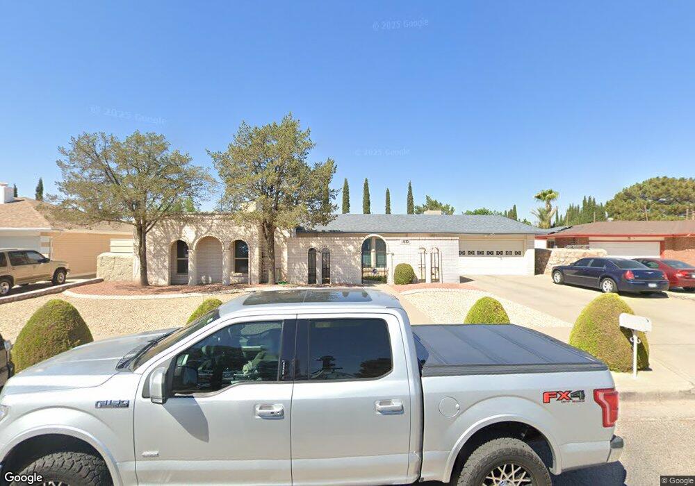
1833 Tommy Aaron Dr El Paso, TX 79936
Vista Del Sol NeighborhoodEstimated Value: $283,033 - $319,000
--
Bed
3
Baths
2,270
Sq Ft
$134/Sq Ft
Est. Value
About This Home
This home is located at 1833 Tommy Aaron Dr, El Paso, TX 79936 and is currently estimated at $305,258, approximately $134 per square foot. 1833 Tommy Aaron Dr is a home located in El Paso County with nearby schools including Tierra Del Sol Elementary School, J M Hanks High School, and EL PASO LEADERSHIP ACADEMY - MIDDLE EAST.
Ownership History
Date
Name
Owned For
Owner Type
Purchase Details
Closed on
Jul 16, 2013
Sold by
Segura Schwartz Gloria I and Schwartz Gloria I
Bought by
Segura Schwartz Gloria I
Current Estimated Value
Home Financials for this Owner
Home Financials are based on the most recent Mortgage that was taken out on this home.
Original Mortgage
$74,400
Interest Rate
4.49%
Mortgage Type
Credit Line Revolving
Purchase Details
Closed on
Aug 5, 2003
Sold by
Schwartz Gloria L
Bought by
Schwartz Gloria I
Create a Home Valuation Report for This Property
The Home Valuation Report is an in-depth analysis detailing your home's value as well as a comparison with similar homes in the area
Home Values in the Area
Average Home Value in this Area
Purchase History
| Date | Buyer | Sale Price | Title Company |
|---|---|---|---|
| Segura Schwartz Gloria I | -- | None Available | |
| Schwartz Gloria I | -- | -- |
Source: Public Records
Mortgage History
| Date | Status | Borrower | Loan Amount |
|---|---|---|---|
| Closed | Segura Schwartz Gloria I | $74,400 |
Source: Public Records
Tax History Compared to Growth
Tax History
| Year | Tax Paid | Tax Assessment Tax Assessment Total Assessment is a certain percentage of the fair market value that is determined by local assessors to be the total taxable value of land and additions on the property. | Land | Improvement |
|---|---|---|---|---|
| 2025 | $3,575 | $276,319 | $44,640 | $231,679 |
| 2024 | $3,575 | $252,437 | -- | -- |
| 2023 | $3,486 | $229,488 | $0 | $0 |
| 2022 | $6,479 | $208,625 | $0 | $0 |
| 2021 | $6,165 | $189,659 | $30,451 | $159,208 |
| 2020 | $5,823 | $184,362 | $27,640 | $156,722 |
| 2018 | $5,609 | $180,365 | $27,640 | $152,725 |
| 2017 | $5,159 | $169,141 | $27,640 | $141,501 |
| 2016 | $4,690 | $153,418 | $27,640 | $125,778 |
| 2015 | $3,736 | $153,418 | $27,640 | $125,778 |
| 2014 | $3,736 | $154,392 | $27,640 | $126,752 |
Source: Public Records
Map
Nearby Homes
- 1868 Tom Bolt Dr
- 1817 Hugh Royer Place
- 1913 Seagull Dr
- 1804 Jerry Abbott St
- 1739 Jerry Abbott St
- 1901 Bobby Jones Dr
- 11204 Bob Mitchell Dr
- 2001 Bobby Jones Dr Unit A
- 1703 Robert Wynn St
- 2009 Bobby Jones Dr Unit B
- 11016 Bob Stone Dr
- 11012 Bob Stone Dr
- 11013 Bob Stone Dr
- 1700 Jerry Abbott St
- 1617 Tommy Aaron Dr
- 2604 Anise Dr
- 1607 Tommy Aaron Dr
- 2101 E Glen Dr
- 11157 Leo Collins Dr
- 11262 Enid Wilson Ln
- 1837 Tommy Aaron Dr
- 1829 Tommy Aaron Dr
- 1824 Tom Bolt Dr
- 1820 Tom Bolt Dr
- 1825 Tommy Aaron Dr
- 1828 Tom Bolt Dr
- 1841 Tommy Aaron Dr
- 1832 Tom Bolt Dr
- 1816 Tom Bolt Dr
- 1821 Tommy Aaron Dr
- 1836 Tom Bolt Dr
- 1845 Tommy Aaron Dr
- 1823 Tom Bolt Dr
- 1817 Tommy Aaron Dr
- 1812 Tom Bolt Dr
- 1827 Tom Bolt Dr
- 1817 Tom Bolt Dr
- 1831 Tom Bolt Dr
- 1840 Tom Bolt Dr
- 1849 Tommy Aaron Dr