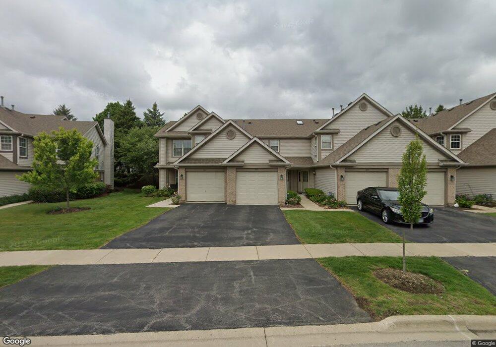
1834 Grove Ave Schaumburg, IL 60193
South Schaumburg NeighborhoodEstimated Value: $297,212 - $351,000
2
Beds
--
Bath
1,400
Sq Ft
$230/Sq Ft
Est. Value
About This Home
This home is located at 1834 Grove Ave, Schaumburg, IL 60193 and is currently estimated at $321,553, approximately $229 per square foot. 1834 Grove Ave is a home located in Cook County with nearby schools including Hanover Highlands Elementary School, Robert Frost Junior High School, and Schaumburg High School.
Ownership History
Date
Name
Owned For
Owner Type
Purchase Details
Closed on
Feb 18, 2000
Sold by
Thompson Kevin M and Thompson Maria B
Bought by
Lin Steve and Jiang Julia
Current Estimated Value
Home Financials for this Owner
Home Financials are based on the most recent Mortgage that was taken out on this home.
Original Mortgage
$126,400
Interest Rate
7.75%
Purchase Details
Closed on
Apr 24, 1995
Sold by
Parkway Bank & Trust Company
Bought by
Thompson Kevin M and Reuter Maria B
Home Financials for this Owner
Home Financials are based on the most recent Mortgage that was taken out on this home.
Original Mortgage
$105,600
Interest Rate
7.87%
Create a Home Valuation Report for This Property
The Home Valuation Report is an in-depth analysis detailing your home's value as well as a comparison with similar homes in the area
Home Values in the Area
Average Home Value in this Area
Purchase History
| Date | Buyer | Sale Price | Title Company |
|---|---|---|---|
| Lin Steve | $158,000 | -- | |
| Thompson Kevin M | $137,500 | Land Title Group Inc |
Source: Public Records
Mortgage History
| Date | Status | Borrower | Loan Amount |
|---|---|---|---|
| Closed | Lin Steve | $126,400 | |
| Previous Owner | Thompson Kevin M | $105,600 |
Source: Public Records
Tax History Compared to Growth
Tax History
| Year | Tax Paid | Tax Assessment Tax Assessment Total Assessment is a certain percentage of the fair market value that is determined by local assessors to be the total taxable value of land and additions on the property. | Land | Improvement |
|---|---|---|---|---|
| 2024 | $5,861 | $24,238 | $2,136 | $22,102 |
| 2023 | $5,655 | $24,238 | $2,136 | $22,102 |
| 2022 | $5,655 | $24,238 | $2,136 | $22,102 |
| 2021 | $4,797 | $19,158 | $1,396 | $17,762 |
| 2020 | $4,783 | $19,158 | $1,396 | $17,762 |
| 2019 | $4,831 | $21,452 | $1,396 | $20,056 |
| 2018 | $3,769 | $15,993 | $1,150 | $14,843 |
| 2017 | $3,727 | $15,993 | $1,150 | $14,843 |
| 2016 | $3,728 | $15,993 | $1,150 | $14,843 |
| 2015 | $3,480 | $14,254 | $1,068 | $13,186 |
| 2014 | $3,458 | $14,254 | $1,068 | $13,186 |
| 2013 | $3,351 | $14,254 | $1,068 | $13,186 |
Source: Public Records
Map
Nearby Homes
- 1721 Chesapeake Ln Unit 4
- 1518 Harbour Ct Unit A1
- 1471 Fairlane Dr Unit 2A
- 1463 Mercury Dr Unit 115
- 1463 Mercury Dr Unit 304
- 1467 Fairlane Dr Unit 1B
- 1662 Commodore Ct Unit 70294
- 6908 Orchard Ln
- 1460 Fairlane Dr Unit 228
- 6915 Hawthorne Ln
- 7031 Glenwood Ln
- 6938 Meadowbrook Ln
- 1410 Brownstone Place Unit 38
- 6925 Edgebrook Ln
- 1882 Keystone Place Unit 1882
- 7138 Edgebrook Ln
- 7468 Filmore Ave
- 1102 Westover Ln Unit 1C
- 664 Wedgewood Dr
- 1011 Mercury Dr Unit 7
- 1830 Grove Ave Unit 17B183
- 1832 Grove Ave Unit 17A183
- 1828 Grove Ave Unit 17B182
- 1846 Grove Ave Unit 18C184
- 1846 Grove Ave Unit C
- 1824 Grove Ave Unit 17C182
- 1826 Grove Ave Unit 17B182
- 1838 Grove Ave Unit 18B183
- 1836 Grove Ave Unit 18C183
- 1842 Grove Ave Unit 18B184
- 1844 Grove Ave Unit 18A184
- 1829 Grove Ave Unit 76A182
- 1831 Grove Ave Unit 76B183
- 1833 Grove Ave Unit 76C183
- 1847 Grove Ave Unit 75B184
- 1823 Grove Ave Unit 76C182
- 1851 Grove Ave Unit 75C185
- 1847 Grove Ave Unit B
- 1827 Grove Ave Unit 76B182
- 1825 Grove Ave Unit 76A182