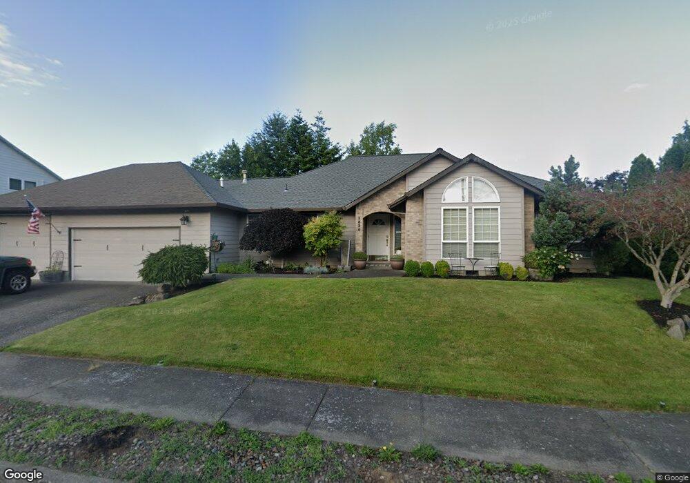
1834 SW Haskins Ct Troutdale, OR 97060
Sunrise NeighborhoodEstimated Value: $501,000 - $618,000
3
Beds
2
Baths
1,906
Sq Ft
$299/Sq Ft
Est. Value
About This Home
This home is located at 1834 SW Haskins Ct, Troutdale, OR 97060 and is currently estimated at $570,383, approximately $299 per square foot. 1834 SW Haskins Ct is a home located in Multnomah County with nearby schools including Troutdale Elementary School, Walt Morey Middle School, and Reynolds High School.
Ownership History
Date
Name
Owned For
Owner Type
Purchase Details
Closed on
Apr 27, 2015
Sold by
Heskin Lowell
Bought by
Cox Christopher J and Cox Kristie L
Current Estimated Value
Home Financials for this Owner
Home Financials are based on the most recent Mortgage that was taken out on this home.
Original Mortgage
$220,000
Outstanding Balance
$168,808
Interest Rate
3.73%
Mortgage Type
New Conventional
Estimated Equity
$401,575
Purchase Details
Closed on
Jul 23, 2007
Sold by
Pettichord Ronald
Bought by
Nelson Charles Norman
Purchase Details
Closed on
Aug 13, 2004
Sold by
Friend William D
Bought by
Pettichord Ronald
Home Financials for this Owner
Home Financials are based on the most recent Mortgage that was taken out on this home.
Original Mortgage
$200,000
Interest Rate
4.62%
Mortgage Type
Purchase Money Mortgage
Create a Home Valuation Report for This Property
The Home Valuation Report is an in-depth analysis detailing your home's value as well as a comparison with similar homes in the area
Home Values in the Area
Average Home Value in this Area
Purchase History
| Date | Buyer | Sale Price | Title Company |
|---|---|---|---|
| Cox Christopher J | $275,000 | First American | |
| Nelson Charles Norman | $339,000 | Pacific Nw Title | |
| Pettichord Ronald | $250,000 | Fidelity Natl Title Co Of Or |
Source: Public Records
Mortgage History
| Date | Status | Borrower | Loan Amount |
|---|---|---|---|
| Open | Cox Christopher J | $220,000 | |
| Previous Owner | Pettichord Ronald | $200,000 |
Source: Public Records
Tax History Compared to Growth
Tax History
| Year | Tax Paid | Tax Assessment Tax Assessment Total Assessment is a certain percentage of the fair market value that is determined by local assessors to be the total taxable value of land and additions on the property. | Land | Improvement |
|---|---|---|---|---|
| 2025 | $6,811 | $370,510 | -- | -- |
| 2024 | $6,434 | $359,720 | -- | -- |
| 2023 | $6,265 | $349,250 | $0 | $0 |
| 2022 | $6,114 | $339,080 | $0 | $0 |
| 2021 | $5,973 | $329,210 | $0 | $0 |
| 2020 | $5,588 | $319,630 | $0 | $0 |
| 2019 | $5,363 | $310,330 | $0 | $0 |
| 2018 | $5,327 | $301,300 | $0 | $0 |
| 2017 | $5,315 | $292,530 | $0 | $0 |
| 2016 | $5,136 | $284,010 | $0 | $0 |
| 2015 | $5,007 | $275,740 | $0 | $0 |
| 2014 | $4,824 | $267,710 | $0 | $0 |
Source: Public Records
Map
Nearby Homes
- 2154 SE Sandy Ct
- 2020 SW Laura Ct
- 839 SW Grant Way
- 665 SW 24th St
- 1226 SW Hensley Rd
- 821 SW 14th St
- 2511 S Troutdale Rd
- 1021 SW 24th St
- 621 SE 11th Cir
- 809 SW Crestview Way
- 735 SW Sunset Way
- 2505 SE Clark Ct
- 724 SW 28th St
- 2521 SE Clark Ct
- 1212 SW Edgefield Ave
- 1019 SE 27th St
- 1648 SE Lewellyn Ave
- 1427 SW 24th St
- 2846 SW Faith Ct
- 2326 SW Mcginnis Ave
- 1822 SW Haskins Ct
- 1885 SW Spence Ave
- 224 SW 18th St
- 1846 SW Haskins Ct
- 1863 SW Haskins Ct
- 1873 SW Spence Ave
- 206 SW 18th St
- 1882 SW Spence Ave
- 1825 SW Haskins Ct
- 1858 SW Haskins Ct
- 118 SW 18th St
- 1860 SW Haskins Ct
- 1875 SW Haskins Ct
- 1861 SW Spence Ave
- 1878 SW Spence Ave
- 426 SW 18th St
- 104 SW 18th St
- 1872 SW Haskins Ct
- 235 SW 18th St
- 213 SW 18th St