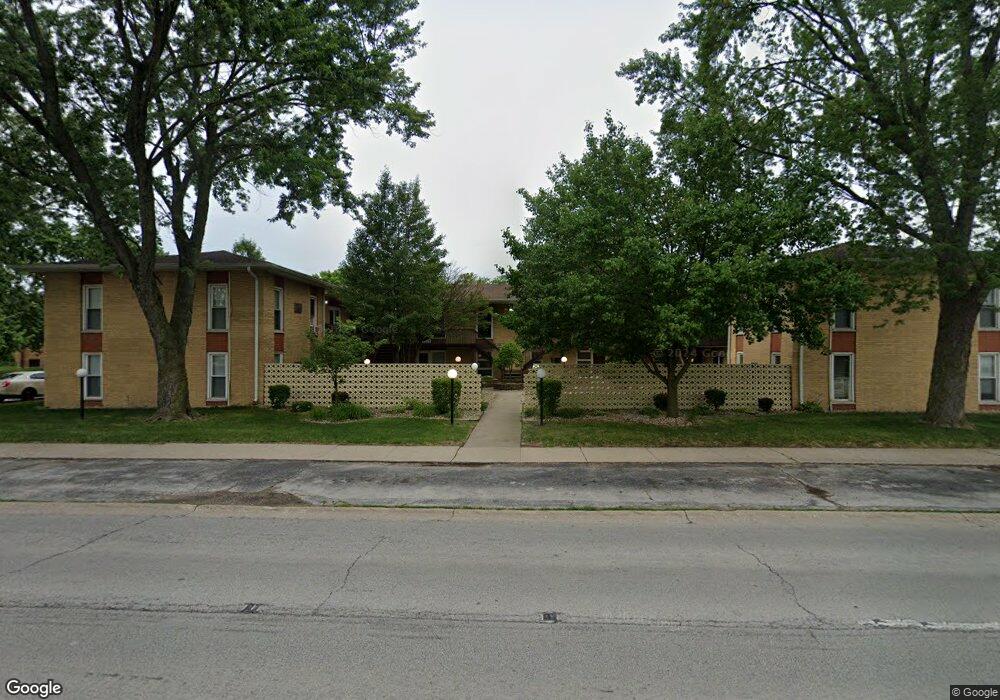
18340 Burnham Ave Unit 1 Lansing, IL 60438
Estimated Value: $66,310 - $94,000
2
Beds
1
Bath
721
Sq Ft
$109/Sq Ft
Est. Value
About This Home
This home is located at 18340 Burnham Ave Unit 1, Lansing, IL 60438 and is currently estimated at $78,328, approximately $108 per square foot. 18340 Burnham Ave Unit 1 is a home located in Cook County with nearby schools including Coolidge Elementary School, Memorial Jr High School, and Thornton Fractnl So High School.
Ownership History
Date
Name
Owned For
Owner Type
Purchase Details
Closed on
Dec 30, 1996
Sold by
Valois Joseph J and Valois Julia E
Bought by
Schmidt David L
Current Estimated Value
Home Financials for this Owner
Home Financials are based on the most recent Mortgage that was taken out on this home.
Original Mortgage
$32,000
Outstanding Balance
$3,440
Interest Rate
7.64%
Estimated Equity
$74,888
Purchase Details
Closed on
May 13, 1994
Sold by
Keller Bertha C
Bought by
Valois Joseph J and Valois Julia E
Create a Home Valuation Report for This Property
The Home Valuation Report is an in-depth analysis detailing your home's value as well as a comparison with similar homes in the area
Home Values in the Area
Average Home Value in this Area
Purchase History
| Date | Buyer | Sale Price | Title Company |
|---|---|---|---|
| Schmidt David L | $38,500 | -- | |
| Valois Joseph J | -- | -- |
Source: Public Records
Mortgage History
| Date | Status | Borrower | Loan Amount |
|---|---|---|---|
| Open | Schmidt David L | $32,000 |
Source: Public Records
Tax History Compared to Growth
Tax History
| Year | Tax Paid | Tax Assessment Tax Assessment Total Assessment is a certain percentage of the fair market value that is determined by local assessors to be the total taxable value of land and additions on the property. | Land | Improvement |
|---|---|---|---|---|
| 2024 | $282 | $3,899 | $400 | $3,499 |
| 2023 | -- | $3,899 | $400 | $3,499 |
| 2022 | $0 | $3,003 | $353 | $2,650 |
| 2021 | $855 | $3,002 | $352 | $2,650 |
| 2020 | $855 | $3,002 | $352 | $2,650 |
| 2019 | $0 | $3,269 | $329 | $2,940 |
| 2018 | $855 | $4,965 | $329 | $4,636 |
| 2017 | $897 | $4,965 | $329 | $4,636 |
| 2016 | $970 | $4,272 | $305 | $3,967 |
| 2015 | $838 | $4,272 | $305 | $3,967 |
| 2014 | $853 | $4,272 | $305 | $3,967 |
| 2013 | $798 | $4,402 | $305 | $4,097 |
Source: Public Records
Map
Nearby Homes
- 18315 Burnham Ave Unit 204
- 18302 Roy St
- 18301 Chicago Ave
- 18275 Ada St
- 18429 Ridgewood Ave
- 18514 Ridgewood Ave
- 18316 Sherman St
- 2934 186th St
- 3225 Otto St
- 18452 Oakwood Ave
- 19510 Burnham Ave
- 18602 Chicago Ave
- 3445 N Schultz Dr
- 2914 Ridge Rd
- 18240 Wildwood Ave
- 18019 Lorenz Ave
- 18136 Oakwood Ave
- 2810 186th St
- 18013 Park Ave
- 18018 Park Ave
- 18340 Burnham Ave Unit 16
- 18340 Burnham Ave Unit 5
- 18340 Burnham Ave Unit 14
- 18340 Burnham Ave Unit 9
- 18340 Burnham Ave Unit 6
- 18340 Burnham Ave Unit 8
- 18340 Burnham Ave Unit 15
- 18340 Burnham Ave Unit 3
- 18340 Burnham Ave Unit 10
- 18340 Burnham Ave Unit 7
- 18340 Burnham Ave Unit 13
- 18340 Burnham Ave Unit 12
- 18340 Burnham Ave Unit 11
- 18340 Burnham Ave Unit 4
- 18340 Burnham Ave Unit 1
- 18340 Burnham Ave Unit 2
- 18339 Greenbay Ave
- 18328 Burnham Ave
- 18345 Greenbay Ave
- 18333 Greenbay Ave